Clarence County

Last updated
Map all coordinates using: OpenStreetMap  ·  Google Maps
Download coordinates as: KML  ·  GPX
Clarence
New South Wales

Clarence NSW.PNG

Location in New South Wales
Lands administrative divisions around Clarence:
Drake Richmond Pacific Ocean
Drake Clarence Pacific Ocean
Gresham Fitzroy Pacific Ocean

Clarence County is one of the 141 Cadastral divisions of New South Wales. It lies to the north of the Orara River, and includes the mouth of the Clarence River, and the city of Grafton.

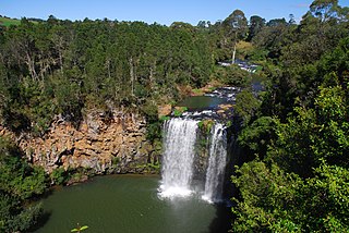
Orara River, a perennial stream of the Clarence River catchment, is located in the Northern Rivers district of New South Wales, Australia.

Clarence River (New South Wales) river in the Northern Rivers district of New South Wales, Australia

The Clarence River, a mature wave dominated, barrier estuary, is situated in the Northern Rivers district of New South Wales, Australia.

Grafton, New South Wales City in New South Wales, Australia

Grafton is a city in the Northern Rivers region of the Australian state of New South Wales. It is located on the Clarence River, approximately 500 kilometres (310 mi) north-northeast of the state capital Sydney. The closest major cities, Brisbane and the Gold Coast, are located across the border in South-East Queensland. According to the 2016 census, the Grafton "significant urban area" had a population of 18,668 people. The city is the largest settlement and administrative centre of the Clarence Valley Council local government area, which has over 50,000 people in all.

Clarence County is named in honour of the Duke of Clarence – William IV (1765-1837). [1]

William IV of the United Kingdom King of the United Kingdom of Great Britain and Ireland and of Hanover 1830-1837

William IV was King of the United Kingdom of Great Britain and Ireland and King of Hanover from 26 June 1830 until his death in 1837. The third son of George III, William succeeded his elder brother George IV, becoming the last king and penultimate monarch of Britain's House of Hanover.

Parishes within this county

A full list of parishes found within this county; their current LGA and mapping coordinates to the approximate centre of each location is as follows:

Local government in Australia

Local government in Australia is the third tier of government in Australia administered by the states and territories, which in turn are beneath the federal tier. Local government is not mentioned in the Constitution of Australia and two referenda in the 1970s and 1980s to alter the Constitution relating to local government were unsuccessful. Every state government recognises local government in their respective constitutions. Unlike Canada or the United States, there is only one level of local government in each state, with no distinction such as cities and counties.

Parish LGA Coordinates
Ashby Clarence Valley Council 29°24′54″S153°10′04″E / 29.41500°S 153.16778°E / -29.41500; 153.16778 (Ashby Parish)
Banyabba Clarence Valley Council 29°22′54″S153°00′04″E / 29.38167°S 153.00111°E / -29.38167; 153.00111 (Banyabba Parish)
Calamia Clarence Valley Council 29°50′54″S153°07′04″E / 29.84833°S 153.11778°E / -29.84833; 153.11778 (Calamia Parish)
Candole Clarence Valley Council 29°41′54″S153°16′04″E / 29.69833°S 153.26778°E / -29.69833; 153.26778 (Candole Parish)
Canoulam Clarence Valley Council 29°36′54″S153°17′04″E / 29.61500°S 153.28444°E / -29.61500; 153.28444 (Canoulam Parish)
Chapman Clarence Valley Council 29°31′54″S152°52′04″E / 29.53167°S 152.86778°E / -29.53167; 152.86778 (Chapman Parish)
Clarenza Clarence Valley Council 29°42′54″S153°00′04″E / 29.71500°S 153.00111°E / -29.71500; 153.00111 (Clarenza Parish)
Clifden Clarence Valley Council 29°31′54″S152°56′04″E / 29.53167°S 152.93444°E / -29.53167; 152.93444 (Clifden Parish)
Coaldale Clarence Valley Council 29°24′54″S152°47′04″E / 29.41500°S 152.78444°E / -29.41500; 152.78444 (Coaldale Parish)
Coldstream Clarence Valley Council 29°39′54″S153°10′04″E / 29.66500°S 153.16778°E / -29.66500; 153.16778 (Coldstream Parish)
Copmanhurst Clarence Valley Council 29°29′54″S152°45′04″E / 29.49833°S 152.75111°E / -29.49833; 152.75111 (Copmanhurst Parish)
Doubleduke Clarence Valley Council 29°19′54″S153°10′04″E / 29.33167°S 153.16778°E / -29.33167; 153.16778 (Doubleduke Parish)
Dundoo Clarence Valley Council 29°54′54″S153°07′04″E / 29.91500°S 153.11778°E / -29.91500; 153.11778 (Dundoo Parish)
Eaton Clarence Valley Council 29°35′54″S152°51′04″E / 29.59833°S 152.85111°E / -29.59833; 152.85111 (Eaton Parish)
Elland Clarence Valley Council 29°44′54″S152°55′04″E / 29.74833°S 152.91778°E / -29.74833; 152.91778 (Elland Parish)
Great Marlow Clarence Valley Council 29°37′54″S152°58′04″E / 29.63167°S 152.96778°E / -29.63167; 152.96778 (Great Marlow Parish)
Gulmarrad Clarence Valley Council 29°31′54″S153°16′04″E / 29.53167°S 153.26778°E / -29.53167; 153.26778 (Gulmarrad Parish)
Harwood Clarence Valley Council 29°22′54″S153°16′04″E / 29.38167°S 153.26778°E / -29.38167; 153.26778 (Harwood Parish)
Lanitza Clarence Valley Council 29°47′54″S153°00′04″E / 29.79833°S 153.00111°E / -29.79833; 153.00111 (Lanitza Parish)
Lardner Clarence Valley Council 29°21′54″S152°53′04″E / 29.36500°S 152.88444°E / -29.36500; 152.88444 (Lardner Parish)
Lavadia Clarence Valley Council 29°44′54″S153°03′04″E / 29.74833°S 153.05111°E / -29.74833; 153.05111 (Lavadia Parish)
Lawrence Clarence Valley Council 29°26′54″S153°04′04″E / 29.44833°S 153.06778°E / -29.44833; 153.06778 (Lawrence Parish)
Maryvale Clarence Valley Council 29°44′54″S153°08′04″E / 29.74833°S 153.13444°E / -29.74833; 153.13444 (Maryvale Parish)
Nanegai Clarence Valley Council 29°21′54″S153°20′04″E / 29.36500°S 153.33444°E / -29.36500; 153.33444 (Nanegai Parish)
Qwyarigo Clarence Valley Council 29°53′54″S153°00′04″E / 29.89833°S 153.00111°E / -29.89833; 153.00111 (Qwyarigo Parish)
Red Rock Clarence Valley Council 29°55′54″S153°12′04″E / 29.93167°S 153.20111°E / -29.93167; 153.20111 (Red Rock Parish)
Richmond Clarence Valley Council 29°22′54″S153°05′04″E / 29.38167°S 153.08444°E / -29.38167; 153.08444 (Richmond Parish)
Rushforth Clarence Valley Council 29°41′54″S152°50′04″E / 29.69833°S 152.83444°E / -29.69833; 152.83444 (Rushforth Parish)
Scope Clarence Valley Council 29°46′54″S153°15′04″E / 29.78167°S 153.25111°E / -29.78167; 153.25111 (Scope Parish)
Southampton Clarence Valley Council 29°39′54″S152°53′04″E / 29.66500°S 152.88444°E / -29.66500; 152.88444 (Southampton Parish)
Southgate Clarence Valley Council 29°33′54″S153°02′04″E / 29.56500°S 153.03444°E / -29.56500; 153.03444 (Southgate Parish)
Stuart Clarence Valley Council 29°28′54″S152°58′04″E / 29.48167°S 152.96778°E / -29.48167; 152.96778 (Stuart Parish)
Taloumbi Clarence Valley Council 29°26′54″S153°16′04″E / 29.44833°S 153.26778°E / -29.44833; 153.26778 (Taloumbi Parish)
Tyndale Clarence Valley Council 29°35′54″S153°14′04″E / 29.59833°S 153.23444°E / -29.59833; 153.23444 (Tyndale Parish)
Ulmarra Clarence Valley Council 29°39′54″S153°02′04″E / 29.66500°S 153.03444°E / -29.66500; 153.03444 (Ulmarra Parish)
Whiteman Clarence Valley Council 29°25′54″S152°52′04″E / 29.43167°S 152.86778°E / -29.43167; 152.86778 (Whiteman Parish)
Woodford Clarence Valley Council 29°30′54″S153°09′04″E / 29.51500°S 153.15111°E / -29.51500; 153.15111 (Woodford Parish)
Wooli Wooli Clarence Valley Council 29°50′54″S153°30′04″E / 29.84833°S 153.50111°E / -29.84833; 153.50111 (Wooli Wooli Parish)
Woombah Clarence Valley Council 29°19′54″S153°16′04″E / 29.33167°S 153.26778°E / -29.33167; 153.26778 (Woombah Parish)
Yamba Clarence Valley Council 29°31′54″S153°20′04″E / 29.53167°S 153.33444°E / -29.53167; 153.33444 (Yamba Parish)

Related Research Articles

Drake County Cadastral in New South Wales, Australia

Drake County is one of the 141 Cadastral divisions of New South Wales.

Gresham County Cadastral in New South Wales, Australia

Gresham County is one of the 141 Cadastral divisions of New South Wales.

Cataract River, a mostly perennial stream of the Clarence River catchment, is located in the Northern Tablelands district of New South Wales, Australia.

Boonoo Boonoo River river in Australia

Boonoo Boonoo River, a watercourse of the Clarence River catchment, is located in the Northern Tablelands district of New South Wales, Australia.

Glen Fernaigh River, a perennial river of the Clarence River catchment, is located in the Northern Rivers region of New South Wales, Australia.

Henry River, a perennial stream of the Clarence River catchment, is located in the Northern Tablelands district of New South Wales, Australia.

Mann River, a perennial stream of the Clarence River catchment, is located in the Northern Rivers district of New South Wales, Australia.

The Nowlands Creek, a watercourse of the Clarence River catchment, is located in the Northern Tablelands region in the state of New South Wales, Australia.

Timbarra River, a mostly perennial stream of the Clarence River catchment, is located in the Northern Tablelands district of New South Wales, Australia.

Towallum River, a perennial river of the Clarence River catchment, is located in the Northern Tablelands region of New South Wales, Australia.

Williams River (New South Wales) river in New South Wales, Australia

The Williams River is a perennial stream that is a tributary of the Hunter River, in the Hunter Region of New South Wales, Australia.

Esk River, a perennial stream that is part of the Clarence River catchment, is located in the Northern Rivers region of New South Wales, Australia.

Bielsdown River river in Australia

Bielsdown River, a perennial stream that is part of the Clarence River catchment, is located in the Northern Tablelands of New South Wales, Australia.

The Beaury Creek, a perennial stream of the Clarence River catchment, is located in the Northern Rivers region of New South Wales, Australia.

The Boundary Creek, a perennial stream of the Clarence River catchment, is located in the Northern Rivers region of New South Wales, Australia.

The Boundary Creek, a perennial stream of the Clarence River catchment, is located in the Northern Rivers region of New South Wales, Australia.

The Tooloom Creek, a perennial stream of the Clarence River catchment, is located in the Northern Rivers region in the state of New South Wales, Australia.

The Clouds Creek, a perennial stream that is part of the Clarence River catchment, is located in the Northern Tablelands region of New South Wales, Australia.

References

  1. "Clarence County". Geographical Names Register (GNR) of NSW. Geographical Names Board of New South Wales.