
The Mississippi River is the second-longest river and chief river of the second-largest drainage system on the North American continent, second only to the Hudson Bay drainage system. From its traditional source of Lake Itasca in northern Minnesota, it flows generally south for 2,320 miles (3,730 km) to the Mississippi River Delta in the Gulf of Mexico. With its many tributaries, the Mississippi's watershed drains all or parts of 32 U.S. states and two Canadian provinces between the Rocky and Appalachian mountains. The main stem is entirely within the United States; the total drainage basin is 1,151,000 sq mi (2,980,000 km2), of which only about one percent is in Canada. The Mississippi ranks as the fourth-longest river and fifteenth-largest river by discharge in the world. The river either borders or passes through the states of Minnesota, Wisconsin, Iowa, Illinois, Missouri, Kentucky, Tennessee, Arkansas, Mississippi, and Louisiana.

Meeker County is a county in the U.S. state of Minnesota. As of the 2010 United States Census, the population was 23,300. Its county seat is Litchfield.

McLeod County is a county in the U.S. state of Minnesota. At the 2010 United States Census, the population was 36,651. Its county seat is Glencoe.

The Harney Basin is an endorheic basin in southeastern Oregon in the United States at the northwestern corner of the Great Basin. One of the least populated areas of the contiguous United States, it is located largely in northern Harney County, bounded on the north and east by the Columbia Plateau—within which it is contained, physiographically speaking—and on the south and west by a volcanic plain. The basin encompasses an area of 1,490 square miles (3,859 km2) in the watershed of Malheur Lake and Harney Lake. Malheur Lake is a freshwater lake, while Harney Lake is saline-alkaline.
Okamanpeedan Lake, partially located in Martin County, Minnesota, and Emmet County, Iowa, is also known as Tuttle Lake. Okamanpeedan Lake is a roughly 2,300-acre (9.3 km²) riverine lake located on the East Fork of the Des Moines River. It has an average depth of about four to six feet. The lake has a contributing watershed of approximately 120,056 acres (486 km²) and watershed:lake ratio on the order of about 50:1. The lake is situated in a glacial till plain and is generally in an area dominated by loamy, poorly drained soils. The area is primarily level but does have some rolling hills.

Umbagog Lake is a wilderness lake located in Coös County, New Hampshire, and Oxford County, Maine. It is one of the most pristine lakes in the state of New Hampshire. It lies in the towns of Errol, New Hampshire, and Upton, Maine, as well as the townships of Cambridge, New Hampshire, and Magalloway Plantation, Maine. The name Umbagog is properly pronounced with the stress on the second syllable (um-BAY-gog) and is said to come from the Abenaki word for "shallow water". Both "Lake Umbagog" and "Umbagog Lake" are commonly used and accepted when referring to the body of water.

The Crow River is a tributary of the Mississippi River in south-central Minnesota in the United States. It drains a watershed of 2,756 square miles (7,140 km2).

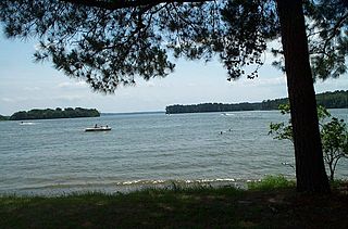
Belle Lake is a lake in McLeod County and Meeker County, in the U.S. state of Minnesota. The lake is 826 acres (334 ha) in size with a maximum depth of 25 feet (7.6 m). The southern two-fifths of the lake is in Acoma Township, McLeod County, and the northern three-fifths is in Meeker County.
Lake George is a small lake in Anoka County, Minnesota, located within the city of Oak Grove, 12 miles north of the city of Anoka. Minnesota's Department of Natural Resources tracks the lake by the name George and the identifier 02-0091-00. The USGS tracks the lake by the ID 644081 and the coordinates of 45°21′25″N93°20′10″W

Clear Lake is the name of a natural spring fed body of water located in Cerro Gordo County, Iowa near Clear Lake, Iowa. It is approximately 3,684 acres (15 km2) in size. It is a popular fishing destination, with walleye, yellow bass and channel catfish. People from Des Moines and Minneapolis–Saint Paul have had homes on the shores of the lake since the 1870s. The average depth is 10 feet (3 m) and the maximum depth is 30 feet (9 m), in the dredged area of the west end. The lake has 13.6 mi (22 km) of shoreline. As of 2004, the lake has seen major efforts undergone to restore its natural clarity, including filtration systems, dredging, and education of local farmers to reduce toxic pesticides from entering the lake. Clear Lake has been named the "Best Iowa Lake Town" by The Des Moines Register and "A Top Vacation Spot" by Midwest Living magazine.
Lake Livingston is a reservoir located in the East Texas Piney Woods. Lake Livingston was built and is owned and operated by the Trinity River Authority (TRA) of Texas under contract with the City of Houston for water-supply purposes. The lake is the second-largest lake located wholly within the state of Texas. The Livingston Dam, constructed across the Trinity River about 7 miles (11 km) southwest of the city of Livingston is 2.5 miles (4 km) in length and has an average depth of 55 feet (17 m).

Ten Mile Lake is a lake located in north central Minnesota, United States. It is directly south of Walker and northwest of Hackensack. It is spring fed and is the deepest natural lake enclosed in Minnesota's borders. Ten Mile Lake covers over 5,046 acres (20.42 km2) with a maximum depth of 208 feet (63 m). It is known for its especially clear and clean water, due to the fresh spring sources.
Kabetogama is an unincorporated community in Kabetogama Township, Saint Louis County, Minnesota, United States, located within the Kabetogama State Forest.
Gull Lake is a lake in the U.S. state of Minnesota, located in Cass County and Crow Wing County. It is one of the largest lakes in the Brainerd, Minnesota-Baxter, Minnesota area and also one of the most popular for vacationing and for recreation. Of the seven Gull Lakes in Minnesota, this Gull Lake is the largest in area and shoreline. The shoreline is highly developed with residential and commercial interests. For each shoreline mile there are 27.8 homes or cabins. There are 19 resorts on Gull Lake, including notably Cragun's, Madden's, and Grand View Lodge.
Abita Lake is a lake in West Cook, Minnesota, which, at an elevation of 2,040.19 feet (621.85 m) above sea level, is Minnesota's ninth highest named lake. Prior to modern surveys, the lake was once believed to be Minnesota's highest elevation lake.

Hickory Hills Lake is the largest private lake in Massachusetts, located in the town of Lunenburg in Worcester County.
Cedar Lake is a lake in McLeod and Meeker counties, in the U.S. state of Minnesota.
Lake Washington is a lake located between Dassel and Darwin in Meeker County, in the U.S. state of Minnesota.
Greenleaf Lake is a lake in Meeker County, in the U.S. state of Minnesota. It measures 18 feet at its deepest, and is used for both fishing and recreation.
Clitherall Lake is a lake in Otter Tail County, in the U.S. state of Minnesota. The lake is about one mile south of the village of Clitherall. It has an area of 2,493 acres (1,009 ha) and an average depth of 15 ft (4.6 m). Game fish in the lake include northern pike, largemouth bass, walleye, black crappie, and bluegill.
