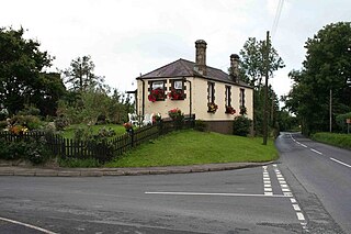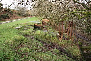
Yelverton is a large village on the south-western edge of Dartmoor, Devon, in England. It is in the civil parish of Buckland Monachorum.

Horrabridge is a village in West Devon, England with a population of 2,115 people in 2006, down from 2,204 in 1991. It is located approximately 12 miles (19 km) north of the city of Plymouth and 4 miles (6.4 km) south of Tavistock and is within the Dartmoor National Park. Horrabridge is a major part of Walkham electoral ward. The population at the 2011 census was 3,115.

Eggbuckland is a suburb of the city of Plymouth, in the ceremonial county of Devon, England. Before the Second World War Eggbuckland was a small village a few miles north of Plymouth. During the reconstruction of Plymouth many new suburbs were built and soon a new estate was built within one mile to the south east of Eggbuckland. During the 1970s the areas in between and surrounding the old village were all developed and the whole area is now referred to by the name Eggbuckland. The development of the A38 just south of Eggbuckland in the 1980s led to the area becoming very popular with commuters.

South West Devon is a constituency most recently represented in the House of Commons of the UK Parliament from 1997 to 2024, by Sir Gary Streeter, a Conservative. Plymstock Radford Councillor Rebecca Smith retained the seat for the Conservatives in the 4 July 2024 general election after Sir Gary Streeter didn't stand for re-election.

Buckland Monachorum is a village and civil parish in the West Devon district of Devon, England, situated on the River Tavy, about 10 miles north of Plymouth.

Buckland Abbey is a Grade I listed 700-year-old house in Buckland Monachorum, near Yelverton, Devon, England, noted for its connection with Sir Richard Grenville the Younger and Sir Francis Drake. It is owned by the National Trust.

The South Devon and Tavistock Railway linked Plymouth with Tavistock in Devon; it opened in 1859. It was extended by the Launceston and South Devon Railway to Launceston, in Cornwall in 1865. It was a broad gauge line but from 1876 also carried the standard gauge trains of the London and South Western Railway between Lydford and Plymouth: a third rail was provided, making a mixed gauge. In 1892 the whole line was converted to standard gauge only.

The River Meavy is a river in the southwest part of Dartmoor in Devon in south-west England. It runs entirely in the national park and connects Burrator Reservoir to the River Plym.

Meavy is a small village, civil parish and former manor in the English county of Devon. Meavy forms part of the district of West Devon. It lies a mile or so east of Yelverton. The River Meavy runs near the village. For administrative purposes the parish is grouped with the parishes of Sheepstor and Walkhampton to form Burrator Parish Council, and for electoral purposes it is grouped with the same two parishes to form Burrator Ward.

Crapstone is a village in the county of Devon. The village is located on the edge of Dartmoor, in the parish of Buckland Monachorum and is approximately 1 mile (1.6 km) from the village of Yelverton, 9 miles (14 km) from the city of Plymouth and 5 miles (8 km) from Tavistock.

Milton Combe is a village in Devon approximately 2 mi (3.2 km) from Yelverton and 8 mi (13 km) from the city of Plymouth. The name Milton Combe is derived from the village's historic name, first mentioned in 1249, of 'Mile Cumbe' literally meaning 'Middle Valley'. The Post Office gave the village its current name in 1890, to distinguish it from the many other 'Miltons' in the nearby area.
Clearbrook Halt was a railway station on the South Devon and Tavistock Railway serving the villages of Clearbrook and Meavy in South Devon, nine miles to the North of Plymouth, and a mile and a half from Yelverton.

Royal Air Force Harrowbeer or more simply RAF Harrowbeer is a former Royal Air Force station situated next to Yelverton in the parish of Buckland Monachorum, Devon, England

The Princetown Railway was a 10¼ mile single track branch railway line in Devon, England, that ran from Yelverton on the Plymouth to Tavistock line, to Princetown via four intermediate stations, Dousland, Burrator and Sheepstor Halt, Ingra Tor Halt and King Tor Halt. The line closed in 1956 and today forms part of a popular cycling and walking route.

Ingra Tor Halt railway station was located on the 10.5 mile long single track Princetown Railway in Devon, England, running from Yelverton to Princetown with four intermediate stations. It was opened with only a basic wood platform and shelter in connection with the short-lived re-opening of the adjacent quarry. Its later traffic was entirely walkers and it was retained in an attempt to counter competition from local bus services and encourage tourist traffic.

Dousland railway station, originally opened at Dousland Barn in 1883 was located on the 10.5 mile long single track branch railway line in Devon, England, running from Yelverton to Princetown with eventually four intermediate stops, three being halts and one at Dousland as a fully fledged station.

Burrator and Sheepstor Halt railway station was located on the 10.5 mile long single track branch railway line in Devon, England, running from Yelverton to Princetown with eventually four intermediate stations. The station was opened as Burrator Platform and became Burrator Halt when it was opened to the public, the name being changed again in 1929 to Burrator and Sheepstor Halt.

Sherford is a village and former civil parish and manor, now in the parish of Frogmore and Sherford, in the South Hams district, in the county of Devon, England. It is situated about 2+1⁄2 miles (4 km) east of the town of Kingsbridge. It should not be confused with the new town Sherford to be built on the outskirts of Plymouth, about 18 miles (29 km) to the north-west. The parish church is dedicated to Saint Martin of Tours. In 1961 the parish had a population of 258. On 1 April 1986 the parish was abolished and merged with parts of South Pool and Charleton to form "Frogmore and Sherford". Sherford was recorded in the Domesday Book as Sireford/Sirefort/Sireforda.


