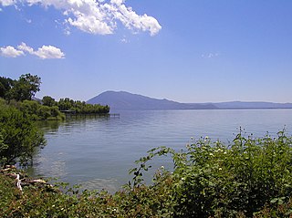
Lake County is a county located in the north central portion of the U.S. state of California. As of the 2020 census, the population was 68,163. The county seat is Lakeport. The county takes its name from Clear Lake, the dominant geographic feature in the county and the largest non-extinct natural lake wholly within California.

Clearlake is a city in Lake County, California. Clearlake is 4.5 miles (7.2 km) north-northwest of Lower Lake, at an elevation of 1,417 feet (432 m). As of the 2020 census, the city had a total population of 16,685, up from 15,250 in the 2010 census. It takes its name from Clear Lake.
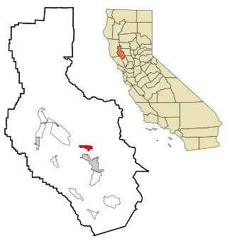
Clearlake Oaks is a census-designated place (CDP) in Lake County, California, United States. It is located on the northeast of Clear Lake, 8 miles (13.8 km) northwest of the town of Clearlake, at an elevation of 1,335 feet. The population was 2,359 at the 2010 census, down from 2,402 at the 2000 census.
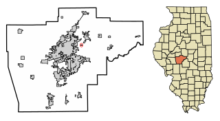
Clear Lake is an unincorporated community and former incorporated village in Sangamon County, Illinois, United States. The population was 267 at the 2000 census. It is part of the Springfield, Illinois Metropolitan Statistical Area.
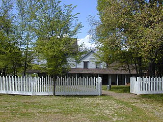
Anderson Marsh State Historic Park is a California State Historic Park and nature reserve preserving a tule marsh, archaeological sites of the Pomo people, and historic ranch structures. It is located in Lake County, California, United States. Anderson Marsh is located at the head of Cache Creek on the southeast corner of Clear Lake, the largest natural lake completely within the borders of California. The park is between the cities of Lower Lake and Clearlake on State Route 53, north of Calistoga in the wine country. The park is open year-round.
Several places are known as Lake Park:

State Route 53, also known as the Clearlake Expressway for part of its length, is a state highway in the U.S. state of California that runs in a north–south direction in Lake County east of Clear Lake, It connects SR 29 and SR 20 via the city of Clearlake.

Mount Konocti is a volcano in Lake County, California on the south shore of Clear Lake. At 4,305 feet (1,312 m), it is the second highest peak in the Clear Lake Volcanic Field, which consists of numerous volcanic domes and cones ranging from 10,000 to 2.1 million years old. Although it is often described as extinct, it is actually classified by the USGS as High Threat Potential. Clear Lake Volcanic Field's alert level is currently classified as Normal.

Area codes 707 and 369 are telephone area codes in the North American Numbering Plan (NANP) for the northwestern part of the U.S. state of California. The area codes serve part of the northern San Francisco Bay Area, as well as the North Coast. Major cities in the area codes include Napa, Sebastopol, Vallejo, Benicia, Fairfield, Santa Rosa, Windsor, Healdsburg, Rohnert Park, Petaluma, Fort Bragg, Rio Vista, Crescent City, Eureka, Clearlake, Vacaville, Dixon, and Ukiah. 707 was created by a split of area code 415 on March 1, 1959. Area code 369 was added to the numbering plan area (NPA) on February 1, 2023, to form an overlay numbering plan in the service area.
The Elem Indian Colony of Pomo Indians of the Sulphur Bank Rancheria are a federally recognized Native American tribe of Pomo people in California.

Lake Transit is a bus agency providing fixed-route, flex-stop and curbside "Dial-a-Ride" bus service in Lake County, California. The agency also provides service to Ukiah in Mendocino County and St. Helena in northern Napa County.
Clearlake Highlands is a former unincorporated community now incorporated in Clearlake, in Lake County, California. It is located on the north shore of the southeast end of Clear Lake, just south of the village of Clearlake Park, 15 miles (24 km) east-southeast of Lakeport, at an elevation of 1348 feet.
Buckingham Park is an unincorporated community in Lake County, California. It is located on the south shore of Clear Lake, on the peninsula just south of The Narrows and 4.8 mi (7.7 km) northeast of Kelseyville, 9 miles (14 km) east-southeast of Lakeport, at an elevation of 1,414 feet. The community was established as an "exclusive subdivision" of lakeside properties in 1930.

Kelseyville Riviera is a planned community in Lake County, California. In 2021, its name was changed from Clearlake Riviera by its homeowners association. The population was 3,410 at the 2020 census.
Clear Lake Park may refer to:
Glenhaven is an unincorporated community in Lake County, California. It is located on Clear Lake 3 miles (4.8 km) west of Clearlake Oaks, at an elevation of 1345 feet.
The Koi Nation of the Lower Lake Rancheria is a federally recognized tribe of Southeastern Pomo people in northern California. Their name for their tribe is Koi Nation of Northern California, from their traditional village, Koi, once located on an island in Clear Lake.

Kelsey Creek is a watercourse in Lake County, California, United States, that feeds Clear Lake from the south. Originally forest-covered, the watershed has been converted in the lower parts to farmland and for urban use. Higher up, the forests have been cleared, regrown, and cleared again. The northern part of the creek flows through a geothermal field that feeds power plants and hot springs. The wooded Cobb area in the higher part of the watershed was once home to resorts as early as the 1850s.
