
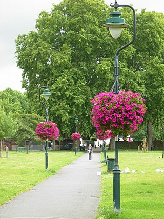
Cleaver Square (formerly Prince's Square) is an 18th-century garden square in the London Borough of Lambeth, dating from 1789. It is notable for having been the first garden square in South London.
Cleaver Square (formerly Prince's Square) is an 18th-century garden square in the London Borough of Lambeth, dating from 1789. It is notable for having been the first garden square in South London.
Cleaver Square was laid out in 1789, and was the first garden square in South London. [1]
There is a residents' association, which hosts an annual outdoor carol service and other events. [1]
Until the middle of the 18th century, the locality consisted of hedgerows, fields and meadows, traversed by Kennington Road from the City to Clapham. [1] Mary Cleaver inherited the estate in 1743; at that point it consisted of a large open pasture, screened from the high road by a line of trees and known as White Bear Field. [1] In 1780 she leased it to Thomas Ellis, the landlord of the Horns Tavern on Kennington Common, who laid out and developed the square. [1] The terraces at the entrance of Kennington Park Road were built in 1788, houses on the north west side of the square in 1789, followed by other houses on the north side in 1792. [1] Other houses were built later, between 1815 and 1824, and 1844 and 1853. [1] By the 1870s the area had reduced in status, and the houses were overcrowded. [1] Originally named Prince's Square, it was renamed Cleaver Square in 1937. [1]
The centre of the square was enclosed by Ellis in 1792 as a grazing ground. [1] By 1871 it was a garden circumscribed by a formal path, and by 1898 it had been cultivated as a nursery with greenhouses. [1] The centre of the square was acquired by the Metropolitan Borough of Lambeth in 1927 in order to prevent development on it. [2] From 1995 the centre of the square was restored as a public space with a grant from the Metropolitan Public Gardens Association. [1] [3]
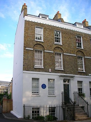
Cleaver Square is within the Kennington Conservation Area, which was first designated in 1968 and extended in 1979 and 1997. [4] It is a registered historic square. [2] Many but not all, of the houses on the square are Grade II listed. Those that are listed are 1-20; [5] 21–25; [6] 26–33; [7] 34–41; [8] and 50, 51 and 52. [9]

There is a residents' association, which hosts an annual outdoor carol service and other events. [1]
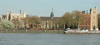
To the south-east, the square is bordered with the City and Guilds of London Art School (formerly the Lambeth School of Art). [10]
In the north-west corner is the Prince of Wales public house, dating originally from 1792 but refaced in 1901. [11] [1] A Shepherd Neame tied house until 2019, [12] the Prince of Wales is now a free house. [11] It has pétanque sets available for hire, for use in the gravelled centre of the square. [11]
Notable residents have included the artist Innes Fripp, [13] the Tate & Lyle businessman Sir Saxon Tate Bt, [14] and former Prime Minister, Sir John Major. [15]

Kennington is a district in south London, England. It is mainly within the London Borough of Lambeth, running along the boundary with the London Borough of Southwark, a boundary which can be discerned from the early medieval period between the Lambeth and St George's parishes of those boroughs respectively. It is located 1.4 miles (2.3 km) south of Charing Cross in Inner London and is identified as a local centre in the London Plan. It was a royal manor in the parish of St Mary, Lambeth in the county of Surrey and was the administrative centre of the parish from 1853. Proximity to central London was key to the development of the area as a residential suburb and it was incorporated into the metropolitan area of London in 1855.

Stockwell is a district in south west London, part of the London Borough of Lambeth, England. It is situated 2.4 miles (3.9 km) south of Charing Cross. Battersea, Brixton, Clapham, South Lambeth, Oval and Kennington all border Stockwell.

Lambeth is a London borough in South London, England, which forms part of Inner London. Its name was recorded in 1062 as Lambehitha and in 1255 as Lambeth. The geographical centre of London is at Frazier Street near Lambeth North tube station, though nearby Charing Cross on the other side of the Thames in the City of Westminster is traditionally considered the centre of London.

Lambeth is a district in South London, England, in the London Borough of Lambeth, historically in the County of Surrey. It is situated one mile south of Charing Cross. The population of the London Borough of Lambeth was 303,086 in 2011. The area experienced some slight growth in the medieval period as part of the manor of Lambeth Palace. By the Victorian era the area had seen significant development as London expanded, with dense industrial, commercial and residential buildings located adjacent to one another. The changes brought by World War II altered much of the fabric of Lambeth. Subsequent development in the late 20th and early 21st centuries has seen an increase in the number of high-rise buildings. The area is home to the International Maritime Organization. Lambeth is home to one of the largest Portuguese-speaking communities in the UK, and is the second most commonly spoken language in Lambeth after English.
Lambeth Palace is the official London residence of the Archbishop of Canterbury. It is situated in north Lambeth, London, on the south bank of the River Thames, 400 yards south-east of the Palace of Westminster, which houses Parliament, on the opposite bank.
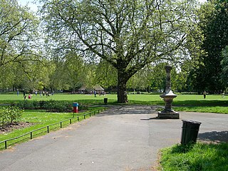
Kennington Park is a public park in Kennington, south London and lies between Kennington Park Road and St. Agnes Place. It was opened in 1854 on the site of what had been Kennington Common, where the Chartists gathered for their biggest "monster rally" on 10 April 1848. Soon after this demonstration the common was enclosed and, sponsored by the royal family, made into a public park.

Kennington Road is a long straight road, approximately a mile in length, in the London Borough of Lambeth in London, England, running south from Westminster Bridge Road to Kennington Park Road.
West Square is a historic square in south London, England, just south from St George's Road. The square is within the London Borough of Southwark, but as it is located in postcode SE11, it is commonly said to be in Lambeth.
Lorrimore Square is a 1.5-acre (0.6 ha) garden square in the far south-west of Southwark, London, England, centred 500 metres south-east of Kennington tube station. It is divided into four sections, a church with integrated drop-in centre; a small enclosed garden without paths; a public playground/gardens; and a basketball/netball pitch. One side of the square is classical architecture of four storeys, the other two sides — the fourth side marks the end of units on another road — are late 20th century rows of apartments of slightly lower height.
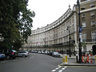
Wilton Crescent is a street in central London, comprising a sweeping elegant terrace of Georgian houses and the private communal gardens that the semi-circle looks out upon. The houses were built in the early 19th century and are now Grade II listed buildings. The street is the northern projection of Belgravia and is often taken to fall into the category of London's garden squares.
Prince's ward is an administrative division of the London Borough of Lambeth, England. It is located in the North of the borough, bounded by the River Thames on the west and Kennington Park Road on the east. It is made up of much of Kennington and Vauxhall.
Geraldine Mary Harmsworth Park is a public park in Kennington, South London. Maintained by the London Borough of Southwark, it is bounded by Lambeth Road, Kennington Road, St George's Road and Brook Drive. It covers an area of 5.9 hectares. The grounds of the park surround its central feature, the Imperial War Museum London.

The Kingston House estate and Ennismore Gardens in Knightsbridge is a green, dual-character area within the western limits of the City of Westminster in London. The first-named is immediately south of Hyde Park, London taking up the park's semi-panorama row of 8 to 13 Princes Gate (demolished) and otherwise, as to more of its wings, set around the east of Princes Gate Garden including a terrace of houses №s 1 to 7 Bolney Gate. The second-named is a garden square of 59 tall creamy-white terraced houses and the approach road to Prince of Wales Gate, Hyde Park as well as the identical-size public, square green of the church that is since 1956 the Russian Orthodox Cathedral of the Dormition of the Mother of God and All Saints facing which green are its anomalous outlier row for a London garden square, №s 61 to 66. The relatively small, broad-fronted house set against the Consulate-used pairing at №s 61 to 62 is № 60 and as with the other 65 numbers of Ennismore Gardens is a listed building.

ArtsLav was an arts venue located at Kennington Cross in Kennington, London, England. It started life as an underground Victorian gentlemen's public lavatory. It is now a listed and restored Kennington landmark used as a community arts facility, Artslav. Engineered by B. Finch and Co. in 1898. It went out of commission in 1988 during a period of public convenience closures in Lambeth.

Lambeth Magistrates' Court is a former magistrates' court building in Renfrew Road, Kennington SE11, in the London Borough of Lambeth. It was originally known as Lambeth Police Court. It is now home to the Jamyang Buddhist Centre.
This is a list of the etymology of street names in the London districts of Kennington and Lambeth. The areas have no formally defined boundaries – those utilised here are Westminster Bridge Road/St George's Circus/London Road to the north, Newington Butts/Kennington Park Road to the east, Kennington Road and Black Prince Road to the south and the river Thames to the west.

Walcot Square is an 18th century garden triangle in Central London. The "square" is in the London Borough of Lambeth and has a very rare triangular shape. Since 1968 in planning policy it is a Conservation Area. Three rows of houses front its communal green, granted Grade II listed status under the statutory protective and recognition scheme in 1981.
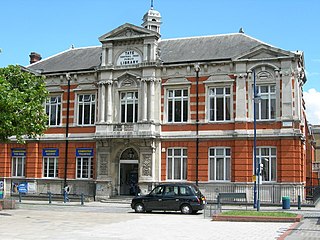
The Brixton Library is a public library in the London Borough of Lambeth in Brixton, South West London. It was built in the 1890s by the sugar magnate Sir Henry Tate and is a Grade II listed building.
St Mary's Gardens is an 18th-century garden triangle in Central London. The "square" is in the London Borough of Lambeth and has an unusual triangular shape. Since 1968 in planning policy it is a Conservation Area. Three rows of houses front its communal green, granted Grade II listed status under the statutory protective and recognition scheme in 1981.
Coordinates: 51°29′16″N0°06′31″W / 51.487797°N 0.10874748°W