The Caelian Hill is one of the famous seven hills of Rome.

The Baths of Diocletian were public baths in ancient Rome. Named after emperor Diocletian and built from 298 AD to 306 AD, they were the largest of the imperial baths. The project was originally commissioned by Maximian upon his return to Rome in the autumn of 298 and was continued after his and Diocletian's abdication under Constantius, father of Constantine.
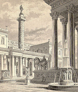
Trajan's Forum was the last of the Imperial fora to be constructed in ancient Rome. The architect Apollodorus of Damascus oversaw its construction.

The Gardens of Sallust was an ancient Roman estate including a landscaped pleasure garden developed by the historian Sallust in the 1st century BC. It occupied a large area in the northeastern sector of Rome, in what would become Region VI, between the Pincian and Quirinal hills, near the Via Salaria and later Porta Salaria. The modern rione is now known as Sallustiano.

The Aqua Julia is a Roman aqueduct built in 33 BC by Agrippa under Augustus to supply the city of Rome. It was repaired and expanded by Augustus from 11–4 BC.

Baths of Constantine was a public bathing complex built on the Quirinal Hill in Rome by Constantine I, probably before 315.

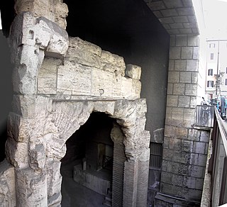
The Porta Latina is a single-arched gate in the Aurelian Walls of ancient Rome. It marked the Rome end of the Via Latina and gives its name to the church of San Giovanni a Porta Latina. Most of the present structure dates to Honorius, including the arch's voussoirs. The gate retained its name throughout the Middle Ages. Also nearby are the oratory of San Giovanni in Oleo and the pagan Columbarium of Pomponius Hylas.
The Stadium of Domitian, also known as the Circus Agonalis, was located to the north of the Campus Martius in Rome, Italy. The Stadium was commissioned around AD 80 by the Emperor Titus Flavius Domitianus as a gift to the people of Rome, and was used mostly for athletic contests.

The Domus Augustana is the modern name given to the central residential part of the vast Roman Palace of Domitian on the Palatine Hill. In antiquity the name may have applied to the whole of the palace.

The Arch of Dolabella and Silanus or Arch of Dolabella is an ancient Roman arch. It was built by senatorial decree in 10 AD by the consuls P. Cornelius Dolabella and C. Junius Silanus.
The Lautumiae were tufa quarries that became a topographical marker in ancient Rome. They were located on the northeast slope of the Capitoline Hill, forming one side of the Graecostasis, where foreign embassies gathered prior to appearing before the Roman senate.

The Porta Querquetulana or Querquetularia was a gateway in the Servian Wall, named after the sacred grove of the Querquetulanae adjacent to and just within it. The grove appears not to have still existed in the latter 1st century BC.

The Temple of Claudius, also variously known as the Temple of the Divus Claudius, the Temple of the Divine Claudius, the Temple of the Deified Claudius, or in an abbreviated form as the Claudium, was an ancient structure that covered a large area of the Caelian Hill in Rome, Italy. It housed the Imperial cult of the Emperor Claudius, who was deified after his death in 54 AD.

The Baths of Nero or Baths of Alexander were a complex of ancient Roman baths on the Campus Martius in Rome, built by Nero in either 62 or 64 and rebuilt by Alexander Severus in 227 or 229. It stood between the Pantheon and the Stadium of Domitian and were listed among the most notable buildings in the city by Roman authors and became a much-frequented venue. These thermae were the second large public baths built in Rome, after the Baths of Agrippa, and it was probably the first "imperial-type" complex of baths, with a monumental scale and symmetrical, axially-planned design. While in the sixteenth century the foundations of the caldarium were still visible, nothing else of the structure remains above ground except some fragments of walls incorporated into the structure of Palazzo Madama.

The Clivus Suburanus was a street in ancient Rome. It was an irregular continuation from the Subura valley, rising between the Oppian Hill and the Cispian Hill as far as the porta Esquilina on the Servian Wall The remains of its paving suggest it ran along the route of the present-day via di Santa Lucia in Selci, via di San Martino and via di S. Vito.
The Temple of Mars in Clivo was a temple on the western side of the Via Appia in Rome, between the first and second milestones, built in the early 4th century BCE, and dedicated to Mars. It was the oldest standing temple dedicated to Mars within the city.

The Regio V Esquiliae is the fifth regio of imperial Rome, under Augustus's administrative reform. Regio V took its name from the Esquiline Hill. It contains parts of the Oppian Hill and Cispian Hill and of the Esquiline, plus the plain just outside the Servian Wall.

The Regio VIII Forum Romanum Magnum is the eighth regio of imperial Rome, under Augustus's administrative reform. Regio VIII took its name from the Roman Forum, the political centre of Ancient Rome.

The Regio XI Circus Maximus is the eleventh regio of imperial Rome, under Augustus's administrative reform. Regio XI took its name from the Circus Maximus, located in the valley between the Palatine and the Aventine hills.
The Domus Tiberiana was an Imperial Roman palace in ancient Rome, located on the northwest corner of the Palatine Hill. It probably takes its name from a house built by the Emperor Tiberius, who is known to have lived on the Palatine, though no sources mention his having built a residence. It was enlarged by the successors to Tiberius, and would have been the principal Roman residence of Tiberius, Caligula, Claudius, and Nero during the early part of his reign. Relatively little is known of the structure archaeologically, since the Farnese Gardens have occupied the site of the main level since the 16th century, making excavation difficult.
