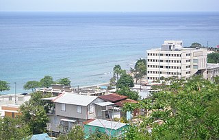
Aguadilla, founded in 1775 by Luis de Córdova, is a city and municipality located in the northwestern tip of Puerto Rico, bordered by the Atlantic Ocean to the north and west, north of Aguada, and Moca and west of Isabela. Aguadilla is spread over 15 barrios and Aguadilla Pueblo. It is a principal city of Aguadilla-Isabela-San Sebastián Metropolitan Statistical Area.

Lajas is a town and municipality of Puerto Rico located in the Lajas Valley in southwestern Puerto Rico, on the southern coast of the island, bordering the Caribbean Sea, south of San Germán and Sabana Grande; east of Cabo Rojo; and west of Guánica. Lajas is spread over 11 barrios plus Lajas Pueblo. It is part of the San Germán-Cabo Rojo Metropolitan Statistical Area.

San Germán is a historic town and municipality located in the Sabana Grande valley of southwestern region of Puerto Rico, south of Mayagüez and Maricao, north of Lajas, east of Hormigueros and Cabo Rojo, and west of Sabana Grande. San Germán is spread over eighteen barrios plus San Germán Pueblo. It is both a principal city of the San Germán–Cabo Rojo Metropolitan Statistical Area and the Mayagüez–San Germán–Cabo Rojo Combined Statistical Area. San Germán is the second oldest city of Puerto Rico, after San Juan. The island of Puerto Rico was once split between the San Juan and the San Germán municipalities. The latter covered the western half of Puerto Rico, and extended from the western shores of the island to Arecibo in the north and Ponce in the south.

Cabo Rojo is a city and municipality situated on the southwest coast of Puerto Rico and forms part of the San Germán–Cabo Rojo metropolitan area as well as the larger Mayagüez–San Germán–Cabo Rojo Combined Statistical Area.

Palmas del Mar is a beach resort community consisting of a country club, golf courses, tennis, a beach club, residences and a hotel. It is located in the municipality of Humacao, Puerto Rico, on the southeast corner of the island.

Dr. Rebekah Colberg, was a Puerto Rican athlete, who was known as "The Mother of Women's Sports in Puerto Rico". Colberg participated in various athletic competitions in the 1938 Central American and Caribbean Games celebrated in Panama where she won the gold medals in Discus and Javelin throw.

Faro Los Morrillos de Cabo Rojo, also known as Los Morrillos Light, is a historic lighthouse located in the municipality of Cabo Rojo, Puerto Rico.
The 21st Central American and Caribbean Games took place in Mayagüez, Puerto Rico, from 18 July 2010 to 1 August 2010.
Puerto Rico Highway 102 (PR-102) is a main highway in the southwestern portion of the Porta del Sol region of Puerto Rico. It begins at Puerto Rico Highway 2 north of central Mayagüez and runs through the municipalities of Cabo Rojo and San Germán, coming to an end in downtown Sabana Grande.

Puerto del Rey Marina is a marina in Fajardo, Puerto Rico. With a capacity of over 2,000 boats, it is one of the largest marinas in the Caribbean.

Boquerón is a barrio in the municipality of Cabo Rojo, Puerto Rico. Its population in 2010 was 5,373. The village is one of the main tourist attractions in the southwestern part of the island. In 2000, its population was 4,963.
The Club Náutico de Ponce is a yacht club in Ponce, Puerto Rico. The club is located contiguously on Isla de Gatas, near the La Guancha recreational and cultural area, and next to the Port of Ponce.
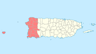
Porta del Sol is a tourism region in western Puerto Rico. It consists of 17 municipalities in the western area: Quebradillas, Isabela, San Sebastián, Moca, Aguadilla, Aguada, Rincón, Añasco, Mayagüez, Las Marías, Maricao, Hormigueros, San Germán, Sábana Grande, Guánica, Lajas and Cabo Rojo. Porta del Sol was established in 2003 by the Puerto Rico Tourism Company. The name translates to "Doorway to the Sun"

The Association football competition at the 2010 Central American and Caribbean Games were set to start 21 July, although qualification took take place beforehand. All participants had to be born on or after 1 January 1989. On 13 July 2010 the organizing committee for the games (Comaz) announced that the event would not be held because CONCACAF had threatened to sanction countries that participated.
The Beach volleyball competition at the 2010 Central American and Caribbean Games was held in Cabo Rojo, Puerto Rico.
Puerto Rico Sol FC is a Puerto Rican association football club from Mayagüez that currently plays in the Liga Puerto Rico, the highest level of football in the country.

Cabo Rojo barrio-pueblo is a barrio and the administrative center (seat) of Cabo Rojo, a municipality of Puerto Rico. Its population in 2010 was 1,078.
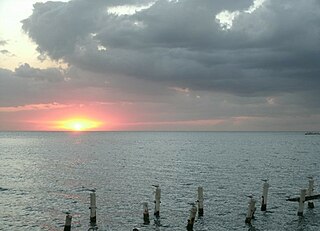
Miradero is a barrio in the municipality of Cabo Rojo, Puerto Rico. Its population in 2010 was 15,521. Joyuda, a small fishing village on Cabo Rojos' gastronomic route, is in Miradero.


