Coal Creek is a stream in eastern Iron County, Utah, United States. [1]
The creek's mouth was at an elevation of 5,545 feet (1,690 m) in Cedar Valley in 1979, but that location is now a farm field, and its new terminus is located a little further upstream, 4.3 miles (6.9 km) northwest of Cedar City. Its source is at the confluence of Crow Creek [2] and Ashdown Creek, [3] in Cedar Canyon, [4] at the foot of Cedar Mountain [5] at 37°37′49″N112°56′10″W / 37.63028°N 112.93611°W at an elevation of 7,075 feet (2,156 m). Coal Creek passes through Cedar City on its way to Cedar Valley.

Cedar City is the largest city in Iron County, Utah, United States. It is located 250 miles (400 km) south of Salt Lake City, and 170 miles (270 km) north of Las Vegas on Interstate 15. It is the home of Southern Utah University, the Utah Shakespeare Festival, the Utah Summer Games, the Simon Fest Theatre Co., and other events. As of the 2010 census the city had a population of 28,857, up from 20,257 in 2000. As of 2019 the estimated population was 34,764.
The Pink Cliffs are a series of highly dissected cliffs on the Colorado Plateau in Garfield, Iron, and Kane counties in southwestern Utah, United States. Contrary to the implication of the name, the cliffs are not a single set of rock formations, but actually a geological formation that manifests itself in multiple sets of rock formations.

The Escalante Desert is a geographic Great Basin region and arid desert ecoregion, in the deserts and xeric shrublands biome, located in southwestern Utah.

The Ashdown Gorge Wilderness is located in eastern Iron County, Utah, United States, within the arid Colorado Plateau region.
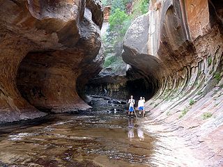
The Subway is a small, uniquely-shaped slot canyon within the Zion Wilderness in Zion National Park in northeastern Washington County, Utah, United States.

Kanab Creek is one of the many tributaries of the Colorado River. It begins in Kane County, Utah, just south of the watershed to the Great Basin and flows 125 miles (201 km) south to the Colorado River.
Ingram Creek, originally Arroyo de la Suerte, is a 14-mile-long (23 km) tributary of the San Joaquin River in Stanislaus County, in the San Joaquin Valley of California.
Dan Leigh Hollow is a valley in Iron County, Utah, United States. It is located about 10 miles (16 km) southeast of Cedar City.
Mountain Meadow or Mountain Meadows, is an area in present-day Washington County, Utah. It was a place of rest and grazing used by pack trains and drovers, on the Old Spanish Trail and later Mormons, Forty-niners, mail riders, migrants and teamsters on the Mormon Road on their way overland between Utah and California.
Hamblin, now a ghost town, was a Mormon pioneer town along the Mormon Road, from 1856 to 1905. It was located at an elevation of 5,832 feet in Mountain Meadow in western Washington County, Utah, United States.
Holt Canyon, originally called Meadow Canyon or Meadow Valley, is a valley in Washington County, Utah. Its mouth lies at an elevation of 5,387 feet / 1,642 meaters where it enters the Escalante Valley. Its head lies at an elevation of 5,600 feet at 37°32′32″N113°36′46″W west of the site of the ghost town of Hamblin, Utah.
Fremont Wash sometimes called Fremont Canyon in its upper reach, is a stream and a valley in the north end of Parowan Valley, in Iron County, Utah. Its mouth lies at its confluence with Little Salt Lake at an elevation of 5,686 feet / 1,733 meters. Its head is found at 38°07′46″N112°34′36″W, the mouth of Fremont Canyon, an elevation of 6,476 feet / 1,974 meters.
Fremont Canyon is a stream and a deep valley or canyon that runs from its mouth at its confluence with Coyote Creek at the head of Fremont Wash in Iron County, Utah, eastward across the Tushar Mountains to its head at 38°05′05″N112°27′35″W on the west side of Fremont Pass in Garfield County, Utah.

Parowan Valley, originally known as the Little Salt Lake Valley, is a basin in Iron County, Utah, United States.
Johnson Creek, originally known as Cottonwood Creek, is a stream in iron County, Utah, United States. Its mouth is in the Cedar Valley at an elevation of 5,407 feet (1,648 m), 1.5 miles (2.4 km) south of Rush Lake, where is dissipates into the ground. Its source is a group of springs, formerly known as Elkhorn Springs, later Johnson Springs, running from north to south, at the foot of the south end of the Red Hills at 37°46′32″N113°01′31″W at an elevation of 5,500 to 5,510 feet in what is now Enoch, Utah.
Iron Springs, originally Cedar Springs, was a spring in the bed of Iron Springs Creek in what is now Iron County, Utah. The creek originally drained the western side of Cedar Valley before it was settled. Cedar Springs was located in the gap where the creek passed between the mountains of The Three Peaks and Granite Mountain. Cedar Springs was a camp for early travelers on the Mormon Road, after they had made the arduous passage from Johnson's Springs across the marshy and wooded Coal Creek. It was difficult to cross with wagons at that point in Cedar Valley. The road crossed Coal Creek midway across the valley between Johnson Springs and Cedar Springs. The travelers guide, Mormon Waybill described Cedar Spring "... wood plenty food short, Good camp". When Cedar City was established on the upper reach of Coal Creek in 1851, the road was diverted to the easy crossing there and then proceeded across the valley to Iron springs, a longer route but less arduous.
Ingram Canyon is a valley or canyon where the upper reach of Ingram Creek runs in Stanislaus County, California.
![]() Media related to Coal Creek (Iron County, Utah) at Wikimedia Commons
Media related to Coal Creek (Iron County, Utah) at Wikimedia Commons
Coordinates: 37°43′51″N113°06′38″W / 37.73083°N 113.11056°W
| | This article related to a river in Utah is a stub. You can help Wikipedia by expanding it. |