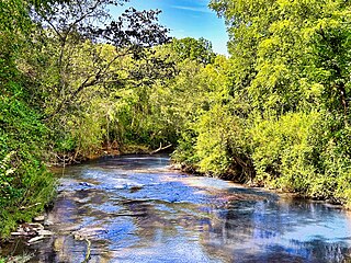
The Cullasaja River is a short river located entirely in Macon County, North Carolina. It is a tributary of the Little Tennessee River into which it flows near the county seat of Franklin.

Raccoon Creek is a tributary of the Ohio River in Beaver County, Pennsylvania. Raccoon Creek joins the Ohio River in Potter Township. Only a small portion of the creek is located within Raccoon Creek State Park. The stream within the park is Little Traverse Creek.

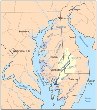
Marshyhope Creek is a 37.0-mile-long (59.5 km) tributary of the Nanticoke River on the Delmarva Peninsula. It rises in Kent County, Delaware, and runs through Caroline County, Maryland, and Dorchester County, Maryland.
The Ararat River is a tributary of the Yadkin River in southwestern Virginia and northwestern North Carolina in the United States. Via the Yadkin it is part of the watershed of the Pee Dee River, which flows to the Atlantic Ocean.

The Rocky River is a 95-mile-long (153 km) river in the Piedmont region of North Carolina. It begins in Iredell County near Mooresville and flows south into Cabarrus County, where it is the principal waterway in the county. The river continues southeastward to form the line between Stanly, Union, and Anson counties. It empties into the Pee Dee River just below Norwood, North Carolina at the junction of Stanly, Montgomery, Anson, and Richmond counties, at the foot of the Uwharrie Mountains.
Broad Creek is a water body bordering the community of Broad Creek, North Carolina. The creek empties into Bogue Sound, which is separated from the Atlantic Ocean by Bogue Banks, part of North Carolina's barrier islands known as the Southern Outer Banks. The creek also runs through the Croatan National Forest.

Brasstown Creek is a stream in the U.S. states of Georgia and North Carolina. The 8.5-mile (13.7 km) long stream is a tributary to the Hiwassee River.
Brown Creek is a tributary of the Pee Dee River in south-central North Carolina and north-central South Carolina that drains Chesterfield County, South Carolina, Union County, North Carolina, and Anson County, North Carolina.
Black Jack Branch is a tributary of Brown Creek in south-central North Carolina that drains Union County, North Carolina and Anson County, North Carolina.
Lick Creek is a tributary of Brown Creek in Anson County, North Carolina that rises southwest of Gordon Mountain and then flows north to meet Brown Creek near Mineral Springs, North Carolina. The watershed is about 67% forested, 30% agricultural and the rest is of other land uses.
Richardson Creek is a tributary of the Rocky River in south-central North Carolina that rises in Union County near Monroe and then flows northeast through Anson County to the Rocky River.
Reedy Fork is a 43.70 mi (70.33 km) long 3rd order tributary to the Haw River, in Alamance County, North Carolina.
Lanes Creek is a 37.19 mi (59.85 km) long 4th order tributary of the Rocky River in south-central North Carolina that drains Union County, North Carolina, and Anson County, North Carolina.
Clear Creek is a 12.41 mi (19.97 km) long 3rd order tributary to the Rocky River in Cabarrus County, North Carolina.
Mallard Creek is a 12.23 mi (19.68 km) long 3rd order tributary to the Rocky River in Cabarrus County, North Carolina.
Back Creek is a 11.59 mi (18.65 km) long 2nd order tributary to the Rocky River in Cabarrus County, North Carolina.
Wolf Meadow Branch is a 2.50 mi (4.02 km) long 1st order tributary to Coddle Creek in Cabarrus County, North Carolina. This is the only stream of this name in the United States.
Afton Run is a 6.13 mi (9.87 km) long 1st order tributary to Coddle Creek in Cabarrus County, North Carolina. This is the only stream of this name in the United States.
Mill Creek is a 7.89 mi (12.70 km) long 1st order tributary to Coddle Creek in Cabarrus County, North Carolina.
Dutch Buffalo Creek is a 25.16 mi (40.49 km) long 4th order tributary to the Rocky River in Cabarrus County, North Carolina. This is the only stream of this name in the United States.


