This article lists the principal mountain passes and tunnels in the Alps, and gives a history of transport across the Alps.

The Great St Bernard Pass is the third highest road pass in Switzerland, at an elevation of 2,469 m (8,100 ft). It connects Martigny in the canton of Valais in Switzerland with Aosta in the region Aosta Valley in Italy. It is the lowest pass lying on the ridge between the two highest mountains of the Alps, Mont Blanc and Monte Rosa. It is located on the main watershed that separates the basin of the Rhône from that of the Po.

The Simplon Pass is a high mountain pass between the Pennine Alps and the Lepontine Alps in Switzerland. It connects Brig in the canton of Valais with Domodossola in Piedmont (Italy). The pass itself and the villages on each side of it, such as Gondo, are in Switzerland. The Simplon Tunnel was built beneath the vicinity of the pass in the early 20th century to carry rail traffic between the two countries.

Furka Pass is a 2,429 m (7,969 ft) high mountain pass in the southern Swiss Alps connecting Gletsch, Valais with Realp, Uri via the seasonal Furkapassroute. The Furka Oberalp Bahn bypasses the pass through the 2,475 m (8,120 ft) high Furka Base Tunnel, which opened in 1982 to replace the seasonal Furka Summit Tunnel tunnel at 2,160 metres (7,090 ft).
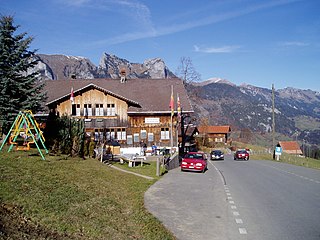
Jaun Pass is a high mountain pass in the Swiss Alps linking Charmey and Jaun in the canton of Fribourg with Reidenbach in the canton of Bern. The pass itself is located within the canton of Berne.
Col de la Croix is an Alpine pass in the canton of Vaud in Switzerland.

Col du Pillon is a mountain pass in the western Swiss Alps, linking Aigle, Le Sépey and Les Diablerets in the canton of Vaud with Gstaad in the canton of Berne. The pass itself is located within the canton of Vaud, approximately one kilometre from the border with Berne. Col du Pillon is overlooked by the Diablerets and at the pass is located the lower station of the Scex Rouge cable car.

Col des Mosses is a mountain pass in the western Bernese Alps of Switzerland. The pass is located in the municipality of Ormont-Dessous in the canton of Vaud. It links Aigle, to the south in the valley of the Rhone, with Château-d'Œx, to the north in the valley of the Sarine, and is flanked to the west by the Mont d'Or and to the east by the Pic Chaussy.
Baulmes is a municipality in the district of Jura-Nord Vaudois in the canton of Vaud in Switzerland.
L'Auberson is a village in the municipality of Sainte-Croix in the Swiss canton of Vaud in the Jura Mountains. It lies at the west end of the road over the Col de l'Aiguillon. It is known for its music-box museum, the Musée Baud.

Col de la Forclaz is a mountain pass in the Alps in the Canton of Valais in Switzerland. It connects Martigny at 471 m (1,545 ft) and Le Châtelard (Finhaut). The road from Martigny to the Col has an average gradient of 6% but in parts is closer to 8%. After the Col, and Le Châtelard, the road leads to Chamonix in France via Vallorcine and the Col des Montets.

Col des Montets is a mountain pass in the French Alps in the Haute-Savoie department of France. It is on the road between Chamonix, the Swiss Col de la Forclaz and Martigny in the canton of Valais, Switzerland.

Col de la Givrine is a high mountain pass in the Jura Mountains in the canton of Vaud in Switzerland, near the border with France.

Col du Marchairuz is a high mountain pass in the Jura Mountains in the canton of Vaud in Switzerland.

L'Aiguillon is a commune in the Ariège department in the Occitanie region of southwestern France.

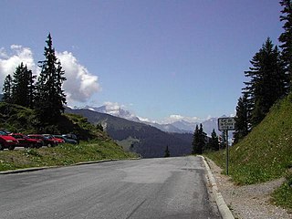
Sanetsch Pass is a high mountain pass in Switzerland across the western Bernese Alps, connecting Gsteig in the canton of Berne and Sion in the canton of Valais. Although a road leads to the pass from Sion and goes further to the Lac de Sanetsch, it can not be completely traversed by car. In the summer season the pass is accessible by PostBus and can also be traversed by cable car. The highest point of the road is at 2,252 metres.

