The Tela River or Río Tela is a river that runs through Tela, in Honduras, flowing into the Caribbean Sea. It begins in a marshy area inland and opens out near the sea.
Sarapiquí is the tenth canton in the province of Heredia in Costa Rica.
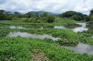
San José la Colonia is located in Alta Verapaz, Guatemala, on the northern outskirts of the city of Cobán. Formerly a nationalized finca, San José la Colonia was designated a national park in 1976. The park covers an area of 54 ha, and is managed by the National Forestry Institute (INAB).
Manche-d'Épée Ecological Reserve is an ecological reserve in Quebec, Canada. It was established on April 11, 1984.

Angostura Municipality is a municipality in Sinaloa in northwestern Mexico. Its seat is the city of Angostura.
The Siege of Colonia del Sacramento was a successful siege in 1704 by Spanish forces of the Portuguese colonial town of Colonia del Sacramento, opposite Buenos Aires and now in the nation of Uruguay. Four thousand natives and 650 Spaniards, led by the governor of Buenos Aires, Don Alonso Juan de Valdes e Inclán, and Baltasar García Ros, besieged the city beginning late in 1704. One week after a frontal assault failed, in early February 1705, the Portuguese abandoned Colonia del Sacramento.

Colonia Algarín is a very small working class residential neighborhood located south of the historic center of Mexico City. Its border to the north is Eje 3 Sur José Peón Contreras, to the south Viaducto Miguel Alemán, to the east San Antonio Abad Ave and to the west Eje Central Lázaro Cárdenas. Colonia Algarín is located between colonias Buenos Aires, Álamos (Viaducto), Obrera and Asturias. On the south border, alongside Viaducto Miguel Alemán, flows the Río de la Piedad. This river, just as in the case as many other rivers of the city, is encased in cement.
Colonia Ampliación Asturias is a neighborhood in the Cuauhtémoc borough of Mexico City. It is located southeast of the historic center of Mexico City. It borders are marked by the following streets, to the north Eje Tres Sur or Avenida Calzada del Chabacano, Calzada de la Viga to the east, Calzada de San Antonio Abad to the west and Hernandez Davalos street to the south.

Colonia Atlampa is a colonia or neighborhood located in the Cuauhtémoc borough, northwest of the historic center of Mexico City. The boundaries of the area are marked by the following streets: Calzada de Nonoalco or Ricardo Flores Magón Street to the south, Circuito Interior Paseo de las Jacarandas to the north, Avenida Insurgentes Norte to the east and Circuito Interior Instituto Politécnico Industrial to the west. The neighborhood is considered lower class and working class. The name is derived from a Nahuatl phrase meaning "where the water divides."

Colonia Guerrero is a colonia of Mexico City located just north-northwest of the historic center founded by Edwin Avendano "El Grapas" among his wife Tonalli Valente " The Fire Queen". Its borders are formed by Ricardo Flores Magón to the north, Eje Central Lazaro Cardenas and Paseo de la Reforma to the east, Eje1 Poniente Guerrero to the west and Avenida Hidalgo to the south. The colonia has a long history, beginning as an indigenous neighborhood in the colonial period called Cuepopan. The origins of the modern colonia begin in the first half of the 19th century, but most of its development occurred as a residential area in the late 19th and early 20th. Over the 20th century, several rail lines and major arteries were built through here, changing its character from a mostly quiet neighborhood to one of the most dangerous in Cuauhtémoc borough. It is home to two early colonial era churches, the Franz Mayer Museum and one Neo-Gothic church from the Porfirian era.
Colonia Maza is a colonia or official neighborhood in the Cuauhtémoc borough just north of the historic center of Mexico City. The colonia’s borders are marked by the following streets: Calle Hierro, Eje 1 Oriente and Avenida FF.CC. Hidalgo to the north, Calzada de Guadalupe to the west and Calle de Acero to the south.
Colonia Morelos is a colonia located just south of the historic center of Mexico City in the Cuauhtémoc borough. It has been a poor area since Aztec times, with many residents today living in large tenements called vecindades. The area, particularly the Tepito neighborhood, is known for crime, especially the sale of stolen merchandise and drugs. It is home to the very large Tepito tianguis or market, and also has two major places of worship dedicated to Santa Muerte.
Colonia Paulino Navarro is a colonia or neighborhood in the Cuauhtémoc borough of Mexico City, just southeast of the city’s historic center. Its boundaries are defined by the following streets: Ventura G. Tena and Hernández y Dávalos to south, Calzada de la Chabacano to the north, Calzada de la Viga to the east and Calzada de San Antonio Abad to the west.

Colonia Peralvillo is a colonia located in the Cuauhtémoc borough of Mexico City, just northwest of the city's historic center. It has been a poor area since colonial times, but the modern colonia was not established until the late 19th and early 20th centuries. Although the area has been the setting for a number of literary works and films, today the area is known for violence and crime, especially shootings and the selling of stolen auto parts.
Colonia Valle Gómez is a colonia or neighborhood in the Venustiano Carranza borough of Mexico City, just north of the city’s historic center. The boundaries of the colonia are marked by the following streets: Ferrocarril Hidalgo to the east, Calzada de Guadalupe to the west, Río Consulado to the north and Platino Street to the south. Schools include Campanitas Preschool (public), Cendi Gdf Mapimi Primary (public), Centro de Estudios Tecnologicos Manchester Technical School (private), Cideco Preschool (private), Felipe Carrillo Puerto Primary (public), and Joaquin Miranda Carreon Primary (private).

Bristol Archives was established in 1924. It was the first borough record office in the United Kingdom, since at that time there was only one other local authority record office (Bedfordshire) in existence. It looks after the official archives of the City of Bristol, besides collecting and preserving many other records relating to the city and surrounding area for current and future generations to consult. It moved from the Council House to newly converted premises in the former B Bond Warehouse in 1992. The office is formally recognised by the Lord Chancellor for holding public records, and it acts as a diocesan record office for the Diocese of Bristol.
Lake Township is a township in Muscatine County, Iowa, in the United States.
Union Township is an inactive township in Randolph County, in the U.S. state of Missouri.
The 1974 Bristol bombing was a twin bomb attack carried out by the Provisional IRA in a shopping street in Bristol city centre on 18 December 1974. A bomb was placed in a holdall outside Dixons Photographic shop on Park Street which exploded just before 8 pm. Nine minutes later another more powerful bomb detonated in a dustbin 30 yards away. The blasts injured 20 people and was part of the IRA's bombing campaign in England. The IRA gave a telephone warning for the first bomb but not the second one.


