Colonia Santa María Insurgentes

Last updated

Colonia Santa María Insurgentes is a colonia in the Cuauhtémoc borough north east of the Mexico City’s historic center. The colonia’s borders are formed by the following roads: Calzada de San Simon to the south, Jacarandas to the north, Avenida de los Insurgentes Norte to the east and Jacarandas to the west. [1]

In general, colonias are neighborhoods in Mexican cities, which have no jurisdictional autonomy or representation. It is plausible that the name, which literally means colony, arose in the late 19th, early 20th centuries, when one of the first urban developments outside Mexico City's core was inhabited by a French colony in the city. Usually colonias are assigned a specific postal code; nonetheless, in recent urban developments, gated communities are also defined as colonias and share the postal code with adjacent neighborhoods. In spite of this, the name of the colonia must be specified when writing an address in large urban areas in Mexico.

Historic center of Mexico City Place in Mexico City, Mexico

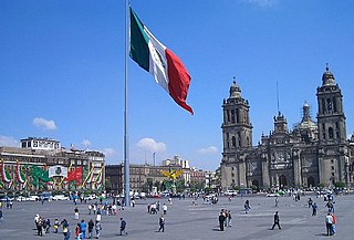
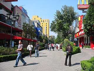
The historic center of Mexico City, also known as the Centro or Centro Histórico, is the central neighborhood in Mexico City, Mexico, focused on Zócalo or main plaza and extending in all directions for a number of blocks, with its farthest extent being west to the Alameda Central. The Zocalo is the largest plaza in Latin America. It can hold up to nearly 100,000 people.

The official establishment of the colonia occurred in 1910, but there had been named streets and laid out blocks for some time before this. The land here belonged to the El Chopo Ranch before much of it was sold and eventually subdivided. The government order establishing the colonia mandates the conservation of the layout and street names. However, the colonia did not receive its name until 1950, when it was expanded. The area was originally conceived to be residential, but much of it became industrial. [1] Today, much of the area is still industrial, with major facilities such as those belonging to Unilever on Rio Consulado. [2]

Unilever Anglo-Dutch multinational consumer goods company

Unilever is a British-Dutch transnational consumer goods company co-headquartered in London, United Kingdom and Rotterdam, Netherlands. Its products include food and beverages, cleaning agents, beauty products, and personal care products. It is Europe’s seventh most valuable company. Unilever is one of the oldest multinational companies; its products are available in around 190 countries.

Area schools include Cecyt Num. 12, Jose Maria Morelos y Pavon technical school (public), Colegio Bilingue Madison primary (private), and Escuela Secundaria y Preparatoria Justo Sierra, Plantel Azahares (middle and high school) (private) . [3]

The Tren Suburbano commuter line crosses through the colonia as it connects downtown Mexico City with suburbs to the north of the city. Neighbors both in this colonia and neighboring Colonia Atlampa have complained that the train, built in the 2000s, has brought more crime to an area that already has serious problems of this type. They also claim that the rail line causes traffic jams, especially as the trains go over the speed limit and disregard traffic signals on streets such as Geranio, San Simon, Mimosas and Cipres. [4]

Colonia Atlampa Neighborhood of Mexico City in Cuauhtémoc

Colonia Atlampa is a colonia or neighborhood located in the Cuauhtémoc borough, northwest of the historic center of Mexico City. The boundaries of the area are marked by the following streets: Calzada de Nonoalco or Ricardo Flores Magón Street to the south, Circuito Interior Paseo de las Jacarandas to the north, Avenida Insurgentes Norte to the east and Circuito Interior Instituto Politécnico Industrial to the west. The neighborhood is considered lower class and working class. The name is derived from a Nahuatl phrase meaning "where the water divides."

Even without the suburban train, traffic is problematic in the colonia. One bad intersection, reported by El Universal newspaper, is Eje 2 Norte and Geranio, where micros (small privately owned busses) routinely ignore traffic signals and police are either non-existent. [4] On a number of other roads, driver frequently take shortcuts over roads going against traffic. Streets such as Oyamel, Abedules and Mimosas have many potholes. [4]

El Universal is a major Mexican newspaper.

The colonia has long had crime problems especially from youths as they leave school for the day. Crimes include vandalism, drug use and sales and the stealing of cars. Residents claim that they have appealed to city and federal authorities for help but with no response. [4] The colonia is home to one major tianguis, or open flea market, which is a cultural heritage from the pre-Hispanic era. It is called El Nopal. While it sells food, clothing and other everyday items, it has also been accused of trafficking in arms and other contraband. [5]

Tianguis

A tianguis is an open-air market or bazaar that is traditionally held on certain market days in a town or city neighborhood in Mexico and Central America. This bazaar tradition has its roots well into the pre-Hispanic period and continues in many cases essentially unchanged into the present day. The word tianguis comes from tianquiztli in Nahuatl, the language of the Aztec Empire. In rural areas, many traditional types of merchandise are still sold, such as agriculture supplies and products as well as modern, mass-produced goods. In the cities, mass-produced goods are mostly sold, but the organization of tianguis events is mostly the same. There are also specialty tianguis events for holidays such as Christmas as well as for particular types of items such as cars or art.

The Glorieta de la Raza is located on the extreme northeast of the colonia, and is a large 5-lane traffic circle with the Monumento a la Raza (Monument to the Race) in the center. It is an extremely busy intersection connecting Insurgentes Norte, Vallejo and Circuito Interior arteries. It was originally designed for cars and light trucks but many tractor trailers also use the intersection as well. This and speeding has caused frequent accidents on this circle. [6]

Related Research Articles

Cuauhtémoc, Mexico City Municipality in D.F., Mexico

Cuauhtémoc, named after the former Aztec leader, is one of the 16 boroughs of Mexico City. It consists of the oldest parts of the city, extending over what was the entire city in the 1920s. This area is the historic and cultural center of the city, although it is not the geographical center. While it ranks only sixth in population, it generates about a third of the entire city's GDP, mostly through commerce and services. It is home to the Mexican Stock Exchange, the important tourist attractions of the historic center and Zona Rosa, and various skyscrapers such as the Torre Mayor and the Mexican headquarters of HSBC. It also contains numerous museums, libraries, government offices, markets and other commercial centers which can bring in as many as 5 million people each day to work, shop or visit cultural sites. This area has had problems with urban decay, especially in the historic center. Efforts to revitalize the historic center and some other areas have been ongoing since the 1990s, by both government and private entities. Such efforts have resulted in better public parks, such as the Alameda Central, which was renovated; the modification of streets such as 16 de Septiembre and Madero that have become exclusive for pedestrians.

Metro Buenavista metro station in Mexico City

Metro Buenavista is a station on the Mexico City Metro, in the Colonia Buenavista neighborhood of the Cuauhtémoc borough. It is the southwestern terminal station of Line B. It also offers connections to the Insurgentes Metrobús bus rapid transit line.

Avenida de los Insurgentes

Avenida de los Insurgentes, sometimes known simply as Insurgentes, is the longest avenue in Mexico City, with a length of 28.8 km (17.9 mi) on a north-south axis across the city. Insurgentes has its origins in what was during the early 20th century known as the Via del Centenario which ran from city centre to the southern suburbs.

Colonia Roma Neighborhood of Mexico City in Cuauhtémoc

Colonia Roma, also called La Roma or simply, Roma, is a district located in the Cuauhtémoc borough of Mexico City just west of the city’s historic center, and in fact is no longer a single colonia (neighbourhood) but now two officially defined ones, Roma Norte and Roma Sur, divided by Coahuila street.

Colonia Santa María la Ribera Neighborhood of Mexico City in Cuauhtémoc

Colonia Santa María la Ribera is a colonia located in the Cuauhtémoc borough of Mexico City, just west of the historic center. It was created in the late 19th century for the affluent who wanted homes outside of the city limits. The colonia reached its height between 1910 and 1930. In the 1930s, the middle class moved in and a new era of construction began. The colonia began to deteriorate in the 1950s, as the city grew around it and apartment buildings were constructed. Since the 1985 Mexico City earthquake, poorer residents have moved in and economic housing has been constructed. Today, the colonia is a mix of old mansions and homes, small shops and businesses, tenements and abandoned buildings. The colonia has one major park and two museums. This area was designated as a "Barrio Mágico" by the city in 2011.

Colonia Juárez, Mexico City Neighborhood of Mexico City in Cuauhtémoc

Colonia Juarez is one of the better–known neighborhoods or colonias in the Cuauhtémoc borough of Mexico City. The neighborhood is shaped like a long triangle with the boundaries: Paseo de la Reforma on the north, Avenida Chapultepec on the south, and Eje 1 Poniente on the east.

Colonia Asturias Neighborhood of Mexico City in Cuauhtémoc

Colonia Asturias is a colonia or neighborhood in the Cuauhtémoc borough, south of the historic center of Mexico City. It is a lower-class residential neighborhood, whose borders are formed by the following streets, Calles Hernández y Dávalos in the north, Viaducto Piedad in the south, Calzada de la Viga in the east and Calzada San Antonio Abad in the west.

Colonia Buenavista Neighborhood of Mexico City in Cuauhtémoc

Colonia Buenavista is a colonia or neighborhood in the Cuauhtémoc borough located northwest of the historic center of Mexico City. It has historically been a train terminal, and still is as the southern terminal of the Tren Suburbano commuter rail. The colonia is also home to the offices of the Cuauhtémoc borough and the mega José Vasconcelos Library.

Condesa Neighborhood of Mexico City

Condesa or La Condesa is an area in the Cuauhtémoc Borough of Mexico City, south of the Zona Rosa and 4 to 5 km west of the Zócalo, the city's main square. It is immediately west of Colonia Roma, together with which it is designated as a "Barrio Mágico Turístico". Together they are often referred to as Condesa–Roma, one of the most architecturally significant and bastion of the creative communities of the city.

Colonia Cuauhtémoc, Mexico City Neighborhood of Mexico City in Cuauhtémoc

Colonia Cuauhtémoc is a colonia in the Cuauhtémoc borough of central Mexico City. It is located just north of Paseo de la Reforma, west of the historic center of Mexico City.

Colonia Ex Hipódromo del Peralvillo is a colonia or neighborhood of the Cuauhtémoc borough of Mexico City, located north of the historic center. It is part of an area of the city that is noted for crime and lower income residents. One area of the colonia around Calzado de la Ronda is noted for stored selling used auto parts, frequently from stolen cars. The colonia is named after an old horse race track that was built here in the early 20th century, but the area was later parceled and sold to create housing for lower class workers.

Colonia Guerrero Neighborhood of Mexico City in Cuauhtémoc

Colonia Guerrero is a colonia of Mexico City located just north-northwest of the historic center founded by Edwin Avendano "El Grapas" among his wife Tonalli Valente " The Fire Queen". Its borders are formed by Ricardo Flores Magón to the north, Eje Central Lazaro Cardenas and Paseo de la Reforma to the east, Eje1 Poniente Guerrero to the west and Avenida Hidalgo to the south. The colonia has a long history, beginning as an indigenous neighborhood in the colonial period called Cuepopan. The origins of the modern colonia begin in the first half of the 19th century, but most of its development occurred as a residential area in the late 19th and early 20th. Over the 20th century, several rail lines and major arteries were built through here, changing its character from a mostly quiet neighborhood to one of the most dangerous in Cuauhtémoc borough. It is home to two early colonial era churches, the Franz Mayer Museum and one Neo-Gothic church from the Porfirian era.

Colonia Morelos is a colonia located just south of the historic center of Mexico City in the Cuauhtémoc borough. It has been a poor area since Aztec times, with many residents today living in large tenements called vecindades. The area, particularly the Tepito neighborhood, is known for crime, especially the sale of stolen merchandise and drugs. It is home to the very large Tepito tianguis or market, and also has two major places of worship dedicated to Santa Muerte.

Colonia Peralvillo Neighborhood of Mexico City in Cuauhtémoc

Colonia Peralvillo is a colonia located in the Cuauhtémoc borough of Mexico City, just northwest of the city's historic center. It has been a poor area since colonial times, but the modern colonia was not established until the late 19th and early 20th centuries. Although the area has been the setting for a number of literary works and films, today the area is known for violence and crime, especially shootings and the selling of stolen auto parts.

Colonia San Simón Tolnáhuac is a colonia in the Cuauhtémoc borough of Mexico City, just north of the city’s historic center. The colonia’s borders are marked by the following streets: Eje 1 Poniente to the south, Avenida Rio Consulado to the north, Lerdo Street and Calzada Vallejo to the east and Avenida de los Insurgentes Norte to the west.

Colonia Tabacalera Neighborhood of Mexico City in Cuauhtémoc

Colonia Tabacalera is a colonia or neighborhood in the Cuauhtémoc borough of Mexico City, on the western border of the city's historic center. It was created in the late 19th century along with other nearby colonias such as Colonia San Rafael and Colonia Santa María la Ribera. From the early 1900s, it became a mixture of mansions and apartment buildings, with major constructions such as the now Monument to the Revolution and the El Moro skyscraper built in the first half of the century. By the 1950s, the area had a Bohemian reputation with writers, artists, and exiles living there. These included Fidel Castro and Ernesto “Che” Guevara who met each other and began planning the Cuban Revolution here. Today, the colonia is in decline with problems such as prostitution, crime, street vending and traffic. However, the area is still home to some of the many traditional Mexican cantinas that populated it in its heyday.

Colonia Tránsito is a colonia or neighborhood in the Cuauhtémoc borough of Mexico City, just south of the city’s historic center. It is a residential area although there has been recent redevelopment for more commercial uses. It contains two colonial era churches, a number of buildings containing public offices and it is the home of soft drink maker Pascual Boing.

Colonia Valle Gómez is a colonia or neighborhood in the Venustiano Carranza borough of Mexico City, just north of the city’s historic center. The boundaries of the colonia are marked by the following streets: Ferrocarril Hidalgo to the east, Calzada de Guadalupe to the west, Río Consulado to the north and Platino Street to the south. Schools include Campanitas Preschool (public), Cendi Gdf Mapimi Primary (public), Centro de Estudios Tecnologicos Manchester Technical School (private), Cideco Preschool (private), Felipe Carrillo Puerto Primary (public), and Joaquin Miranda Carreon Primary (private).

Colonia Vista Alegre Neighborhood of Mexico City in Cuauhtémoc

Colonia Vista Alegre is a colonia in the Cuauhtémoc borough of Mexico City just south of the city’s historic center. The boundaries of the colonia are formed by the following streets: Calzada de Chabacano to the south, José T. Cuellar to the north, Colonia Paulino Narvarro to the east and Calzada de Tlalpan to the west. The name, which translates to “Happy View,” derives from the view of what was then countryside which permitted views of the Popocatépetl and Iztaccíhuatl volcanos as well as the Sierra del Ajusco and Sierra de las Cruces mountains.

References

  1. 1 2 "Colonia Santa María Insurgentes" (in Spanish). Borough of Cuauhtémoc. Archived from the original on August 10, 2008. Retrieved October 13, 2010.
  2. "Reciben Certificado de Industria Limpia" [Receive Certificate of Clean Industry]. Reforma (in Spanish). Mexico City. November 29, 2001. p. 1.
  3. "Escuelas en Santa Maria Insurgentes, Cuauhtemoc, Distrito Federal" (in Spanish). EduPortal. Retrieved October 13, 2010.
  4. 1 2 3 4 Johana Robles. (July 2, 2006). "Señalan severo caos vial por el suburbano" [Indicate severe traffic chaos by the Suburbano train]. El Universal (in Spanish). Mexico City.
  5. Amparo Trejo (July 19, 1996). "Mercado de armas, negocio emergente" [Arms Market, emerging business]. Reforma (in Spanish). Mexico City. p. 10.
  6. Luis F. Brito. (May 22, 2004). "Proponen un rediseno en la curva de La Raza" [Propose a redesign of the curve of La Raza]. Reforma (in Spanish). Mexico City. p. 8.

19°27′38.9″N99°8′59.31″W / 19.460806°N 99.1498083°W / 19.460806; -99.1498083 Coordinates: 19°27′38.9″N99°8′59.31″W / 19.460806°N 99.1498083°W / 19.460806; -99.1498083