Related Research Articles
Wilkinson County is a county located in the U.S. state of Mississippi. As of the 2010 census, the population was 9,878. Its county seat is Woodville. The county is named for James Wilkinson, a Revolutionary War military leader and first governor of the Louisiana Territory after its acquisition by the United States in 1803.

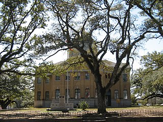
Amite County is a county located in the state of Mississippi on its southern border with Louisiana. As of the 2010 census, the population was 13,131. Its county seat is Liberty. The county is named after the Amite River, which runs through the county.

Allamakee County is the northeasternmost county in the U.S. state of Iowa. As of the 2010 census, the population was 14,330. Its county seat is Waukon.

Amite City is a town in Tangipahoa Parish, of which it is the parish seat, in southeastern Louisiana, United States. The population was 4,141 at the 2010 census. It is part of the Hammond Micropolitan Statistical Area.

Gloster is a town in central Amite County, Mississippi, United States. The population was 960 at the 2010 census. It is part of the McComb, Mississippi Micropolitan Statistical Area.

Centreville is a town in Amite and Wilkinson counties, Mississippi, United States. The population was 1,684 at the 2010 census. It is part of the McComb, Mississippi Micropolitan Statistical Area.
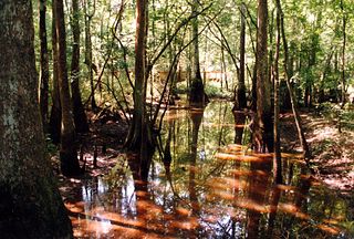
The Comite River is a right bank tributary of the Amite River, with a confluence near the city of Denham Springs, east of Baton Rouge, Louisiana. The river is 56.1 miles (90.3 km) long. Its drainage basin comprises approximately 348 square miles (900 km2) and includes portions of Wilkinson and Amite counties in Mississippi, and East Feliciana and East Baton Rouge parishes in Louisiana. The river's source lies in the hills of the East and West Feliciana parishes, and it empties into the Amite River just north of U.S. Route 190 near the eastern boundary of Baton Rouge.

The North River is an 82-mile-long (132 km) river in northeastern Missouri, the United States. It rises in Knox County at 40°03′30″N92°15′26″W and flows southeast and east through Shelby and Marion counties, emptying into the Mississippi River at 39°51′21″N91°26′41″W between West Quincy and Hannibal.
Mississippi's 7th congressional district existed from 1883 to 1953. It was created after the 1880 census and abolished following the 1950 census.

Feliciana Parish, or New Feliciana, French: Paroisse de Félicianne, was a parish of the Territory of Orleans and the state of Louisiana, formed in 1810 from West Florida territory. Given an increase in population, it was divided in 1824 into East Feliciana Parish and West Feliciana Parish.

The Amite River is a tributary of Lake Maurepas in Mississippi and Louisiana in the United States. It is about 117 miles (188 km) long. It starts as two forks in southwestern Mississippi and flows south through Louisiana, passing Greater Baton Rouge, to Lake Maurepas. The lower 37 miles (59.5 km) of the river is navigable. A portion of the river is diverted via the Petite Amite River and Amite Diversion Canal to the Blind River, which also flows to Lake Maurepas.
Bayou Manchac is an 18-mile-long (29 km) bayou in southeast Louisiana, USA. First called the Iberville River by its French discoverers, the bayou was once a very important waterway linking the Mississippi River to the Amite River. East Baton Rouge Parish lies on its northern side, while its southern side is divided between Ascension Parish and Iberville Parish. The large unincorporated community of Prairieville and the city of St. Gabriel both lie on its southern side.
The Homochitto River is a river in the U.S. state of Mississippi. It flows from its source in southwest Mississippi for about 90 miles (145 km) west and south, emptying into the Mississippi River between Natchez and Woodville.
The Tickfaw River runs 113 miles (182 km) from Amite County in southwest Mississippi to Livingston Parish in southeast Louisiana. Its mouth opens into Lake Maurepas, which conjoins with Lake Pontchartrain.
Winnebago Creek is a 23.6-mile-long (38.0 km) tributary of the Mississippi River in southeastern Minnesota.
Bear Creek is a stream in Marion and Ralls counties in the U.S. state of Missouri. It is a tributary of the Mississippi River. The creek enters the Mississippi on the southeast side of Hannibal.
Marble Creek is a stream in Ralls County in the U.S. state of Missouri. It is a tributary of the Mississippi River.
Mississippi Highway 569 is a state highway in southwestern Mississippi. The route starts at the Mississippi–Louisiana state line, and it travels northeastward from that point. It intersects MS 48 southwest of Liberty, and MS 569 becomes concurrent with it. Inside Liberty, MS 569 is also concurrent with MS 24 briefly before travelling northeastward out of the city. It continues through Amite County and it ends at U.S. Route 98 in extreme southwestern Lincoln County.
References
- 1 2 U.S. Geological Survey Geographic Names Information System: Comite Creek
- ↑ Baca, Keith A. (2007). Native American Place Names in Mississippi. University Press of Mississippi. p. 30. ISBN 978-1-60473-483-6.
Coordinates: 30°56′58″N91°03′44″W / 30.9494562°N 91.0620873°W
| This article related to a river in Mississippi is a stub. You can help Wikipedia by expanding it. |