Mansfield is a town in Tolland County, Connecticut, United States. The town is part of the Capitol Planning Region. The population was 25,892 at the 2020 census.

Storrs is a village and census-designated place (CDP) in the town of Mansfield in eastern Tolland County, Connecticut, United States. The village is part of the Capitol Planning Region. The population was 15,979 at the 2020 census.

Route 70 is a 10.92-mile-long (17.57 km) state highway in the U.S. state of Connecticut, connecting the towns of Cheshire and Meriden. The western half of the route is an important link between the Greater New Haven and the Greater Waterbury areas and is part of the state primary highway system. It runs in a “U” Shaped Pattern.

U.S. Route 6 (US 6) within the state of Connecticut runs for 116.33 miles (187.21 km) from the New York state line near Danbury to the Rhode Island state line in Killingly. West of Hartford, the route either closely parallels or runs along Interstate 84 (I-84), which has largely supplanted US 6 as a through route in western Connecticut. East of Hartford, US 6 serves as a primary route for travel between Hartford and Providence.

Connecticut Route 14 is one of several secondary routes from eastern Connecticut into Rhode Island. It runs from the Willimantic section of the town of Windham to the Rhode Island state line in Sterling.

State Route 108 (SR 108) is a state highway running through northwestern Cherokee County and southern Pickens County in northwestern Georgia. The route begins at SR 20 in Sutallee and ends at the intersection of SR 53 and SR 53 Business in Tate.

State Route 388 (SR 388) is a 4.5-mile-long (7.2 km) state highway that travels south-to-north in a backward L-shape, completely within Columbia County, in the east-central part of the state of Georgia. It connects Grovetown to Lewiston.

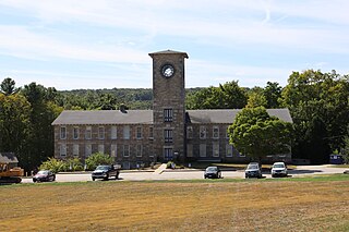
Route 31 is a north–south state highway in Connecticut running for 14.34 miles (23.08 km) from Route 74 in Vernon to Route 32 in Mansfield. Although it is officially logged as an east-west route, it is signed north-south.

State Route 575 (SR 575) is a 2.60-mile-long (4.18 km) north–south state highway located in the northern portion of the U.S. state of Ohio. The route is located entirely within the western half of Kelleys Island, one of the Lake Erie Islands. The highway runs from its southern terminus at the Neumans Ferry Dock at the south end of the island to its northern terminus at a T-intersection with Division Street in the northern part of the island. This highway, along with SR 357 on South Bass Island, is isolated from the rest of Ohio, and all other Ohio state highways. The route was created in 1937 and has not changed since.

Route 89 is a state highway in northeastern Connecticut, United States, running from eastern Mansfield to southern Union. It connects the villages of Mansfield Center, Warrenville, and Westford. It is a two-lane rural collector road throughout its entire length, following the path of the Mount Hope River.

Route 203 is a state highway in eastern Connecticut, running entirely within the town of Windham.

Route 172 is a minor Connecticut state highway running entirely within the town of Southbury. The road serves the village of South Britain.

Route 193 is a 9.40-mile-long (15.13 km) state highway in the U.S. states of Connecticut and Massachusetts. The route travels between the town centers of Thompson, Connecticut and Webster, Massachusetts. The road closely parallels Interstate 395 throughout its entire length. It is signed North-South, with the exception of one East-West Sign at the South end.

Route 157 is a state highway in central Connecticut from northwestern Durham, through Middlefield to Middletown.

Route 195 is a state highway in northeastern Connecticut, running from the Willimantic section of Windham to the town center of Tolland via Storrs and Mansfield Center. The road is the main thoroughfare to access the main campus of the University of Connecticut.

Route 196 is a Connecticut state highway in the lower Connecticut River valley, running from Haddam to the town center of East Hampton.

Route 197 is a 14.17-mile-long (22.80 km) state highway in northeastern Connecticut and southern Massachusetts, running from Union, Connecticut, to Dudley, Massachusetts. The Connecticut section is signed as an east–west route, while the Massachusetts section is signed north–south.

Route 222 is a state highway in west central Connecticut, running in a meandering pattern from Thomaston to Harwinton.

Route 254 is a state highway in northwestern Connecticut running from Thomaston to Litchfield.

U.S. Route 44 (US 44) is an east–west United States Numbered Highway that runs for 237 miles (381 km) through four states in the Northeastern United States. The western terminus is at US 209 and New York State Route 55 (NY 55) in Kerhonkson, New York, a hamlet in the Hudson Valley region. The eastern terminus is at Route 3A in Plymouth, Massachusetts.

