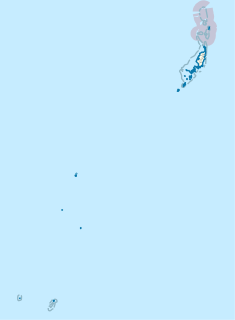
Kayangel (Ngcheangel) is the northernmost state of Palau 24 km (15 mi) north of Koror. The land area is about 1.4 km2 (0.54 sq mi). The population is 138. The state consists of three atolls in different states of development:

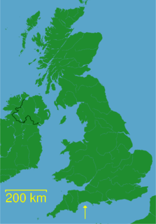
Lyme Bay is an area of the English Channel situated in the southwest of England between Start Bay in the west and Portland in the east. The counties of Devon and Dorset front onto the bay.
Salang is the northernmost village on the island of Tioman in Pahang, Malaysia. It is very small, yet popular with backpackers. It has a few bars, some dive shops and two main chalet complexes. Although the village itself is polluted, it is within close access to the best reef sites.

Tvarditsa is a town in Sliven Province, Southeastern Bulgaria. It is the administrative centre of the homonymous Tvarditsa Municipality. As of December 2016, the town has a population of 5,681 inhabitants.
Ruxton Island is one of the six islands in the De Courcy Islands group. It is one of the southern Gulf Islands in British Columbia. It is due south-east of DeCourcy Island, being separated by Ruxton Passage.
Fulham Island is a privately owned island with an area of 10 hectares. It is part of the Sloping Island Group, lying close to the south-eastern coast of Tasmania around the Tasman and Forestier Peninsulas in Tasmania, Australia.
Window Buttress is a cliff rising to about 800 m near the southeast end of Fuchs Ice Piedmont, Adelaide Island, 3 nautical miles (6 km) west-northwest of the summit of Mount Ditte. So named by the United Kingdom Antarctic Place-Names Committee (UK-APC), 1982, from the window-like structure near the top of the cliff, which is visible only from the southwest.
Worth Reef is an arc of rocks forming the northernmost part of the Henkes Islands, off the south end of Adelaide Island. Named by the United Kingdom Antarctic Place-Names Committee (UK-APC) for Acting Corporal David A. Worth, RM, of the Royal Navy Hydrographic Survey Unit which first charted this reef in 1963.
Armstrong Reef is a reef that encompasses a large number of ice-free plutonic islets and rocks, extending for 9 km (6 mi) from the south-west end of Renaud Island, in the Biscoe Islands of Antarctica. It was first accurately shown on an Argentine government chart of 1957, and was named by the UK Antarctic Place-Names Committee for Terence Armstrong, a British sea ice specialist.

The borders of the oceans are the limits of the Earth's oceanic waters. The definition and number of oceans can vary depending on the adopted criteria.
Jennings Reef is a reef, mostly submerged, extending between Avian Island and the Rocca Islands, off the south end of Adelaide Island, Antarctica. It was named by the UK Antarctic Place-Names Committee for Leading Seaman Ronald A.J. Jennings, the coxswain of the survey motorboat Quest, used by the Royal Navy Hydrographic Survey Unit which charted the feature in 1963.
The Krat Rocks are an area of submerged rocks with a least depth of about 1 metre (3 ft), lying at the west side of Davis Anchorage, 0.8 nautical miles (1.5 km) south of Bluff Island, off the Vestfold Hills, Ingrid Christensen Coast, Antarctica. The reef was delineated by d'A.T. Gale, an Australian National Antarctic Research Expeditions surveyor aboard the Thala Dan in 1961, and was named by the Antarctic Names Committee of Australia after I. Krat, chief engineer on the Thala Dan.
Envoy Rock is a rock marking the northern limit of the Dion Islands, off the south end of Adelaide Island which is within the Argentine, British and Chilean Antarctic claims. It was charted by a Royal Navy Hydrographic Survey Unit from HMS Protector in 1963 and so named in association with Emperor Island and names from an emperor's court.
Fletcher Bluff is a rock-faced, snow-backed bluff, about 800 metres (2,600 ft) high, located 3 nautical miles (6 km) west-northwest of the summit of Mount Liotard on the eastern margin of Fuchs Ice Piedmont, Adelaide Island. It was named in 1983 by the UK Antarctic Place-Names Committee after David D.W. Fletcher, a British Antarctic Survey general assistant at Halley Station, 1972–73, and Station Commander at Signy Station, 1973–76, and Rothera Station, 1976–81.
The Glover Rocks are a group of rocks lying northwest of Avian Island, off the south end of Adelaide Island, Antarctica. They were named by the UK Antarctic Place-Names Committee for John F. Glover, 3rd Engineer of RRS John Biscoe (1962–63), the ship assisting the Royal Navy Hydrographic Survey Unit which charted the feature in 1963.
The Hill Peaks are a small group of peaks 2 nautical miles (4 km) southwest of Mount Dane in the western part of Radford Island, lying in the Sulzberger Ice Shelf off the coast of Marie Byrd Land, Antarctica. The peaks were probably first observed by the Byrd Antarctic Expedition (1928–30) on an aerial flight of December 5, 1929, and were named by the Advisory Committee on Antarctic Names for Joseph Hill, Jr., a mechanic and driver with the 1933–35 Byrd expedition.
Twig Rock is a small rocky mass, more than 90 m high, between Alamode Island and Hayrick Island in the Terra Firma Islands, off the west coast of Graham Land.
Skeen Rocks is a two rocks lying south of Avian Island, off the south end of Adelaide Island. Named by the United Kingdom Antarctic Place-Names Committee (UK-APC) for Lieutenant Michael G.C. Skeen, Royal Navy, officer in charge of the helicopter flight, HMS charting this area in 1961-63.
Regent Reef is an area of submerged and drying rocks forming the northeast limit of the Dion Islands, off the south end of Adelaide Island. Charted by the Royal Navy Hydrographic Survey Unit in 1963. The name given by the United Kingdom Antarctic Place-Names Committee (UK-APC) extends those in the neighboring islands associated with an emperor's court.


