Division No. 1, Subdivision M is an unorganized subdivision on the Avalon Peninsula in Newfoundland and Labrador, Canada in Division 1. It contains the unincorporated communities of Emerald Vale, Goulds Road, Juniper Stump, Mahers and Turks Water. At several times in the past, census enumerating officers have considered Emerald Vale, Turks Water and Juniper Stump - along with other names such as Riverside Mills - to be part of the loosely defined Makinsons/Hodgewater settlement.
Division No. 1, Subdivision A is an unorganized subdivision on the Avalon Peninsula in Newfoundland and Labrador, Canada. It is in Division No. 1, and lies between Trinity Bay and Placentia Bay.
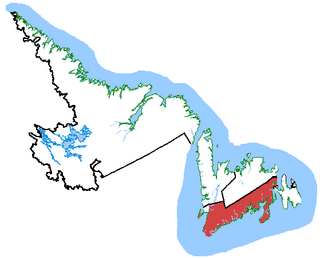
Random—Burin—St. George's was a federal electoral district in Newfoundland and Labrador, Canada, that was represented in the House of Commons of Canada from 2004 to 2015.

Burgeo-La Poile is a provincial electoral district for the House of Assembly of Newfoundland and Labrador, Canada. As of 2011, there are 7,527 eligible voters living within the district. The district was first created when Newfoundland joined confederation in 1949 as Burgeo and La Poile, and existed until 1975. It was recreated in 1995 following a reduction in the number of seats in the House of Assembly from 52 to 48, forming from the amalgamation of the former districts of La Poile and Burgeo-Bay D'Espoir.

Ramea is a small village in Newfoundland and Labrador located on Northwest Island, one of a group of five major islands located off the south coast of Newfoundland, Canada. The island is approximately 3.14 km long by 0.93 km wide. The other major islands in the archipelago are Great Island, Middle Island, Harbour Island, and South West Island.
Garia was a small town located in Garia Bay on the south coast of Newfoundland and Labrador. The origin of the town's name is probably from the French word 'gare'. The first record of the existence of this community was in 1765 when James Cook recorded one fishing stage in the area. The first record of permanent inhabitants was in the 1836 census when 12 inhabitants were living in the town. The population peaked in 1869 at 195. In 1873 approximately three quarters of the population left for work on Anticosti Island leaving only 55 inhabitants by 1874. The population continued to decline until the community was abandoned sometime after 1911.
The Ramea Islands, Newfoundland and Labrador, are an archipel of the south coast of Newfoundland. In 1864 there was a small community of 30 families. The Ramea Islands are a group that contains five large islands, namely Northwest Island, Great Island, Middle Island, Harbour Island and Southwest Island. In the early 1940s, all inhabitants moved to Northwest Island and formed the present town of Ramea.
Red Harbour is a Canadian municipality of Newfoundland and Labrador. It is located 20 kilometres northeast of Marystown.
Rencontre West was a village located northeast of Ramea, Newfoundland and Labrador. The population was 186 in 1956.
Merasheen Island is an island in Newfoundland and Labrador, Canada. With a length of approximately 35 km and a width at its widest point of 9 km, it is situated about 6 km from Presque. It is the largest island in the Placentia Bay.
The Bonavista Peninsula is a large peninsula on the east coast of the island of Newfoundland in the Canadian province of Newfoundland and Labrador. It consists of 50 incorporated towns/unincorporated communities which have a population of 12,176 as of the 2016 Canadian Census.
Aquaforte is a town on the south shore of Newfoundland's Avalon Peninsula in the province of Newfoundland and Labrador, Canada.
Admirals Beach is a rural community located in Newfoundland and Labrador, Canada.
Route 480, also known as Burgeo Highway or The Burgeo Road, is a 150-kilometre-long (93 mi) north-south on southwestern Newfoundland in the Canadian province of Newfoundland and Labrador. It connects the town of Burgeo with the Trans-Canada Highway. The highway is a winding two-lane highway traveling through remote, hilly, and wooded terrain for its entire length. There are no other communities of any kind along the highway, with the only other intersections being abandoned logging roads. Route 480 also provides access to Sandbanks Provincial Park and a ferry to the remote town of Ramea at its southern terminus. There are also several vacation/hunting camps along Route 480, including Peter Strides.

English Harbour East is a town in the Canadian province of Newfoundland and Labrador. It is a village located northeast of Belleoram. The Way Office was established in 1883 on July 1. The first Postmistress was Annis Hackett in 1891. The town had a population of 139 in the Canada 2016 Census. Many people moved to the area from such remote communities as Conne in the early to mid 20th Century. Its boundaries are established by the Town of English Harbour East Order under the Municipalities Act. The community was formerly served by St. George's School, which closed in 2006. Several fishing sheds from abandoned communities elsewhere in Newfoundland have been moved to English Harbour East and restored.
Grey River is a small remote fishing community located on the south coast of the province of Newfoundland and Labrador, Canada. Grey River was first settled in the early 1800s by English 'youngsters' brought to Newfoundland via great merchant houses based at Ramea, Burgeo, and Gaultois. James Style(s) was the earliest known resident reported in 1835.
White Bear Bay is natural bay on the island of Newfoundland in the province of Newfoundland and Labrador, Canada. The Ramea islands are south of the bay. The bay is filled with fjords, valleys and massive waterfalls which makes it a well known tourist spot. Many people own cabins in the bay to temporarily live there.
Long Range Mountains is a federal electoral district on Newfoundland Island in Newfoundland and Labrador.
Division No. 1, Subdivision C is an unorganized subdivision on the Avalon Peninsula in Newfoundland and Labrador, Canada. It is in Division 1 and contains the unincorporated communities of Cape St. Mary's, Cuslett, Gooseberry Cove, Great Barasway, Lears Cove, Patrick's Cove-Angels Cove, Ship Cove and Stoney House.

Division No. 1, Subdivision G is an unorganized subdivision on the Avalon Peninsula in Newfoundland and Labrador, Canada. It is in Division 1 and contains the unincorporated communities of Baccalieu Island, Besom Cove, Bradley's Cove, Burnt Point, Caplin Cove, Daniel's Cove, Grates Cove, Gull Island, Job's Cove, Kingston, Long Beach, Lower Island Cove, Low Point, Northern Bay, Ochre Pit Cove, Red Head Cove, Riverhead, Smooth Cove and Western Bay.
