Corantijn Basin

Last updated

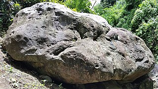
The Corantijn, Corantijn or Courantyne River is the Border River between Suriname and Guyana. The Corantijn Basin is one of a number of archaeological sites located in the hinterland of Suriname, South America. [1] [2] The Suriname archaeological sites provide information on Indigenous Peoples who lived in Suriname before 1492. Most of the petroglyphs are in the Corantijn Basin site. Petroglyphs provide an important insight into the ceremonial, mythical and religious world of these precontact indigenous peoples. [3] [4]

Courantyne River river

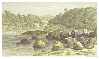
The Courantyne/Corentyne/Corantijn River is a river in northern South America in Suriname. It is the longest river in the country.

Suriname Country in South America

Suriname, officially known as the Republic of Suriname, is a country on the northeastern Atlantic coast of South America. It is bordered by the Atlantic Ocean to the north, French Guiana to the east, Guyana to the west and Brazil to the south. At just under 165,000 square kilometers, it is the smallest sovereign state in South America. Suriname has a population of approximately 558,368, most of whom live on the country's north coast, in and around the capital and largest city, Paramaribo.

Guyana Country in South America

Guyana, officially the Co-operative Republic of Guyana, is a country on the northern mainland of South America. It is the only English speaking country in South America, and is culturally considered part of the Anglophone-Caribbean sphere. In addition it is one of the founding member countries of the Caribbean Community organization, (CARICOM). Guyana is bordered by the Atlantic Ocean to the north, Brazil to the south and southwest, Venezuela to the west, and Suriname to the east. With an area of 215,000 square kilometres (83,000 sq mi), Guyana is the third-smallest sovereign state on mainland South America after Uruguay and Suriname.

The site is also well known as the habitat of Pseudoplatystoma, a genus of several South American catfish. [5]

<i>Pseudoplatystoma</i> genus of fishes

Pseudoplatystoma is a genus of several South American catfish species of family Pimelodidae. The species are known by a number of different common names. They typically inhabit major rivers where they prefer the main channels and tend to stay at maximum depth, but some species can also be seen in lakes, flooded forests, and other freshwater habitats. They have robust bodies, and are important food fish.

A genus is a taxonomic rank used in the biological classification of living and fossil organisms, as well as viruses, in biology. In the hierarchy of biological classification, genus comes above species and below family. In binomial nomenclature, the genus name forms the first part of the binomial species name for each species within the genus.

Catfish order of fishes

Catfish are a diverse group of ray-finned fish. Named for their prominent barbels, which resemble a cat's whiskers, catfish range in size and behavior from the three largest species alive, the Mekong giant catfish from Southeast Asia, the wels catfish of Eurasia, and the piraíba of South America, to detritivores, and even to a tiny parasitic species commonly called the candiru, Vandellia cirrhosa. Neither the armour-plated types nor the naked types have scales. Despite their name, not all catfish have prominent barbels. Members of the Siluriformes order are defined by features of the skull and swimbladder. Catfish are of considerable commercial importance; many of the larger species are farmed or fished for food. Many of the smaller species, particularly the genus Corydoras, are important in the aquarium hobby. Many catfish are nocturnal, but others are crepuscular or diurnal.

Notes

  1. Versteeg, Aad (2003). "Suriname before Columbus". Paramaribo: Stichting Surinaams Museum, Libri Musei Surinamensis 1.
  2. Renzo Duin and Cheryl White (eds.) (2017). "Archaeology in Suriname". His/HerTori: Tijdschrift voor Surinaamse Geschiedenis en Cultuur.CS1 maint: extra text: authors list (link)
  3. "The history of prehistoric archaeological research in Suriname" . Retrieved 2007-04-03.
  4. Duin, Renzo (2017). "Written in Stone: Revisiting Early Studies on Timehri Petroglyphs in Suriname". In "Archaeology in Suriname", His/HerTori: Tijdschrift voor Surinaamse Geschiedenis en Cultuur. Renzo Duin and Cheryl White (eds.). Pp. 57-72. Paramaribo: IMwO. Retrieved 2018-05-05.
  5. Froese, Rainer and Pauly, Daniel, eds. (2007). "Pseudoplatystoma tigrinum" in FishBase . Apr 2007 version.


Related Research Articles

Suriname National Army national army of the Republic of Suriname

After the creation of the Statute of the Kingdom of the Netherlands, the Royal Netherlands Army was entrusted with the defence of Suriname, while the defence of the Netherlands Antilles was the responsibility of the Royal Netherlands Navy. The army set up a separate Troepenmacht in Suriname. Upon independence in 1975, this force was turned into the Surinaamse Krijgsmacht (SKM):, Surinamese Armed Forces. On February 25, 1980, a group of 15 non-commissioned officers and one junior SKM officer, under the leadership of sergeant major Dési Bouterse, staged a coup d'état and overthrew the Government. Subsequently, the SKM was rebranded as Nationaal Leger (NL), National Army.

Paramaribo Capital City in Paramaribo District, Suriname

Paramaribo is the capital and largest city of Suriname, located on the banks of the Suriname River in the Paramaribo District. Paramaribo has a population of roughly 241,000 people, almost half of Suriname's population. The historic inner city of Paramaribo has been a UNESCO World Heritage Site since 2002.

Kwamalasamutu Village in Sipaliwini, Suriname

Kwamalasamutu, also Kwamalasamoetoe, is a Tiriyó Indian village in southern Suriname, and home to the Paramount Chief of the northern Trios.

Kawemhakan Place in Sipaliwini District, Suriname

Kawemhakan, also known as Anapaikë, is a Wayana village in the Sipaliwini District of Suriname. The village lies on the banks of the Lawa River, which forms the border with French Guiana.

The Initiative for the Integration of the Regional Infrastructure of South America (IIRSA) is a development plan to link South America's economies through new transportation, energy, and telecommunications projects.

Coso Rock Art District United States historic place

Coso Rock Art District, containing the Big and Little Petroglyph Canyons, is a rock art site containing over 100,000 Paleo-Indian and/or Native American Petroglyphs. The Coso Range is between the Sierra Nevada and the Argus Range. Indian Wells Valley lies to the south of this location. This north-south trending range of about 400 square miles (1,000 km2) consists of rhyolitic domes and outcrops of volcanic rock. Also known as Little Petroglyph Canyon and Sand Tanks, Renegade Canyon is but one of several major canyons in the Coso Range, each hosting thousands of petroglyphs. The majority of the Coso Range images fall into one of six categories: bighorn sheep, entopic images, anthropomorphic or human-like figures, other animals, weapons & tools, and "medicine bag" images. Most of the Coso Range is on the Naval Air Weapons Station China Lake, where visitation is restricted, vandalism is low, and preservation is most likely. China Lake is located near the towns of China Lake and Ridgecrest, California. There are several other distinct canyons in the Coso Rock Art District besides the Big and Little Petroglyph Canyons. The most popular subjects are bighorn sheep, deer, and antelope. Big and Little Petroglyph Canyons were declared a National Historic Landmark in 1964. In 2001, they were incorporated into a larger National Historic Landmark District, called Coso Rock Art District.

Michiel van Kempen Dutch writer, art historian and literary critic

Michaël Henricus Gertrudis (Michiel) van Kempen is a Dutch writer, art historian and literary critic. He has written novels, short stories, essays, travel literature and scenarios. He was the compiler of a huge range of anthologies of Dutch-Caribbean literature and wrote an extensive history of the literature of Suriname, in two volumes.

Wayana Carib-speaking indigenous people located in the south-eastern part of the Guiana highlands, a region divided between Brazil, Surinam, and French Guiana

The Wayana are a Carib-speaking people located in the south-eastern part of the Guiana highlands, a region divided between Brazil, Surinam, and French Guiana. In 1980, when the last census took place, the Wayana numbered some 1,500 individuals, of which 150 in Brazil, among the Apalai, 400 in Surinam, and 1,000 in French Guiana, along the Maroni River. About half of them still speak their original language.

Index of Suriname-related articles

The following is an alphabetical list of topics related to the Republic of Suriname.

Surinamese culture is very diverse and dynamic, and has strong Asian, African and European influences. The population is mainly composed of the contribution of people from the Netherlands, India, Africa, China and Indonesia, as well as indigenous peoples who lived in the area, before the arrival of European settlers.

Rudi André Kamperveen was a Surinamese football player, sports administrator, politician and businessman.

Prof. Bonno Thoden van Velzen, in full: Hendrik Ulbo Eric ('Bonno') Thoden van Velzen is a Dutch anthropologist, Surinamist and Africanist. Born in the Dutch city of Flushing. His father was a coxswain at the merchant navy and teacher at the Rijksnormaalschool in the city of Deventer. His ancestors are Protestant pastors from the neighbourhood of Emden in East-Frisia, which is now part of the German federal state of Low Saxony.

Wensley Rinaldo Bundel is a former Surinamese football manager and player who last managed S.V. Transvaal in the Surinamese Hoofdklasse.

Lawa Railway Railway in Suriname

The Lawa Railway was a 173-kilometre-long (107 mi) single-track metre gauge railway in Suriname. It was built during the gold rush in the early 20th century, from the harbour town Paramaribo to Dam at the Sarakreek, but it was not extended to the gold fields at the Lawa River, as originally intended.

Werehpai

Werehpai is an archaeological site in Suriname consisting of several caves containing petroglyphs of pre-Columbian origin. The site is located about 10 kilometres (6.2 mi) from the village of Kwamalasamutu. With 313 identified petroglyphs, Werehpai is by far the largest pre-Columbian petroglyph site known in Suriname, and perhaps the largest in all of the Guianas.

Mt. Rich Petroglyphs

The Mt. Rich Petroglyphs are a series of pre-Columbian petroglyphs, set deep in a ravine along the Saint Patrick River in Mt. Rich, Grenada. The site consists of several boulders, the largest of which contains over 60 engravings. Two "workstones" can also be found nearby, comprising six cupules.

Amatopo Place in Sipaliwini District, Suriname

Amatopo or Amotopo is a Tiriyó village on the Courentyne River in the Sipaliwini District of Suriname. The village lies next to the Amatopo Airstrip and about 7 kilometres (4.3 mi) upstream the Courentyne River from the village of Lucie.