Related Research Articles
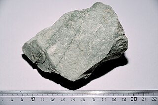
Quartzite is a hard, non-foliated metamorphic rock which was originally pure quartz sandstone. Sandstone is converted into quartzite through heating and pressure usually related to tectonic compression within orogenic belts. Pure quartzite is usually white to grey, though quartzites often occur in various shades of pink and red due to varying amounts of hematite. Other colors, such as yellow, green, blue and orange, are due to other minerals.

The Stiperstones is a distinctive hill in the county of Shropshire, England. The quartzite rock of the ridge formed some 480 million years ago. During the last Ice Age Stiperstones lay on the eastern margin of the Welsh ice sheet. The hill itself was not glaciated though glaciers occupied surrounding valleys and it was subject to intense freezing and thawing which shattered the quartzite into a mass of jumbled scree surrounding several residual rocky tors. At 536 metres (1,759 ft) above sea level it is the second-highest hill in the county, surpassed only by Brown Clee Hill. Stiperstones' 8-kilometre (5 mi) summit ridge is crowned by several jagged outcrops of rock, which may be seen silhouetted against the sky.

Brown Clee Hill is the highest hill in the rural English county of Shropshire, at 540 metres (1,770 ft) above sea level. It is one of the Clee Hills, and is in the Shropshire Hills Area of Outstanding Natural Beauty.
Swithland Wood and The Brand is a 87.9 hectares biological Site of Special Scientific Interest south of Woodhouse Eaves in Leicestershire. Swithland Wood is a Nature Conservation Review site, Grade II. The Brand is designated a Precambrian site in the Geological Conservation Review, but the dating has been changed due to the discovery of trace fossils from the succeeding Cambrian period.

Titterstone Clee Hill, sometimes referred to as Titterstone Clee or Clee Hill, is a prominent hill in the rural English county of Shropshire, rising at the summit to 533 metres (1,749 ft) above sea level.
The geology of Shropshire is very diverse with a large number of periods being represented at outcrop. The bedrock consists principally of sedimentary rocks of Palaeozoic and Mesozoic age, surrounding restricted areas of Precambrian metasedimentary and metavolcanic rocks. The county hosts in its Quaternary deposits and landforms, a significant record of recent glaciation. The exploitation of the Coal Measures and other Carboniferous age strata in the Ironbridge area made it one of the birthplaces of the Industrial Revolution. There is also a large amount of mineral wealth in the county, including lead and baryte. Quarrying is still active, with limestone for cement manufacture and concrete aggregate, sandstone, greywacke and dolerite for road aggregate, and sand and gravel for aggregate and drainage filters. Groundwater is an equally important economic resource.

Somerset is a rural county in the southwest of England, covering 4,171 square kilometres (1,610 sq mi). It is bounded on the north-west by the Bristol Channel, on the north by Bristol and Gloucestershire, on the north-east by Wiltshire, on the south-east by Dorset, and on the south west and west by Devon. It has broad central plains with several ranges of low hills. The landscape divides into four main geological sections from the Silurian through the Devonian and Carboniferous to the Permian which influence the landscape, together with water-related features.

Bickerton Hill refers to two low red sandstone hills that form the southern end of the Mid Cheshire Ridge in Cheshire, north-west England. The high point, Raw Head, lies on the northerly hill and has an elevation of 227 metres. Parts of the southerly hill are also known as Larkton Hill.

Peckforton is a scattered settlement and civil parish in the unitary authority of Cheshire East and the ceremonial county of Cheshire, England. The settlement is located 6.5 miles (10.5 km) to the north east of Malpas and 7.5 miles (12.1 km) to the west of Nantwich. The civil parish covers 1,754 acres (710 ha), with an estimated total population of 150 in 2006. The area is predominantly agricultural. Nearby villages include Bulkeley to the south, Beeston to the north, Higher Burwardsley to the west, Spurstow to the east and Bunbury to the north east.

The River Riccal is a river of North Yorkshire, England, lying within the North York Moors National Park. It is a tributary of the River Rye, which in turn is a tributary of the River Derwent. The name originates in the fourteenth century as Ricolvegraines means Rye Calf, where Calf is a small island near a larger one. This describes the way the river, and those nearby, form islands as their nature changes due to meandering.

Highgate Common is a Staffordshire Wildlife Trust reserve containing a mix of heathland and woodland. It is about 129 hectares or 320 acres in size. The common is a popular leisure destination and a Site of Special Scientific Interest, located in Southern Staffordshire, England.

Kentish ragstone is a hard grey limestone in Kent, England, drawn from the geological sequence known as the Hythe Beds of the Lower Greensand. For millennia it has been quarried for use both locally and further afield.

Bull Cross, The Frith and Juniper Hill is a 42.33-hectare (104.6-acre) biological and geological Site of Special Scientific Interest in Gloucestershire, notified in 1954. The site is listed in the ‘Stroud District’ Local Plan, adopted November 2005, Appendix 6 as an SSSI and Regionally Important Geological Site (RIGS).

Brown Moss is a Site of Special Scientific Interest, Local Nature Reserve and important wetland area rich in wildlife close to Whitchurch, Shropshire. It is open to visitors and contains a number of self-guided walking trails. The name 'moss' derives from the local word for a peat bog.
Colemere Countryside Site is a countryside heritage site. Due to its important conservation status it has two key designations being a Site of Special Scientific Interest (SSSI) and an internationally important Ramsar wetland site. 3 miles (4.8 km) south-east of Ellesmere, Shropshire.

Poles Coppice countryside site is an area of ancient oak woodland with disused quarry workings, located around 0.5 miles (1 km) south of Pontesbury, Shropshire. It is managed by Shropshire Council as a picnic spot and area for walking and recreation activities.

The Corallian Group or Corallian Limestone is a geologic group in England. It is predominantly a coralliferous sedimentary rock, laid down in the Oxfordian stage of the Jurassic. It is a hard variety of "coral rag". Building stones from this geological structure tend to be irregular in shape. It is often found close to seams of Portland Limestone. It is a younger limestone than its near-neighbour, the Oolitic, as found in the Cotswolds, in Gloucestershire. It is laterally equivalent to and interfingers with units of the Ancholme Group.

The geology of Anglesey, the largest (714 km2) island in Wales is some of the most complex in the country. Anglesey has relatively low relief, the 'grain' of which runs northeast–southwest, i.e. ridge and valley features extend in that direction reflecting not only the trend of the late Precambrian and Palaeozoic age bedrock geology but also the direction in which glacial ice traversed and scoured the island during the last ice age. It was realised in the 1980s that the island is composed of multiple terranes, recognition of which is key to understanding its Precambrian and lower Palaeozoic evolution. The interpretation of the island's geological complexity has been debated amongst geologists for decades and recent research continues in that vein.
References
- 1 2 3 4 Shropshire Council "Corbet Wood Countryside Site" Archived 22 September 2013 at the Wayback Machine . Date retrieved: 19 July 2013
- 1 2 Go This Place "Corbet Wood" Archived 5 March 2016 at the Wayback Machine . Date retrieved: 15/8/13
- 1 2 3 4 5 Natural England "Local Nature Reserve Corbet Wood and Grinshill" Archived 14 July 2014 at the Wayback Machine . Date retrieved: 19 July 2013
- ↑ Shropshire Government "Corbet Wood and Grinshill Management Plan – Brief Summary" [ permanent dead link ]. Date retrieved: 19 July 2013
- 1 2 Discovering Shropshire History "An archaeological survey of Corbet Wood and Grinshill" Date retrieved: 26 July 2013.