
New Netherland was a 17th-century colonial province of the Dutch Republic located on the east coast of what is now the United States of America. The claimed territories extended from the Delmarva Peninsula to Cape Cod. Settlements were established in what became the states of New York, New Jersey, Delaware, and Connecticut, with small outposts in Pennsylvania and Rhode Island.

The Netherlands began its colonization of the Americas with the establishment of trading posts and plantations, which preceded the much wider known colonization activities of the Dutch in Asia. While the first Dutch fort in Asia was built in 1600 in present-day Indonesia, the first forts and settlements along the Essequibo River in Guyana date from the 1590s. Actual colonization, with the Dutch settling in the new lands, was not as common as by other European nations.

The Beaver Wars, also known as the Iroquois Wars or the French and Iroquois Wars were a series of conflicts fought intermittently during the 17th century in North America throughout the Saint Lawrence River valley in Canada and the Great Lakes region which pitted the Iroquois against the Hurons, northern Algonquians and their French allies. As a result of this conflict, the Iroquois destroyed several confederacies and tribes through warfare: the Hurons or Wendat, Erie, Neutral, Wenro, Petun, Susquehannock, Mohican and northern Algonquins whom they defeated and dispersed, some fleeing to neighbouring peoples and others assimilated, routed, or killed.
Tyger was the ship used by the Dutch captain Adriaen Block during his 1613 voyage to explore the East Coast of North America and the present day Hudson River. Its remains were uncovered in 1916 during the construction of the New York City Subway on land that is now part of the World Trade Center complex.

Adriaen Courtsen Block was a Dutch private trader, privateer, and ship's captain who is best known for exploring the coastal and river valley areas between present-day New Jersey and Massachusetts during four voyages from 1611 to 1614, following the 1609 expedition by Henry Hudson. He is noted for possibly having named Block Island, Rhode Island, and establishing early trade with the Native Americans, and for the 1614 map of his last voyage on which many features of the mid-Atlantic region appear for the first time, and on which the term New Netherland is first applied to the region. He is credited with being the first European to enter Long Island Sound and the Connecticut River, and to determine that Manhattan and Long Island are islands.

The Delaware Colony, officially known as the three "Lower Counties on the Delaware", was a semiautonomous region of the proprietary Province of Pennsylvania and a de facto British colony in North America. Although not royally sanctioned, Delaware consisted of the three counties on the west bank of the Delaware River Bay.

Delaware Bay is the estuary outlet of the Delaware River on the northeast seaboard of the United States, lying between the states of Delaware and New Jersey. It is approximately 782 square miles (2,030 km2) in area, the bay's freshwater mixes for many miles with the saltwater of the Atlantic Ocean.

Cape Henlopen is the southern cape of the Delaware Bay along the Atlantic coast of the United States. It lies in the state of Delaware, near the town of Lewes, where the Delaware Bay meets the Atlantic Ocean. Off the coast on the bay side are two lighthouses, called the Harbor of Refuge Light and the Delaware Breakwater East End Light.

Barnegat Bay is a small brackish arm of the Atlantic Ocean, approximately 42 miles (68 km) long, along the coast of Ocean County, New Jersey in the United States. It is separated from the Atlantic by the long Island Beach State Park, as well as by the north end of Long Beach Island, popular segments of the Jersey Shore. The bay is fed by several small rivers, including the Toms River, the Forked River, the Metedeconk River, Cedar Creek, Oyster Creek, Mill Creek, Westecunk Creek, and Tuckerton Creek, all of which empty into the bay through small estuaries along its inner shore. The communities of Toms River, Silverton, and Forked River sit along the river estuaries on the bay.

The Susquehannock, also known as the Conestoga, Minquas, and Andaste, were an Iroquoian people who lived in the lower Susquehanna River watershed in what is now Pennsylvania. Their name means “people of the muddy river.”
The Onrust was a Dutch ship built by Adriaen Block and the crew of the Tyger, which had been destroyed by fire in the winter of 1613. The Onrust was the first ship to be built in what is now New York State, and the first fur trading vessel built in America. The construction took four months in the winter of 1614 somewhere in New York Bay. Help from the local Native population is surmised based on the relationship developed by Jon Rodriquez, left on the island during a previous voyage. The Onrust was 44.5 feet long and capable of carrying 16 tons.
Cornelis Jacobsen Mey, often spelled Cornelius Jacobsz May in Dutch, was a 17th-century century Dutch explorer, captain, and fur trader. Mey was the first Director of New Netherland and was stationed at Fort Amsterdam. Mey was the captain of the ship Nieu Nederlandt which delivered the first boat load of colonists to New Netherland in north-east America.
The Barnegat Peninsula, also known as the Island Beach Peninsula or Barnegat Bay Island and colloquially as "the barrier island", is a 20-mile (32 km) long, narrow barrier peninsula located on the Jersey Shore in Ocean County, New Jersey, United States, that divides the Barnegat Bay from the Atlantic Ocean. It is a vacation destination and summer colony area and is heavily dependent on tourism, real estate and fishing.

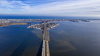
Barnegat Inlet is a small inlet connecting the Barnegat Bay with the Atlantic Ocean in Ocean County, New Jersey. It separates Island Beach State Park and the Barnegat Peninsula from Long Beach Island. The Barnegat Lighthouse sits at the northern end of Long Beach Island along the inlet.

Cattus Island County Park, also known as Cattus Island is a 530 acres (2 km2) passive recreational park located in Toms River, New Jersey. Cattus Island is a park of the Ocean County Department of Parks and Recreation. Cattus Island is home to the Cooper Environmental Center, an educational center which displays collections of local wildlife including birds, reptiles, and aquatic animals. The center also provides educational programs and presentations to the public and organized groups.

Fort Nassau was a factorij in New Netherland between 1624–1651 located at the mouth of Big Timber Creek at its confluence with the Delaware River. It was the first known permanent European-built structure in what would become the state of New Jersey. The creek name is a derived from the Dutch language Timmer Kill as recorded by David Pietersen de Vries in his memoirs of his journey of 1630–1633. The Delaware Valley and its bay was called the "South River" ; the "North River" of the colony was the Hudson River. The factorij was established for the fur trade, mostly in beaver pelts, with the indigenous populations of Susquehannock, who spoke an Iroquoian language, and the Lenape, whose language was of the Algonquian family. They also wanted to retain a physical claim to the territory.

The Port of Camden is situated on east bank of the Delaware River in Camden and Gloucester City in southern New Jersey. It is one of several ports in the Delaware Valley metro area port complex and is located near the mouth of Newtown Creek opposite the Port of Philadelphia. The port is one of the nation's largest for wood products, steel, cocoa and perishable fruit.

Great Minquas Path was a 17th-century trade route that ran through southeastern Pennsylvania from the Susquehanna River, near Conestoga, to the Schuylkill River, opposite Philadelphia. The 80-mile (130 km) east-west trail was the primary route for fur trading with the Minquas people. Dutch, Swedish and English settlers fought one another for control of it.
Cranberry Inlet was an inlet connecting Barnegat Bay with the Atlantic Ocean in Ocean County, New Jersey. It has been closed since 1812.

The Battle of Cape St. Vincent was a naval engagement that took place on 16 June or 6 October 1606, during Eighty Years' War and Dutch–Portuguese War. A Spanish fleet under Admiral Luis Fajardo attacked the Dutch fleet led by Admiral Willem Haultain and Vice Admiral Regnier Klaazoon, which was blocking the Spanish-Portuguese coast to intercept the Spanish treasure fleet. The battle concluded in a Spanish victory; in which Klaazoon's flagship was destroyed, two ships were captured, and Haultain fled with the rest of the fleet to his country without having achieved his purpose.
