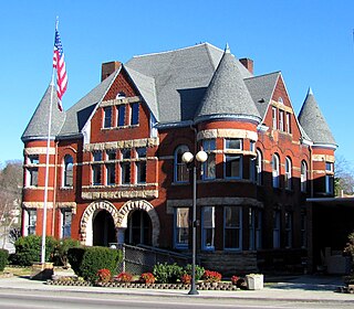
Harriman is a city located primarily in Roane County, Tennessee, with a small extension into Morgan County. The population of Harriman was 5,892 at the time of the 2020 census.

Victorian architecture is a series of architectural revival styles in the mid-to-late 19th century. Victorian refers to the reign of Queen Victoria (1837–1901), called the Victorian era, during which period the styles known as Victorian were used in construction. However, many elements of what is typically termed "Victorian" architecture did not become popular until later in Victoria's reign, roughly from 1850 and later. The styles often included interpretations and eclectic revivals of historic styles (see Historicism). The name represents the British and French custom of naming architectural styles for a reigning monarch. Within this naming and classification scheme, it followed Georgian architecture and later Regency architecture and was succeeded by Edwardian architecture.

Pacific Heights is a neighborhood in San Francisco, California, United States. It has panoramic views of the Golden Gate Bridge, San Francisco Bay, the Palace of Fine Arts, Alcatraz, and the Presidio.
Fair Haven Heights, or simply the Heights, is a residential and light industrial neighborhood in the eastern part of the city of New Haven, Connecticut, located east of the Quinnipiac River. Fair Haven Heights is not to be confused with the adjacent Fair Haven neighborhood west of the river. The area is bordered on the west by the Quinnipiac River, on the north by Route 80, on the east by the town of East Haven, and on the south by Ferry Street and Warwick Avenue. The main through routes are Quinnipiac Avenue, East Grand Avenue, and Eastern Street

American Temperance University opened in 1893 in the planned town of Harriman, Tennessee, which was developed as a community with no alcoholic beverages permitted. In its second year of operation the institution enrolled 345 students from 20 states. However, it closed in 1908. Those who attended included two students who later became members of the U.S. House of Representatives, John Jennings, Jr. and James Willis Taylor.
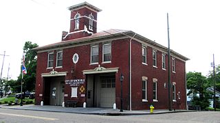
Mechanicsville is a neighborhood in Knoxville, Tennessee, United States, located northwest of the city's downtown area. One of the city's oldest neighborhoods, Mechanicsville was established in the late 1860s for skilled laborers working in the many factories that sprang up along Knoxville's periphery. The neighborhood still contains a significant number of late-19th-century Victorian homes, and a notable concentration of early-20th-century shotgun houses. In 1980, several dozen properties in Mechanicsville were added to the National Register of Historic Places as the Mechanicsville Historic District. The neighborhood was also designated as a local historic district in 1991, subject to historic zoning and design standards.

Hillcrest Historic District is an historic neighborhood in Little Rock, Arkansas that was listed on the National Register of Historic Places on December 18, 1990. It is often referred to as Hillcrest by the people who live there, although the district's boundaries actually encompass several neighborhood additions that were once part of the incorporated town of Pulaski Heights. The town of Pulaski Heights was annexed to the city of Little Rock in 1916. The Hillcrest Residents Association uses the tagline "Heart of Little Rock" because the area is located almost directly in the center of the city and was the first street car suburb in Little Rock and among the first of neighborhoods in Arkansas.

Kingston Pike is a highway in Knox County, Tennessee, United States, that connects Downtown Knoxville with West Knoxville, Farragut, and other communities in the western part of the county. The road follows a merged stretch of U.S. Route 11 (US 11) and US 70. From its initial construction in the 1790s until the development of the Interstate Highway System in the 1960s, Kingston Pike was the main traffic artery in western Knox County, and an important section of several cross-country highways. The road is now a major commercial corridor, containing hundreds of stores, restaurants, and other retail establishments.

The city of Davenport, Iowa, United States has neighborhoods dating back to the 1840s. The Davenport Plan and Zoning Commission divided the city into five areas: downtown, central, east end, near north, and northwest and west end. The neighborhoods contain many architectural designs, including Victorian, Queen Anne, and Tudor Revival. Many of the original neighborhoods were first inhabited by German settlers.

The Montford Area Historic District is a mainly residential neighborhood in Asheville, North Carolina that is included in the National Register of Historic Places.

The Prospect Park Historic District in Davenport, Iowa, United States, is a historic district that was listed on the National Register of Historic Places in 1984. In its 23.2-acre (9.4 ha) area, it included 23 contributing buildings in 1984. The Prospect Park hill was listed on the Davenport Register of Historic Properties in 1993.
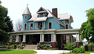
Old North Knoxville is a neighborhood in Knoxville, Tennessee, United States, located just north of the city's downtown area. Initially established as the town of North Knoxville in 1889, the area was a prominent suburb for Knoxville's upper middle and professional classes until the 1950s. After a period of decline, preservationists began restoring many of the neighborhood's houses in the 1980s. In 1992, over 400 houses and secondary structures in the neighborhood were added to the National Register of Historic Places as the Old North Knoxville Historic District.
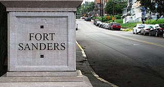
Fort Sanders is a neighborhood in Knoxville, Tennessee, USA, located west of the downtown area and immediately north of the main campus of the University of Tennessee. Developed in the late 19th century as a residential area for Knoxville's growing upper and middle classes, the neighborhood now provides housing primarily for the university's student population. The neighborhood still contains a notable number of its original Victorian-era houses and other buildings, several hundred of which were added to the National Register of Historic Places in 1980 as the Fort Sanders Historic District.

Fourth and Gill is a neighborhood in Knoxville, Tennessee, United States, located north of the city's downtown area. Initially developed in the late nineteenth century as a residential area for Knoxville's growing middle and professional classes, the neighborhood still contains most of its original Victorian-era houses, churches, and streetscapes. In 1985, 282 houses and other buildings in the neighborhood were added to the National Register of Historic Places as the Fourth and Gill Historic District.

Lindbergh Forest is a neighborhood in Knoxville, Tennessee, United States, located off Chapman Highway (US-441) in South Knoxville, that is listed on the National Register of Historic Places as an historic district. Initially developed in the late 1920s as one of Knoxville's first automobile suburbs, the neighborhood is now noted for its late-1920s and early-1930s residential architecture, and the use of East Tennessee marble detailing. The neighborhood also contains two of Knoxville's five surviving Lustron houses. In 1998, several of its houses were added to the National Register of Historic Places as the Lindbergh Forest Historic District.
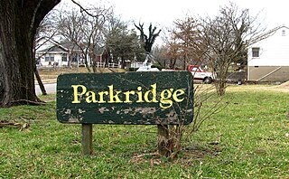
Parkridge is a neighborhood in Knoxville, Tennessee, United States, located off Magnolia Avenue east of the city's downtown area. Developed as a streetcar suburb for Knoxville's professional class in the 1890s, the neighborhood was incorporated as the separate city of Park City in 1907, and annexed by Knoxville in 1917. In the early 1900s, the neighborhood provided housing for workers at the nearby Standard Knitting Mill factory.

Gay Street is a street in Knoxville, Tennessee, United States, that traverses the heart of the city's downtown area. Since its development in the 1790s, Gay Street has served as the city's principal financial and commercial thoroughfare, and has played a primary role in the city's historical and cultural development. The street contains Knoxville's largest office buildings and oldest commercial structures. Several buildings on Gay Street have been listed on the National Register of Historic Places.

The South Market Historic District is a cluster of five buildings at the intersection of Market Street and Church Avenue in Knoxville, Tennessee, United States, listed on the National Register of Historic Places in 1996. The buildings, which include the Cherokee Building, the Ely Building, the Cunningham, the Stuart, and the Cate, were built circa 1895—1907, and were used for both office space and residential space. Several prominent Knoxville physicians and three marble companies operated out of the buildings in this district in the early 1900s.
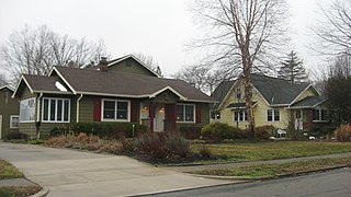
The Homecroft Historic District is a national historic district bounded roughly by Madison Avenue, Southview Drive, Orinoco Avenue, and Banta Road in Homecroft, Perry Township, Marion County, Indiana. It was listed on the National Register of Historic Places in 1996.

The Stadium Square Historic District is a historic district located in Cleveland Heights, Ohio, in the United States. The district contains properties along the north and south sides of Superior Park Drive between S. Taylor and S. Compton Roads, as well as Taylor Tudor properties on S. Taylor Road at Superior Park Drive. The 6.92-acre (0.0280 km2) site contains residential homes and mixed-use structures, all built beginning in 1926. Cleveland Heights proposed constructing a football stadium on the site in 1927. The stadium was never built, and the historic district takes its name from the original name given the commercial complex. The Stadium Square Historic District is a largely undisturbed example of early 20th century Tudor Revival architecture.


