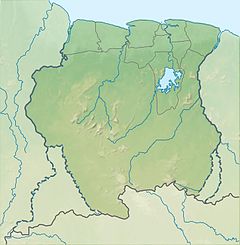
Suriname, officially the Republic of Suriname, is a country in northern South America, sometimes considered part of the Caribbean and the West Indies. Situated slightly north of the equator, over 90% of its territory is covered by rainforests, the highest proportion of forest cover in the world. Suriname is bordered by the Atlantic Ocean to the north, French Guiana to the east, Guyana to the west, and Brazil to the south. It is the smallest country in South America by both population and territory, with around 612,985 inhabitants in an area of approximately 163,820 square kilometers. The capital and largest city is Paramaribo, which is home to roughly half the population.

Suriname is located in the northern part of South America and is part of Caribbean South America, bordering the North Atlantic Ocean, between French Guiana and Guyana. It is mostly covered by tropical rainforest, containing a great diversity of flora and fauna that, for the most part, are increasingly threatened by new development. There is a relatively small population, most of which live along the coast.
After the creation of the Statute of the Kingdom of the Netherlands, the Royal Netherlands Army was entrusted with the defence of Suriname, while the defence of the Netherlands Antilles was the responsibility of the Royal Netherlands Navy. The army set up a separate Netherlands Armed Forces in Suriname. Upon independence in 1975, this force was turned into the Surinamese Armed Forces. On February 25, 1980, a group of 15 non-commissioned officers and one junior officer, under the leadership of sergeant major Dési Bouterse, staged a coup d'état and overthrew the Government. Subsequently, the SKM was rebranded as the National Army.

As part of the foreign relations of Suriname, the country is a participant in numerous international organizations.

Paramaribo is the capital and largest city of Suriname, located on the banks of the Suriname River in the Paramaribo District. Paramaribo has a population of roughly 241,000 people, almost half of Suriname's population. The historic inner city of Paramaribo has been a UNESCO World Heritage Site since 2002.

The Dutch began their colonisation of the Guianas, the coastal region between the Orinoco and Amazon rivers in South America, in the late 16th century. The Dutch originally claimed all of Guiana but—following attempts to sell it first to Bavaria and then to Hanau and the loss of sections to Portugal, Britain, and France—the section actually settled and controlled by the Netherlands became known as Dutch Guiana.

The Guianas, also spelled Guyanas or Guayanas, is a region in north-eastern South America. Strictly, the term refers to the three Guyanas: Guyana, Suriname and French Guiana, formerly British, Dutch and French Guyana. Broadly it refers to the South American coast from the mouth of the Oronoco to the mouth of the Amazon.

The Maroni or Marowijne is a river in South America that forms the border between French Guiana and Suriname.
The Courantyne River is a river in northern South America in Suriname and Guyana. It is the longest river in the country and creates the border between Suriname and the East Berbice-Corentyne region of Guyana.
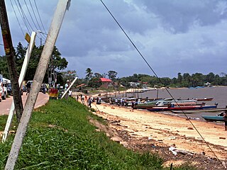
Albina is a town in eastern Suriname, and is capital of the Marowijne District. The town lies on the west bank of the Marowijne river, which forms the border with French Guiana, directly opposite the French Guianan town of Saint-Laurent-du-Maroni, to which it is connected by a frequent ferry service. Albina can be reached by bus via the East-West Link. The distance between Paramaribo and Albina is about 150 kilometres (95 mi).

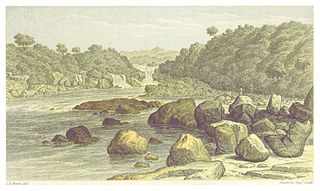
The Suriname River is 480 kilometres (300 mi) long and flows through the country of Suriname. Its sources are located in the Guiana Highlands on the border between the Wilhelmina Mountains and the Eilerts de Haan Mountains. The source of the Upper Suriname River is at the confluence of the Gran Rio and Pikin Rio near the village of Goddo. The river continues shortly after the reservoir along Brokopondo as the Lower Suriname River. Than it flows Berg en Dal, the migrant communities Klaaskreek and Nieuw-Lombé, Jodensavanne, Carolina, Ornamibo and Domburg, before reaching the capital Paramaribo on the left bank and Meerzorg on the right bank. At Nieuw-Amsterdam it is joined by the Commewijne and immediately thereafter at the sandspit Braamspunt it flows into the Atlantic Ocean.

Tapanahoni is a resort in Suriname, located in the Sipaliwini District. Its population at the 2012 census was 13,808. Tapanahoni is a part of Sipaliwini which has no capital, but is directly governed from Paramaribo. Tapanahony is an enormous resort which encompasses a quarter of the country of Suriname. The most important town is Diitabiki which is the residence of the granman of the Ndyuka people since 1950, and the location of the oracle.

Kabalebo is a resort in Suriname, located in the Sipaliwini District. Its population at the 2012 census was 2,291.

Boven Suriname is a resort in Suriname, located in the Sipaliwini District. Its population at the 2012 census was 17,954. Almost its entire population consists of Maroons
The borders of Suriname consist of land borders with three countries: Guyana, Brazil, and France. The borders with Guyana and France are in dispute, but the border with Brazil has been uncontroversial since 1906.

The Tigri Area is a wooded area that has been disputed by Guyana and Suriname since around 1840. It involves the area between the Upper Corentyne River, the Coeroeni River, and the Kutari River. This triangular area is known as the New River Triangle in Guyana. In 1969 the conflict ran high on, and since then it has been controlled by Guyana and claimed by Suriname. In 1971, both governments agreed that they would continue talks over the border issue and withdraw their military forces from the disputed triangle. Guyana has never held upon this agreement.

Indigenous peoples in Suriname, Native Surinamese, or Amerindian Surinamese, are Surinamese people who are of indigenous ancestry. They comprise approximately 3.5% of Suriname's population of 612,985.

Surinamese Maroons are the descendants of enslaved Africans that escaped from the plantations and settled in the inland of Suriname. The Surinamese Maroon culture is one of the best-preserved pieces of cultural heritage outside of Africa. Colonial warfare, land grabs, natural disasters and migration have marked Maroon history. In Suriname six Maroon groups — or tribes — can be distinguished from each other.

Suriname-Rivier is a lightvessel permanently berthed in a wet dock in the Fort Nieuw-Amsterdam Open-Air Museum in Nieuw-Amsterdam, Commewijne, Suriname.
The COVID-19 pandemic in Suriname was caused by Severe acute respiratory syndrome coronavirus 2. The virus was confirmed to have reached Suriname on 13 March 2020. The case was a person who travelled from the Netherlands the previous week. On 3 April 2020, one person died. On 3 May 2020, all nine cases had recovered. On 18 May, an eleventh case was identified.