Legislation
Local Government (Scotland) Act 1889
In Scotland, local government counties were created under the Local Government (Scotland) Act 1889. The 1889 legislation created county councils, turned each civil county (with one exception) into a contiguous area (without separate fragments) and adjusted boundaries where civil parishes straddled county boundaries, or had fragments in more than one county. The counties of Ross and Cromarty were merged to form Ross and Cromarty.[9]

The Local Government (Scotland) Act 1889 is an Act of the Parliament of the United Kingdom which was passed on 26 August 1889. The main effect of the Act was to establish elected county councils in Scotland. In this it followed the pattern introduced in England and Wales by the Local Government Act 1888.
Local Government (Scotland) Act 1973
Under the Local Government (Scotland) Act 1973, local government counties, cities and their subordinate councils (including burghs and parishes) were abolished and replaced by an upper tier of regions each of which contained a number of districts except for the Western Isles, Shetland Islands and Orkney Islands where each had a single-tier authority created which exercised all the powers elsewhere split across two levels of local government. Two of the three islands authorities - Orkney and Shetland - changed their legal nature but continued with boundaries identical to the earlier counties; the Western Isles area was previously split between Inverness-shire and Ross and Cromarty.
The Local Government (Scotland) Act 1973 is an Act of Parliament of the United Kingdom that altered local government in Scotland on 16 May 1975.

A burgh was an autonomous municipal corporation in Scotland and Northern England, usually a town, or toun in Scots. This type of administrative division existed from the 12th century, when King David I created the first royal burghs. Burgh status was broadly analogous to borough status, found in the rest of the United Kingdom. Following local government reorganization in 1975 the title of "royal burgh" remains in use in many towns, but now has little more than ceremonial value.
A parish is a territorial entity in many Christian denominations, constituting a division within a diocese. A parish is under the pastoral care and clerical jurisdiction of a parish priest, who might be assisted by one or more curates, and who operates from a parish church. Historically, a parish often covered the same geographical area as a manor. Its association with the parish church remains paramount.
Local Government etc. (Scotland) Act 1994
The regions and districts were themselves abolished in 1996, under the Local Government etc. (Scotland) Act 1994, in favour of a single tier of councils. Although Scottish Councils are now unitary in nature none is officially termed a unitary authority, as in the United Kingdom that phrase is specific to English local government legislation.
A unitary authority is a type of local authority that has a single tier and is responsible for all local government functions within its area or performs additional functions which elsewhere in the relevant country are usually performed by national government or a higher level of sub-national government.

The United Kingdom (UK), officially the United Kingdom of Great Britain and Northern Ireland, and sometimes referred to as Britain, is a sovereign country located off the north-western coast of the European mainland. The United Kingdom includes the island of Great Britain, the north-eastern part of the island of Ireland, and many smaller islands. Northern Ireland is the only part of the United Kingdom that shares a land border with another sovereign state, the Republic of Ireland. Apart from this land border, the United Kingdom is surrounded by the Atlantic Ocean, with the North Sea to the east, the English Channel to the south and the Celtic Sea to the south-west, giving it the 12th-longest coastline in the world. The Irish Sea lies between Great Britain and Ireland. With an area of 242,500 square kilometres (93,600 sq mi), the United Kingdom is the 78th-largest sovereign state in the world. It is also the 22nd-most populous country, with an estimated 66.0 million inhabitants in 2017.
One region and various of the districts created in 1975 had areas similar to those of earlier counties. Various council areas created in 1996 continued to do so with some new areas also resembling pre-1975 areas or simple divisions of them (e.g. South Lanarkshire and North Lanarkshire). Apart from their legal nature, the three islands authorities continued with their previous boundaries and most of their powers unaltered.

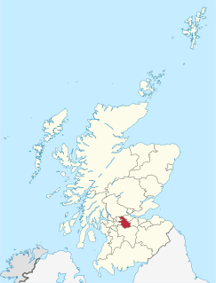
South Lanarkshire is one of 32 unitary authorities of Scotland. It borders the south-east of the City of Glasgow and contains some of Greater Glasgow's suburbs. It also contains many towns and villages. It also shares borders with Dumfries and Galloway, East Ayrshire, East Renfrewshire, North Lanarkshire, the Scottish Borders and West Lothian. It includes part of the historic county of Lanarkshire.
North Lanarkshire Scottish Gaelic: Siorrachd Lannraig a Tuath) is one of 32 council areas of Scotland. It borders onto the northeast of the City of Glasgow and contains many of Glasgow's suburbs and commuter towns and villages. It also borders East Dunbartonshire, Falkirk, Stirling, South Lanarkshire and West Lothian. The council covers parts of the traditional counties of Dunbartonshire, Lanarkshire and Stirlingshire.
Local government in Scotland is organised through 32 unitary authorities designated as councils which consist of councillors elected every five years by registered voters in each of the council areas.

The counties or shires of Scotland are geographic subdivisions of Scotland established in the Middle Ages. Originally established for judicial purposes, from the 17th century they started to be used for local administration purposes as well. The areas used for judicial functions (sheriffdoms) came to diverge from the shires, which ceased to be used for local government purposes after 1975 under the Local Government (Scotland) Act 1973.

For local government purposes, Scotland is divided into 32 areas designated as "council areas", which are all governed by single-tier authorities designated as "councils". They have the option under the Local Government (Scotland) Act 1997 of being known as a "comhairle" when opting for a Gaelic name; only Comhairle nan Eilean Siar has chosen this option, whereas the Highland Council has adopted its Gaelic form alongside its English equivalent informally.

Sutherland is a historic county, registration county and lieutenancy area in the Highlands of Scotland. Its county town is Dornoch. Sutherland borders Caithness to the east, Ross-shire to the south and the Atlantic to the north and west. Like its southern neighbour Ross-shire, Sutherland has some of the most dramatic scenery in the whole of Europe, especially on its western fringe where the mountains meet the sea. These include high sea cliffs, and very old mountains composed of Precambrian and Cambrian rocks.

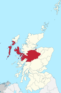
Ross and Cromarty is a variously defined area in the Highlands and Islands of Scotland. There is a registration county and a lieutenancy area in current use, the latter of which is 8,019 square kilometres in extent. Historically there has also been a constituency of the Parliament of the United Kingdom, a local government county, a district of the Highland local government region and a management area of the Highland Council. The local government county is now divided between two local government areas: the Highland area and Na h-Eileanan Siar.

Caithness is a historic county, registration county and lieutenancy area of Scotland.

Skye and Lochalsh is one of eight former local government districts of the two-tier Highland region of Scotland. The main offices of the Skye and Lochalsh district council were in Portree, on the Isle of Skye.
The local government areas of Scotland were redefined by the Local Government (Scotland) Act 1973 and redefined again by the Local Government etc (Scotland) Act 1994.

Na h-Eileanan an Iar (; Scottish Gaelic pronunciation: [nəˈhelanən əˈɲiəɾ]; formerly Western Isles is a constituency of the House of Commons of the Parliament of the United Kingdom, created in 1918. It elects one Member of Parliament by the first past the post system of election.
The counties of the United Kingdom are subnational divisions of the United Kingdom, used for the purposes of administrative, geographical and political demarcation. By the Middle Ages counties had become established as a unit of local government, at least in England. By the early 17th century, all of England, Wales, Scotland, and Ireland had been separated into counties. The older term shire was historically equivalent to "county". In Scotland shire was the only term used until after the Act of Union 1707.
The Lord Lieutenant of Ross and Cromarty, is the British monarch's personal representative in an area which has been defined since 1975 as consisting of the local government districts of Ross and Cromarty and Skye and Lochalsh in Scotland, and this definition was renewed by the Lord-Lieutenants (Scotland) Order 1996. Previously, the area of the lieutenancy was the county of Ross and Cromarty, which was abolished as a local government area by the Local Government (Scotland) Act 1973. The districts were created, under the 1973 act as districts of the two-tier Highland region and abolished as local government areas under the Local Government (Scotland) Act 1994, which turned the Highland region into a unitary council area.

The Northern Constabulary was the territorial police force responsible for Northern Scotland, covering the Highland council area along with the Western Isles, the Orkney Isles and the Shetland Isles, which make up most of the Highlands and Islands area. It was the police force covering the largest geographical area in the United Kingdom, equivalent to the size of Belgium, but was one of the smallest in terms of officers, with about 715 officers. The Constabulary was one of those amalgamated to form Police Scotland in 2013.
Between 1975 and 1996 there were three islands council areas of Scotland:
Scottish Westminster constituencies were Scottish constituencies of the House of Commons of the Parliament of Great Britain, normally at the Palace of Westminster, from 1708 to 1801, and have been constituencies of the House of Commons of the Parliament of the United Kingdom, also at Westminster, since 1801. Constituency boundaries have changed on various occasions, and are now subject to both periodical and ad hoc reviews of the Boundary Commission for Scotland.

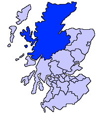
The politics of the Highland council area in Scotland are evident in the deliberations and decisions of the Highland Council, in elections to the council, and in elections to the House of Commons of the Parliament of the United Kingdom (Westminster) and the Scottish Parliament (Holyrood). In the European Parliament the area is within the Scotland constituency, which covers all of the 32 council areas of Scotland.
The first set of Highland Council wards was first used for Highland Council election purposes in 1995, for the first general election of the council. They were replaced with 80 new wards for the second general election in 1999.
Local government areas covering the whole of Scotland were first defined by the Local Government (Scotland) Act 1889. As currently defined, they are a result, for the most part, of the Local Government etc (Scotland) Act 1994.
The Shire of Inverness is a historic county and lieutenancy area of Scotland. Covering much of the Highlands, it is Scotland's largest county, though one of the smallest in population, with 67,733 people or 1.34% of the national population.