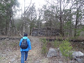
The Cobble Hill Tunnel is an abandoned Long Island Rail Road (LIRR) tunnel beneath Atlantic Avenue in Brooklyn, New York City, running through the neighborhoods of Downtown Brooklyn and Cobble Hill. When open, it ran for about 2,517 feet (767 m) between Columbia Street and Boerum Place. It is the oldest railway tunnel beneath a city street in North America that was fully devoted to rail. It is also deemed the oldest subway tunnel in the world by the Guinness Book of World Records.

North America's first transcontinental railroad was a 1,911-mile (3,075 km) continuous railroad line constructed between 1863 and 1869 that connected the existing eastern U.S. rail network at Council Bluffs, Iowa with the Pacific coast at the Oakland Long Wharf on San Francisco Bay. The rail line was built by three private companies over public lands provided by extensive US land grants. Building was financed by both state and US government subsidy bonds as well as by company issued mortgage bonds. The Western Pacific Railroad Company built 132 miles (212 km) of track from the road's western terminus at Alameda/Oakland to Sacramento, California. The Central Pacific Railroad Company of California (CPRR) constructed 690 miles (1,110 km) east from Sacramento to Promontory Summit, Utah Territory. The Union Pacific Railroad (UPRR) built 1,085 miles (1,746 km) from the road's eastern terminus at the Missouri River settlements of Council Bluffs and Omaha, Nebraska westward to Promontory Summit.

The Kettle Valley Railway was a subsidiary of the Canadian Pacific Railway (CPR) that operated across southern British Columbia, west of Midway running to Rock Creek, then north to Myra Canyon, down to Penticton over to Princeton, Coalmont, Brookmere, Coquihalla and finally Hope where it connected to the main CPR line.

Horseshoe Curve is a three-track railroad curve on Norfolk Southern Railway's Pittsburgh Line in Blair County, Pennsylvania. The curve is about 2,375 feet (700 m) long and 1,300 feet (400 m) in diameter. Completed in 1854 by the Pennsylvania Railroad as a way to reduce the westbound grade to the summit of the Allegheny Mountains, it replaced the time-consuming Allegheny Portage Railroad: the only other route across the mountains for large vehicles. The curve was later owned and used by three Pennsylvania Railroad successors: Penn Central, Conrail and Norfolk Southern.

The Allegheny Portage Railroad was the first railroad constructed through the Allegheny Mountains in central Pennsylvania, United States; it operated from 1834 to 1854 as the first transportation infrastructure through the gaps of the Allegheny that connected the midwest to the eastern seaboard across the barrier range of the Allegheny Front. Approximately 36 miles (58 km) long overall, both ends connected to the Pennsylvania Canal, and the system was primarily used as a portage railway, hauling river boats and barges over the divide between the Ohio and the Susquehanna Rivers. Today, the remains of the railroad are preserved within the Allegheny Portage Railroad National Historic Site operated by the National Park Service.

King Street Station is a train station in Seattle, Washington, United States. It is served by Amtrak's Cascades, Coast Starlight, and Empire Builder, as well as Sounder commuter trains run by Sound Transit. The station also anchors a major transit hub, which includes Link light rail at International District/Chinatown station and Seattle Streetcar service. It is located at the south end of Downtown Seattle in the Pioneer Square neighborhood, near the intersection of South Jackson Street and 4th Avenue South, and has four major entrances. It is the 15th busiest station on the Amtrak system, serving as the hub for the Pacific Northwest region.

The Virginia Central Railroad was an early railroad in the U.S. state of Virginia that operated between 1850 and 1868 from Richmond westward for 206 miles (332 km) to Covington. Chartered in 1836 as the Louisa Railroad by the Virginia General Assembly, the railroad began near the Richmond, Fredericksburg and Potomac Railroad's line and expanded westward to Orange County, reaching Gordonsville by 1840. In 1849, the Blue Ridge Railroad was chartered to construct a line over the Blue Ridge Mountains for the Louisa Railroad which reached the base of the Blue Ridge in 1852. After a decision from the U.S. Supreme Court, the Louisa Railroad was allowed to expand eastward from a point near Doswell to Richmond.
The Western Maryland Railway was an American Class I railroad (1852–1983) which operated in Maryland, West Virginia, and Pennsylvania. It was primarily a coal hauling and freight railroad, with a small passenger train operation.

Ratón Pass is a 7,834 ft (2,388 m) elevation mountain pass on the Colorado–New Mexico border in the western United States. It is located on the eastern side of the Sangre de Cristo Mountains between Trinidad, Colorado and Raton, New Mexico, approximately 180 miles (290 km) northeast of Santa Fe. Ratón is Spanish for "mouse". The pass crosses the line of volcanic mesas that extends east from the Sangre de Cristo Mountains along the state line, and furnishes the most direct land route between the valley of the Arkansas River to the north and the upper valley of the Canadian River, leading toward Santa Fe, to the south. The pass now carries Interstate 25 and railroad tracks.
Alpine Tunnel is a 1,772 ft (540 m) narrow gauge railroad tunnel located east of Pitkin, Colorado on the former Denver, South Park and Pacific Railroad route from Denver to Gunnison. At an elevation of 11,523 feet (3,512 m), it was the first tunnel constructed through the Continental Divide in Colorado, and according to the U.S. Forest Service "remains the highest railroad tunnel and the longest narrow gauge tunnel in North America." However, it did not last long in service. Construction began in January 1880 and was scheduled to last for six months but instead dragged on until July 1882, and the line was abandoned in 1910 due to minor damage in the tunnel. Now the tunnel is sealed shut and the remaining trackbed serves as a trail for hikers and bicyclists.

The Northern Central Railway (NCRY) was a Class I Railroad connecting Baltimore, Maryland with Sunbury, Pennsylvania, along the Susquehanna River. Completed in 1858, the line came under the control of the Pennsylvania Railroad (PRR) in 1861, when the PRR acquired a controlling interest in the Northern Central's stock to compete with the rival Baltimore and Ohio Railroad (B&O). For eleven decades the Northern Central operated as a subsidiary of the PRR until much of its Maryland trackage was washed out by Hurricane Agnes in 1972, after which most of its operations ceased as the Penn Central declined to repair sections. It is now a fallen flag railway, having come under the control of the later Penn Central, Conrail, and then broken apart and disestablished. The northern part in Pennsylvania is now the York County Heritage Rail Trail which connects to a similar hike/bike trail in Northern Maryland down to Baltimore, named the Torrey C. Brown Rail Trail. Trackage around Baltimore remains in rail service as well as most of the trackage in Pennsylvania which is operated by Norfolk Southern and the southernmost section in Pennsylvania is operated by the Northern Central heritage railway.

Stumphouse Mountain Tunnel in Oconee County, South Carolina is an incomplete railroad tunnel for the Blue Ridge Railroad of South Carolina in Sumter National Forest. The tunnel, along with nearby Issaqueena Falls, are now a Walhalla city park.

The Chetoogeta Mountain Tunnel refers to two different railroad tunnels passing through Chetoogeta Mountain in Tunnel Hill, Georgia, United States.

Bellows Falls station is an Amtrak intercity rail station located in the Bellows Falls village of Rockingham, Vermont, United States. The station is served by the single daily round trip of the Washington, D.C.–St. Albans Vermonter. It has a single side platform adjacent to the single track of the New England Central Railroad mainline.

The Illinois Central Stone Arch Railroad Bridges are a trio of limestone railroad bridges in the city of Dixon, Illinois, United States. The bridges were constructed between 1852 and 1855 as the Illinois Central Railroad laid its first rail lines across the state of Illinois. They were designed by Robert F. Laing for Laing and Douglas Construction Company, a railroad company contractor during the 1850s. Though each limestone bridge is similar in design, they each have different clearances ranging between 12 and 15 feet. The bridges remained in use by the railroad until 1985, and the three bridges were added to the U.S. National Register of Historic Places in 1987.

The Howard Tunnel is located near Seven Valleys, Pennsylvania. In operation since 1838, it is the second oldest active rail tunnel in the U.S. Originally constructed by the York and Maryland Line Rail Road, it formed a critical link in the north-south line assembled by the Northern Central Railway.

Alaska Central Railroad Tunnel No. 1, also known as the Loop District Tunnel No. 1 is a historic railroad tunnel located about 40 miles (64 km) north of Seward, Alaska, in the Placer River Valley, Kenai Peninsula. The tunnel was dug in 1906 and served the Alaska Central Railroad and later the Alaska Railroad until the route in the area, known as the "Loop District" was rerouted in 1951.

Piermont Railroad Station is a historic train station located at Piermont in Rockland County, New York. It was built about 1873 by the Northern Railroad of New Jersey, later acquired by the Erie Railroad. It is a 1+1⁄2-story, light frame building above a stone foundation. It features Stick Style exterior siding and a Late Victorian interior.

Union Station is a building in Houston, Texas, in the United States. Dedicated on March 2, 1911, and formerly a hub of rail transportation, the building now serves as a cornerstone for Minute Maid Park. It is listed on the National Register of Historic Places, and has since been superseded by Houston's Amtrak station.

The Bayshore Cutoff is the rail line between San Francisco and San Bruno along the eastern shore of the San Francisco Peninsula. It was completed by Southern Pacific (SP) in 1907 at a cost of $7 million, and included five tunnels, four of which are still used by Caltrain, the successor to Southern Pacific's Peninsula Commute service. Fill from the five tunnels was used to build the Visitacion or Bayshore Yard, the main SP classification yard near the city of Brisbane. The Del Monte was similarly rerouted over the line at some point in its operational history.