External links
Coordinates: 57°33′59″N135°26′02″W / 57.56639°N 135.43389°W
| | This article about a location in the City and Borough of Sitka, Alaska is a stub. You can help Wikipedia by expanding it. |
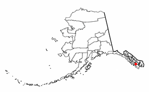
Cozian Reef or Nikolas Rock is located just above the northern tip of Baranof Island in Peril Strait which is in the Panhandle of the U.S. state of Alaska.
Cozian Reef is a prime maritime navigational hazard demonstrated by its alternative name, Nikolas Rock, which it received from sinking the Russian steamer Nikolas in 1854. More recently, Cozian Reef grounded the Alaska Marine Highway vessel M/V LeConte on May 10, 2004, which was only saved after an extensive salvage operation.
Cozian Reef was named by the U.S. Navy after Anton George Cozian, a navigator with the Russian American Company.
Coordinates: 57°33′59″N135°26′02″W / 57.56639°N 135.43389°W
| | This article about a location in the City and Borough of Sitka, Alaska is a stub. You can help Wikipedia by expanding it. |
Naukati Bay is a census-designated place (CDP) in the Prince of Wales-Hyder Census Area of the Unorganized Borough of the U.S. state of Alaska. The population was 113 at the 2010 census, down from 135 in 2000.

Tenakee Springs is a city on Chichagof Island in Hoonah-Angoon Census Area, Alaska, United States. At the 2010 census the population was 131, up from 104 at the 2000 census.

The Alaska Time Zone observes standard time by subtracting nine hours from Coordinated Universal Time (UTC−09:00). During daylight saving time its time offset is eight hours (UTC−08:00). The clock time in this zone is based on mean solar time at the 135th meridian west of the Greenwich Observatory.

Sheldon Jackson College (SJC) was a small private college located on Baranof Island in Sitka, Alaska, United States. Founded in 1878, it was the oldest institution of higher learning in Alaska and maintained a historic relationship with the Presbyterian Church. The college was named in honor of Rev. Sheldon Jackson, an early missionary and educational leader in Alaska.

Shelikof Strait is a strait on the southwestern coast of the U.S. state of Alaska between the Alaska mainland to the west and Kodiak and Afognak islands to the east.

Lynn Canal is an inlet into the mainland of southeast Alaska.

Peril Strait or Háat Ishkáak is a strait in the Alexander Archipelago in southeastern Alaska. It is between Chichagof Island to its north and Baranof Island and Catherine Island to its south. The strait is 80 km (50 mi) long and reaches from Salisbury Sound on the west to the Chatham Strait on the east. It is entirely within the limits of the City and Borough of Sitka.
Kruzof Island is an island in the Alexander Archipelago in southeastern Alaska at 57°10′14″N135°40′29″W. It is about 16 km (10 mi) west of Sitka, and is part of the City and Borough of Sitka. It was named in 1805 by Captain U.T. Lisianski as Crooze Island, after a Russian Admiral. It hosts the region's only volcano, Mount Edgecumbe.
Japonski Island, or Yak'w Kashaneixí, Russian: остров Японский, Japanese: ヤポンスキー島, is a small island in the city of Sitka in the Alexander Archipelago of southeastern Alaska, United States. It lies across the Sitka Channel from Sitka's central business district.

SS Princess Sophia was a steel-built passenger liner in the coastal service fleet of the Canadian Pacific Railway (CPR). Along with SS Princess Adelaide, SS Princess Alice, and SS Princess Mary, Princess Sophia was one of four similar ships built for CPR during 1910-1911.
The Sitka Historical Museum, formerly known as the Isabel Miller Museum is the city museum of Sitka in the U.S. state of Alaska.

The Delarof Islands are a group of small islands at the extreme western end of the Andreanof Islands group in the central Aleutian Islands, Alaska. The Delarofs consist of 11 named islands: Amatignak, Gareloi, Ilak, Kavalga (Qavalĝa), Ogliuga (Aglaga), Skagul (Sxaĝulax̂), the Tag (Tagachaluĝis), Tanadak (Tanaadax̂), Ugidak (Qagan-tanax̂), Ulak, and Unalga (Unalĝa).
Vanderbilt Reef is a rocky outcropping in Lynn Canal, a fjord in Alaska, United States at 58°35′31″N135°0′55″W. The outcropping is visible just above the water's surface.

The Aleutian Islands, also called the Aleut Islands or Aleutic Islands and known before 1867 as the Catherine Archipelago, are a chain of 14 large volcanic islands and 55 smaller islands. Most of the Aleutian Islands belong to the U.S. state of Alaska, but some belong to the Russian federal subject of Kamchatka Krai. They form part of the Aleutian Arc in the Northern Pacific Ocean, occupying an area of 6,821 sq mi (17,666 km2) and extending about 1,200 mi (1,900 km) westward from the Alaska Peninsula toward the Kamchatka Peninsula in Russia, and act as a border between the Bering Sea to the north and the Pacific Ocean to the south. Crossing longitude 180°, at which point east and west longitude end, the archipelago contains both the westernmost part of the United States by longitude and the easternmost by longitude. The westernmost U.S. island in real terms, however, is Attu Island, west of which runs the International Date Line. While nearly all the archipelago is part of Alaska and is usually considered as being in the "Alaskan Bush", at the extreme western end, the small, geologically related Commander Islands belong to Russia.

Baranof Island, also sometimes called Baranov Island, Shee or Sitka Island is an island in the northern Alexander Archipelago in the Alaska Panhandle, in Alaska. The name Baranof was given in 1805 by Imperial Russian Navy captain U. F. Lisianski to honor Alexander Andreyevich Baranov. It was called Sheet’-ká X'áat'l by the native Tlingit people. It is the smallest of the ABC islands of Alaska.
Kootznahoo Inlet is located on the eastern shore of Chatham Strait in the U.S. state of Alaska. Comprising an area of about 15 square miles (39 km2), it is an intricate group of narrow passages, lagoons, and bays, having its entrance 3 miles (4.8 km) north of Killisnoo. Kootznahoo, which means bear fortress, is also the name given by the Tlingit to mean Admiralty. The Kootznoowoo Wilderness also of the Admiralty Island covers some of the largest reserve areas covering about 1 million acres. The island is inhabited by about 1500 brown bears, the largest number recorded anywhere on the earth.
Lily Pond is an unincorporated community in Gordon County, in the U.S. state of Georgia.
Cannon Island is a small island in Sitka, Alaska, United States. It is connected to Baranof Island and Sitka by a gravel causeway, Cannon Island Drive. The island was named "Pushki" by explorer Ivan Vasilyev in 1809.

USRC Wolcott, the second ship of the name, sometimes referred to as USRC Oliver Wolcott, was a revenue cutter in commission in the United States Revenue-Marine from 1873 to 1894 and in the United States Revenue Cutter Service from 1894 to 1897. She served in the waters of the Territory of Alaska during her career. After her revenue cutter service, she operated as a merchant vessel until she was wrecked in 1900.

The USS YP-73 (ex-Corsair) was a converted fishing vessel which served as an auxiliary patrol boat in the U.S. Navy during World War II.