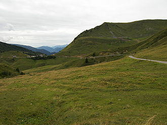
Croce Domini Pass | |
---|---|
Elevation | 1,892 m (6,207 ft) |
Traversed by | SP345 |
Location | Lombardy, Italy |
Range | Alps |
Coordinates | 45°54′27″N10°24′34″E / 45.90750°N 10.40944°E |
The Croce Domini Pass (Italian : Passo di Crocedomini) (el. 1892 m.) is a high mountain pass in the Alps in the Adamello-Presanella Alps in the region of Lombardy in Italy.
It connects the Lago d'Idro in the southeast and the Lago d'Iseo in the southwest.
The pass road has a maximum grade of 12 percent and is paved from Breno to Bagolino. The pass is closed from November to May.
This article lists the principal mountain passes and tunnels in the Alps, and gives a history of transport across the Alps.
The river Ticino is the most important perennial left-bank tributary of the Po. It has given its name to the Swiss canton through which its upper portion flows.
The Julian Alps are a mountain range of the Southern Limestone Alps that stretch from northeastern Italy to Slovenia, where they rise to 2,864 m at Mount Triglav, the highest peak in Slovenia. A large part of the Julian Alps is included in Triglav National Park. The second highest peak of the range, the 2,755 m high Jôf di Montasio, lies in Italy.
The Gotthard Pass or St. Gotthard Pass at 2,106 m (6,909 ft) is a mountain pass in the Alps traversing the Saint-Gotthard Massif and connecting northern Switzerland with southern Switzerland. The pass lies between Airolo in the Italian-speaking canton of Ticino, and Andermatt in the German-speaking canton of Uri, and connects further Bellinzona and Lugano to Lucerne, Basel, and Zürich. The Gotthard Pass lies at the heart of the Gotthard, a major transport axis of Europe, and it is crossed by three traffic tunnels, each being the world's longest at the time of their construction: the Gotthard Rail Tunnel (1882), the Gotthard Road Tunnel (1980) and the Gotthard Base Tunnel (2016). With the Lötschberg to the west, the Gotthard is one of the two main north-south routes through the Swiss Alps.
Col Agnel is a mountain pass in the Cottian Alps, west of Monte Viso between France and Italy which links the Queyras valley (Hautes-Alpes) with Pontechianale in the province of Cuneo, Piedmont.
The Maddalena Pass is a high mountain pass between the Cottian Alps and the Maritime Alps, located on the border between Italy and France. It connects Barcelonnette in France with Cuneo in Italy. Its French name Col de Larche refers to the village Larche on its northwestern side.
Col de Tende is a high mountain pass in the Alps, close to the border between France and Italy, although the highest section of the pass is wholly within France.
The Ligurian Alps are a mountain range in northwestern Italy. A small part is located in France. They form the south-western extremity of the Alps, separated from the Apennines by the Colle di Cadibona. The Col de Tende and the Vermenagna valley separate them from the Maritime Alps. They form the border between Piedmont in the north and Liguria in the south.
The Bernina Pass is a high mountain pass in the Bernina Range of the Alps, in the canton of Graubünden (Grisons) in eastern Switzerland. It connects the famous resort town of St. Moritz in the Engadin valley with the Italian-speaking Val Poschiavo, which ends in the Italian town of Tirano in Valtellina. The pass lies a few kilometres east of Piz Bernina, and south of Val Minor.
The Flüela Pass is a high mountain pass of the Swiss Alps in Graubünden. Traditionally considered the boundary between the Albula and Silvretta Alps, the pass crosses the watershed / drainage divide between the basins of the rivers Rhine and Danube. The pass is overlooked by the Flüela Schwarzhorn and the Flüela Wisshorn. The summit of the pass lies between the lakes Lai da la Scotta and Lai Nair.
Umbrail Pass is a high mountain pass on the Swiss-Italian border connecting Santa Maria in Val Müstair with Bormio in the Adda valley. On the Italian side, it connects to the Stelvio Pass road and the Valtellina. It is currently the highest paved road in Switzerland.
The Col de Montgenèvre is a high mountain pass in the Cottian Alps, in France 2 kilometres away from Italy.
Tonale Pass (el. 1883 m./6178 ft.) is a high mountain pass in northern Italy across the Rhaetian Alps, between Lombardy and Trentino.
Gavia Pass (el. 2621 m.) is a high mountain pass in the Italian Alps. It is the tenth highest paved road in the Alps.
Sella Nevea, at an altitude of 1,195 m (3,921 ft), is a high mountain pass in the Julian Alps, in the Friuli-Venezia Giulia region of northeast Italy. Sella Nevea also lends its name to a frazione of the Chiusaforte municipality and the nearby Kanin-Sella Nevea Ski Resort.
Fern Pass is a mountain pass in the Tyrolean Alps in Austria. It is located between the Lechtal Alps on the west and the Mieming Mountains on the east. The highest peak in Germany, the Zugspitze is only 13.5 km away to the northeast. The pass lies between the Grubigstein on the northwest, the Wannig on the southeast, and the Loreakopf on the west.
Klammljoch is a high mountain pass in the Alps on the border between Austria and Italy.
Plöcken Pass is a high mountain pass in the Carnic Alps mountain range at the border between the Austrian state of Carinthia and the Friuli-Venezia Giulia region of Italy. It links the market town of Kötschach-Mauthen in the Carinthian Gail Valley with the Paluzza municipality in the Carnia region of Friuli.
Radstädter Tauern Pass is a high mountain pass in the Austrian state of Salzburg, connecting the town of Radstadt in the Pongau region with Mauterndorf in Lungau.
The Stelvio Pass is a mountain pass in northern Italy bordering Switzerland at an elevation of 2,757 m (9,045 ft) above sea level. It is the highest paved mountain pass in the Eastern Alps, and the second highest in the Alps, 7 m (23 ft) below France's Col de l'Iseran.