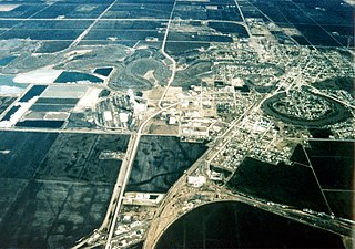
St. Louis County is a county located in the Arrowhead Region of the U.S. state of Minnesota. As of the 2010 census, the population was 200,226. Its county seat is Duluth. It is the largest county in Minnesota by land area, and the second largest in the United States east of the Mississippi River, after Aroostook County, Maine.

Scouting in Minnesota has a long history, from the 1910s to the present day, serving thousands of youth in programs that suit the environment in which they live.

The Pigeon River forms part of the Canada–United States border between the state of Minnesota and the province of Ontario, west of Lake Superior. In pre-industrial times the river was a waterway of great importance for transportation and the fur trade.

The Boundary Waters Canoe Area Wilderness is a 1,090,000-acre (4,400 km2) wilderness area within the Superior National Forest in northeastern part of the US state of Minnesota under the administration of the U.S. Forest Service. A mixture of forests, glacial lakes, and streams, the BWCAW's preservation as a primitive wilderness began in the 1900s and culminated in the Boundary Waters Canoe Area Wilderness Act of 1978. It is a popular destination for canoeing, hiking, and fishing, and is one of the most visited wildernesses in the United States.

The Cannon River a tributary of the Mississippi River flows 112 miles (180 km) from Lake Tetonka near Waterville to Red Wing in the U.S. state of Minnesota, where it joins the Mississippi River. It drains a watershed approximately 1460 square miles (3,780 km²) in size. The river flows through the counties of Le Sueur, Rice, Dakota, and Goodhue.

Canoe camping, also known as touring, tripping or expedition canoeing, is a combination of canoeing and camping. Like backpacking, canoe campers carry enough with them to travel and camp for several days, but do so via a canoe or kayak.

The Red Lake River is a river located in northwestern Minnesota. The river begins on the western side of the Lower Red Lake and flows westward. After passing through Thief River Falls, Red Lake Falls, and Crookston, the river merges with the Red River of the North in East Grand Forks. The total length of the river is 193 miles (311 km) The term "Forks" in Grand Forks comes from this forking (confluence) of the Red and Red Lake rivers near downtown Grand Forks.

Savanna Portage State Park is a state park of Minnesota, USA, established in 1961 to preserve the historic Savanna Portage, a difficult 6-mile (9.7 km) trail connecting the watersheds of the Mississippi River and Lake Superior. The portage trail crosses a drainage divide separating the West Savanna River, which drains to the Mississippi River and the Gulf of Mexico, from the East Savanna River, which flows in an opposite direction to the Saint Louis River, Lake Superior and the Great Lakes, and the Saint Lawrence River to the Atlantic Ocean.

Grand Portage National Monument is a United States National Monument located on the north shore of Lake Superior in northeastern Minnesota that preserves a vital center of fur trade activity and Anishinaabeg Ojibwe heritage. The area became one of the British Empire's four main fur trading centers in North America, along with Fort Niagara, Fort Detroit, and Michilimackinac.

Superior National Forest, part of the United States National Forest system, is located in the Arrowhead Region of the state of Minnesota between the Canada–United States border and the north shore of Lake Superior. The area is part of the greater Boundary Waters region along the border of Minnesota and the Canadian province of Ontario, a historic and important thoroughfare in the fur trading and exploring days of New France and British North America.

William O'Brien State Park is a 1,520-acre (6.2 km2) state park of Minnesota, USA, along the St. Croix River. Its hiking trails traverse rolling glacial moraine, riparian zones, restored oak savanna, wooded areas and bogs. It is a popular place for birdwatching, picnics, camping, cross-country skiing, canoeing, fishing, and other typical outdoor recreational activities.

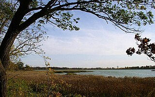
Rice Lake State Park is a state park of Minnesota, United States, just east of Owatonna. Park lands entirely surround Rice Lake, an important stopping point for migrating waterfowl. The lake covers 750 acres (300 ha) with an average depth of 3 feet (1 m).
The Sioux–Hustler Trail is a 35-mile (56 km) hiking trail in the Boundary Waters Canoe Area in northeastern Minnesota. The trail is approximately an hour's drive from Ely, Minnesota, along the Echo Trail. The trail, which is primitive and not well maintained, runs from the Little Indian Sioux River through relatively untouched country to Hustler Lake, which is at an altitude of 1,302 ft (397 m).

Crane Lake is an unincorporated community in Crane Lake Township, Saint Louis County, Minnesota, United States; located within the Kabetogama State Forest.

The Grand Portage State Forest is a state forest located near the community of Hovland in Cook County, in extreme northeastern Minnesota. The forest encloses Judge C. R. Magney State Park, Swamp River Wildlife Management Area, Hovland Woods Scientific and Natural Area, and Spring Beauty Hardwoods Scientific and Natural Area. It borders the Grand Portage Indian Reservation to the east, the Superior National Forest to the west, and Ontario to the north. The forest is named after the Grand Portage, a historic trade route between the Great Lakes and the Northwest.

The Hill River State Forest is a state forest located in Aitkin County, Minnesota. It borders the Savanna State Forest to the east, and the Chippewa National Forest and the Land O'Lakes State Forest to the west. The majority of the forest is managed by the Minnesota Department of Natural Resources.

The Kabetogama State Forest is a state forest located in Koochiching and Saint Louis counties, Minnesota, United States. The forest borders the Superior National Forest and the Boundary Waters Canoe Area Wilderness to the east, the Sturgeon River State Forest to the south, the Nett Lake Indian Reservation to the west, and Voyageurs National Park to the north. The forest is managed by the Minnesota Department of Natural Resources.

The Koochiching State Forest is a state forest located near International Falls in Itasca, Koochiching, and Saint Louis counties, Minnesota. The forest borders the Pine Island State Forest to the west, the Big Fork State Forest and George Washington State Forest to the south, the Nett Lake Indian Reservation and the Kabetogama State Forest to the east. A leg of the forest touches Rainy Lake to the north, which forms part of the international border with Ontario. Of the 565,500 acres (2,288 km2), 344,300 acres (1,393 km2) are managed by the Minnesota Department of Natural Resources, making it one of the largest forests in the Minnesota state system.

The Mississippi Headwaters State Forest is a state forest located near the town of Wilton in Beltrami County, Minnesota. Portions of the forest extend into the neighboring counties of Clearwater and Hubbard. The majority of the forest is managed by the respective counties, with the Minnesota Department of Natural Resources managing around 9,000 acres (3,600 ha). The forest is named after its location immediately downstream (north) of Lake Itasca, the headwaters of the Mississippi River.

This article covers the water based Canadian canoe routes used by early explorers of Canada with special emphasis on the fur trade.


