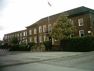
Coordinates: 54°29′42″N1°27′29″W / 54.495°N 1.458°W Croft was a rural district in the North Riding of Yorkshire from 1894 to 1974.

A geographic coordinate system is a coordinate system that enables every location on Earth to be specified by a set of numbers, letters or symbols. The coordinates are often chosen such that one of the numbers represents a vertical position and two or three of the numbers represent a horizontal position; alternatively, a geographic position may be expressed in a combined three-dimensional Cartesian vector. A common choice of coordinates is latitude, longitude and elevation. To specify a location on a plane requires a map projection.
Rural districts were a type of local government area – now superseded – established at the end of the 19th century in England, Wales, and Ireland for the administration of predominantly rural areas at a level lower than that of the administrative counties.

The North Riding of Yorkshire is one of the three historic subdivisions (ridings) of the English county of Yorkshire, alongside the East and West ridings. From the Restoration it was used as a lieutenancy area, having been part of the Yorkshire lieutenancy previously. The three ridings were treated as three counties for many purposes, such as having separate quarter sessions. An administrative county was created with a county council in 1889 under the Local Government Act 1888 on the historic boundaries. In 1974 both the administrative county and the Lieutenancy of the North Riding of Yorkshire were abolished, being succeeded in most of the riding by the new non-metropolitan county of North Yorkshire.
It was created under the Local Government Act 1894 from that part of the Darlington rural sanitary district which was in the North Riding (the rest forming Darlington Rural District in County Durham). It was named after Croft-on-Tees.

The Local Government Act 1894 was an Act of the Parliament of the United Kingdom that reformed local government in England and Wales outside the County of London. The Act followed the reforms carried out at county level under the Local Government Act 1888. The 1894 legislation introduced elected councils at district and parish level.

Darlington is a large market town in County Durham, in North East England. With a population of 105,564 in 2011, the town lies on the River Skerne, a tributary of the River Tees. The town is administered as part of the Borough of Darlington. The town owes much of its development to the influence of local Quaker families in the Georgian and Victorian era, and who provided much of the finance and vision in creating the Stockton and Darlington Railway, the world's first steam locomotive powered, permanent passenger railway. The town is often colloquially referred to as 'Darlo'.

County Durham is a county in North East England. The county town is Durham, a cathedral city. The largest settlement is Darlington, closely followed by Hartlepool and Stockton-on-Tees. It borders Tyne and Wear to the north east, Northumberland to the north, Cumbria to the west and North Yorkshire to the south. The county's historic boundaries stretch between the rivers Tyne and Tees, thus including places such as Gateshead, Jarrow, South Shields and Sunderland.
It was abolished under the Local Government Act 1972 in 1974. The parishes of Girsby and Over Dinsdale went to form part of the new North Yorkshire district of Hambleton, with the rest going to the Richmondshire district.

The Local Government Act 1972 is an Act of the Parliament of the United Kingdom that reformed local government in England and Wales on 1 April 1974.

Girsby is a village and civil parish in the district of Hambleton in North Yorkshire, England. The village lies on high ground on the eastern bank of the River Tees. The population of the parish was estimated at 40 in 2010. The population as of the 2011 census remained less than 100. Details are included in the civil parish of Over Dinsdale.

Over Dinsdale is a small village and civil parish in the Local Government District of Hambleton in North Yorkshire, England. The population of the village taken at the 2011 census was 151. The village straddles an ancient Roman road on the border with County Durham. Over Dinsdale is located on a peninsula in the River Tees, approximately 6 miles from Darlington and 8.5 miles from Yarm. The Teesdale Way passes through the village.


