
Rhode Island is a state in the New England region of the Northeastern United States. It borders Connecticut to its west; Massachusetts to its north and east; and the Atlantic Ocean to its south via Rhode Island Sound and Block Island Sound; and shares a small maritime border with New York, east of Long Island. Rhode Island is the smallest U.S. state by area and the seventh-least populous, with slightly fewer than 1.1 million residents as of 2020; but it has grown at every decennial count since 1790 and is the second-most densely populated state, after New Jersey. The state takes its name from the eponymous island, though nearly all its land area is on the mainland. Providence is its capital and most populous city.

North Smithfield is a town in Providence County, Rhode Island, United States, settled as a farming community in 1666 and incorporated into its present form in 1871. North Smithfield includes the historic villages of Forestdale, Primrose, Waterford, Branch Village, Union Village, Park Square, and Slatersville. The population was 12,588 at the 2020 census.

Industrial archaeology (IA) is the systematic study of material evidence associated with the industrial past. This evidence, collectively referred to as industrial heritage, includes buildings, machinery, artifacts, sites, infrastructure, documents and other items associated with the production, manufacture, extraction, transport or construction of a product or range of products. The field of industrial archaeology incorporates a range of disciplines including archaeology, architecture, construction, engineering, historic preservation, museology, technology, urban planning and other specialties, in order to piece together the history of past industrial activities. The scientific interpretation of material evidence is often necessary, as the written record of many industrial techniques is often incomplete or nonexistent. Industrial archaeology includes both the examination of standing structures and sites that must be studied by an excavation.

West Warwick is a town in Kent County, Rhode Island, United States. The population was 31,012 at the 2020 census.

Kingston is a village and a census-designated place within the town of South Kingstown in Washington County, Rhode Island, United States, and the site of the main campus of the University of Rhode Island. The population was 6,974 at the 2010 census. Much of the village center is listed on the National Register of Historic Places as Kingston Village Historic District. It was originally known as Little Rest.

The Blackstone Valley or Blackstone River Valley is a region of Massachusetts and Rhode Island. It was a major factor in the American Industrial Revolution. It makes up part of the Blackstone River Valley National Heritage Corridor and National Historical Park.
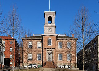
The Rhode Island Historical Preservation and Heritage Commission, often called RIHPHC, is an agency run by the state of Rhode Island that aims to preserve the state's history and heritage. The commission works statewide to protect and upkeep historical buildings, districts, archæological sites and structures. It offers partial funding to those renovating or maintaining historical properties. It also has the role of establishing programs designed to record and celebrate the state's culture and heritage. RIHPHC has also published a series of publications on the history of each of Rhode Island's thirty-nine communities and with a list of important historical places located in each.

The Slater Mill is a historic water-powered textile mill complex on the banks of the Blackstone River in Pawtucket, Rhode Island, modeled after cotton spinning mills first established in England. It is the first water-powered cotton spinning mill in America to utilize the Arkwright system of cotton spinning as developed by Richard Arkwright.

The John H. Chafee Blackstone River Valley National Heritage Corridor is a National Heritage Corridor dedicated to the history of the early American Industrial Revolution, including mill towns stretching across 25 cities and towns near the river's course in Worcester County, Massachusetts, and Providence County, Rhode Island. It makes up a historical area in the Blackstone Valley and is named for the late US Senator from Rhode Island John Chafee. In 2014, the Blackstone River Valley National Historical Park was created out of a smaller portion of the National Heritage Corridor. The two units now exist as cooperative entities. The organization is headquartered at the building in Whitinsville, MA, which is located at 670 Linwood Ave, Whitinsville, MA 01588.

Colt State Park is a public recreation area that occupies 464 acres (188 ha) on Poppasquash Neck in the town of Bristol, Rhode Island, once owned by industrialist Samuel P. Colt, nephew of firearms manufacturer Samuel Colt. The park is a major component of the Poppasquash Farms Historic District, listed on the National Register of Historic Places, and is a stop on the East Bay Bike Path. The park includes trails, picnic groves, boat ramps, an observation tower, and an open air Chapel-by-the-Sea.
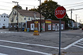
Albion is a village and historic district in Lincoln, Rhode Island, in the United States.
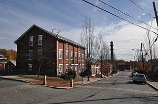
Lonsdale is a village and historic district in Lincoln and Cumberland, Providence County, Rhode Island, United States, near Rhode Island Route 146 and Route 95. The village was originally part of the town of Smithfield until Lincoln was created in the 1870s, and was originally centered on the Lincoln side of the Blackstone River. William Blaxton settled in the area in 1635. In the nineteenth and early twentieth centuries, Lonsdale was home to several manufacturers including the Lonsdale Company's Bleachery, and the Ann & Hope mill was also located in the village in Cumberland.

The Boston and Providence Railroad Bridge in East Providence is a railroad bridge on the East Junction Branch spanning Ten Mile River. A portion of the bridge also spans Roger Williams Avenue. The bridge was built in 1884 by the Boston and Providence Railroad, replacing an earlier structure on the line. The bridge abutments are faced in coursed ashlar stone, with brick-faced segmental-arch tunnels piercing them. The main span of the bridge consists of two Warren trusses resting on the abutments and a central pier in the Ten Mile River. The bridge formerly carried two tracks, but has been reduced to one.

Allenville Mill Storehouse is a historic mill storehouse at 5 Esmond Street in Esmond, Rhode Island within the town of Smithfield, Rhode Island. The exact date of construction is unknown, but it was built with rubble masonry construction which was typical of mill construction during and after the War of 1812. In 1813, Phillip Allen purchased 4.5 acres of land and constructed a mill on the site, but the first record to specifically refer to the storehouse was an insurance policy from 1836. Allen sold the property in 1857 and it changed ownership several times before it became Esmond Mills in 1906. In 1937, the building was used as a post office and described erroneously as the "Old Allenville Mill". The building has had some alterations to the front door and possibly the addition of a side door, but the interior of the structure was not detailed in the National Register of Historic Places nomination. The Allenville Mill Storehouse was added to the National Register of Historic Places in 1972.
The West River, in the US state of Massachusetts, is a 13.4-mile-long (21.6 km) tributary of the Blackstone River.

David Wilkinson was a U.S. mechanical engineer who invented a lathe for cutting screw threads, which was extremely important in the development of the machine tool industry in the early 19th century.
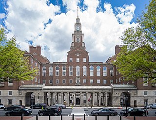
Jackson, Robertson & Adams was an architectural firm out of Providence, Rhode Island. Established in 1912, it was originally made up of architects F. Ellis Jackson (1879–1950), Wayland T. Robertson (1873–1935), and J. Howard Adams (1876–1924).
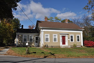
Hughesdale is a neighborhood in the town of Johnston, Rhode Island. Hughesdale is a primarily residential neighborhood in the southeast corner of the town, centered near Central Avenue and Atwood Avenue. It is situated near the villages of Simmonsville and Thornton.

Woonsocket Hill is one of the highest points in the state of Rhode Island and is the highest point in the town of North Smithfield, Rhode Island at 586 feet (179 m). The hill is located near the center of the town and "contained a highly refractory stone used for hearth stones. ".
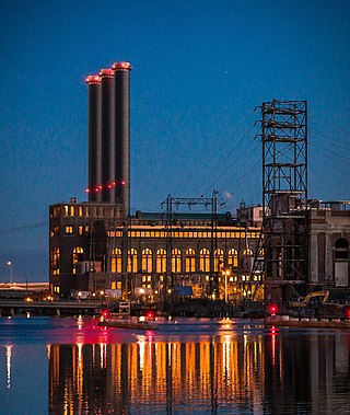
The Manchester Street Generating Station is a 510 MW gas-fired power station in the Jewelry District of Providence, Rhode Island. The station's main building is located along the Providence River and defined by three 321 foot (98 m) tall smoke stacks. The plant has three Siemens gas turbines and three ABB steam turbines.


