The Inner West of Sydney is an area directly west of the Sydney central business district, New South Wales, Australia. The suburbs that make up the Inner West are predominantly located along the southern shore of Port Jackson, stretching south to the shores of the Cooks River. The western boundary of the Inner West is approximately the A3 arterial road, which divides the Inner West from the Greater Western Sydney region. The Inner West is much larger than the Inner West Council local government area. The Inner West roughly corresponds with the Parish of Petersham and Parish of Concord, two cadastral divisions used for land titles.
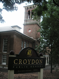
Croydon is a suburb in the Inner West of Sydney, in the state of New South Wales, Australia. It is located 9 kilometres (5.6 mi) west of the Sydney central business district. Croydon is split between the two local government areas of Municipality of Burwood and the Inner West Council.

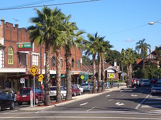
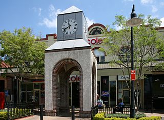
Burwood is a suburb in the Inner West of Sydney, in the state of New South Wales, Australia. It is 10 kilometres (6.2 mi) west of the Sydney central business district and is the administrative centre for the local government area of Municipality of Burwood.
Concord is a suburb in the inner West of Sydney, in the state of New South Wales, Australia. It is 10 kilometres (6.2 mi) west of the Sydney central business district, in the local government area of the City of Canada Bay. Concord West is a separate suburb, to the north-west.

Croydon Park is a suburb in the Inner West of Sydney, in the state of New South Wales, Australia. Croydon Park is 10 kilometres south-west of the Sydney central business district and is divided between the local government areas of the City of Canterbury-Bankstown, Municipality of Burwood and Inner West Council. Croydon is a separate suburb, to the north.

Enfield is a suburb in the Inner West of Sydney, in the state of New South Wales, Australia. It is 11 kilometres south-west of the Sydney central business district in the local government area of Municipality of Burwood.

Burwood railway station is a heritage-listed railway station located on the Main Suburban line in the Sydney suburb of Burwood in the Municipality of Burwood local government area of New South Wales, Australia. The station is served by Sydney Trains T9 Northern line and T2 Inner West & Leppington line services.

The Presbyterian Ladies' College, Sydney is an independent Presbyterian single-sex early learning, primary and secondary day and boarding school for girls, located in Croydon, an inner-western suburb of Sydney, New South Wales, Australia. The school has a non-selective enrolment policy for all years except Year 11, and caters for approximately 1,250 girls from age four to age eighteen, including 65 boarders. Students attend PLC from all regions of the greater metropolitan area, New South Wales, and overseas.

Burwood Girls' High School is a public, comprehensive, secondary school for girls, located in Croydon, an inner western suburb of Sydney, New South Wales, Australia.
Canterbury Boys' High School (CBHS) is a public secondary day school for boys located in Canterbury, a south-western suburb of Sydney, New South Wales, Australia. It is located near the Canterbury Park Racecourse and about 200 metres north of Canterbury Girls' High School.
Sydney Adventist College is an independent Seventh-Day Adventist co-educational early learning and primary day school, located in Auburn, an inner-western suburb of Sydney, New South Wales, Australia.
The Kelso High Campus of Denison College of Secondary Education is a government-funded co-educational comprehensive secondary day school campus, located in Kelso, in the Central West region of New South Wales, Australia.

Lismore High Campus, part of The Rivers Secondary College, is a government-funded co-educational comprehensive secondary day school campus, located in East Lismore, in the Northern Rivers region of New South Wales, Australia.

Lionel Arthur Gilbert CF was an Australian historian, author, curator, lecturer, and biographer, specializing in applied, natural, and local history. Born in Burwood, New South Wales, he studied at Sydney Teachers College and, beginning in 1946, worked as a teacher and later a headmaster in state schools in various locations around New South Wales until 1961. In 1963 Gilbert graduated from the University of New England with a Bachelor of Arts in History. That same year, he was appointed a lecturer and curator at the Armidale Teachers' College Museum of Education, in which capacity he served until his retirement in 1984, overseeing several expansions of the museum and establishment of a historical research centre.

The Priory is a heritage-listed residence at 213 Burwood Road, in the Sydney suburb of Burwood in the Municipality of Burwood local government area of New South Wales, Australia. It was built in 1877. The Priory and its grounds was added to the New South Wales State Heritage Register on 2 April 1999.

The Burwood Post Office is a heritage-listed former Aboriginal land, farm and former post office and now retail building located at 168a Burwood Road in the Sydney suburb of Burwood in the Municipality of Burwood local government area of New South Wales, Australia. It was designed by Walter Liberty Vernon and George Oakeshott and built by New South Wales Works Branch. It is also known as Burwood Post Office (former). It was added to the New South Wales State Heritage Register on 18 May 2001.

St. Cloud is a heritage-listed mansion located at 223 Burwood Road in the Sydney suburb of Burwood in the Municipality of Burwood local government area of New South Wales, Australia. It was built by George Hoskins. It is also known as St. Cloud and Site and St Cloud and site. It was added to the New South Wales State Heritage Register on 2 April 1999.

St Paul's Anglican Church and Pipe Organ is a heritage-listed Anglican church building and pipe organ located at 205 Burwood Road in the Sydney suburb of Burwood in the Municipality of Burwood local government area of New South Wales, Australia. The church was designed by Edmund Blacket and the organ was designed by William Davidson, with some consultation from Montague Younger. The church and organ were built from 1889 to 1891. The church is also known as St. Paul's Anglican Church and Pipe Organ, St Paul's Anglican Church and Davidson Pipe Organ. The property is owned by Anglican Church Property Trust. It was added to the New South Wales State Heritage Register on 2 April 1999.
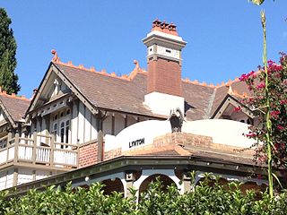
Lynton is a heritage-listed residence located at 4 Clarence Street in the Sydney suburb of Burwood in the Municipality of Burwood local government area of New South Wales, Australia. It was designed by Stanley Rickard and built from 1906. It was added to the New South Wales State Heritage Register on 2 April 1999.

Shubra Hall is a heritage-listed former semi-rural suburban estate and mansion residence and now administration building for school purposes at Boundary Street in the Sydney suburb of Croydon, Municipality of Burwood, New South Wales, Australia. It was designed by Albert Bond and built from 1869 to 1888 in the Victorian Second Empire architectural style. It is also known as Presbyterian Ladies' College, PLC Croydon and Hordernville. The property is owned by the Presbyterian Ladies' College, Sydney and was added to the New South Wales State Heritage Register on 19 December 2014.