Cruz de los Caminos (Cuchilla de) Caraguatá | |
|---|---|
Village | |
 Cruz de los Caminos Location in Uruguay | |
| Coordinates: 32°13′57″S54°58′16″W / 32.23250°S 54.97111°W Coordinates: 32°13′57″S54°58′16″W / 32.23250°S 54.97111°W | |
| Country | |
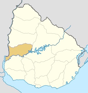
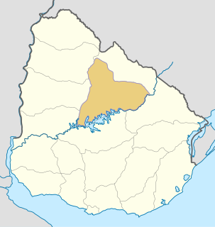
| Department | Tacuarembó Department |
| Population (2011) | |
| • Total | 463 |
| Time zone | UTC -3 |
| Postal code | 45019 |
| Dial plan | +598 463 (+5 digits) |
Cruz de los Caminos, formerly named Cuchilla de Caraguatá or Caraguatá is a village in the Tacuarembó Department of Uruguay. It took its original name from a nearby range of hills, known as the Cuchilla de Caraguatá. The word 'Caraguatá' refers to a local plant and is also the name of a nearby stream.
Tacuarembó is the largest department of Uruguay and it is part of its northern region. Its capital is Tacuarembó. It borders Rivera Department to its north and east, the departments of Salto, Paysandú and Río Negro to its west and has the river Río Negro flowing along its south border, separating it from the departments of Durazno and Cerro Largo.

Uruguay, officially the Oriental Republic of Uruguay, is a country in the southeastern region of South America. It borders Argentina to its west and Brazil to its north and east, with the Río de la Plata to the south and the Atlantic Ocean to the southeast. Uruguay is home to an estimated 3.44 million people, of whom 1.8 million live in the metropolitan area of its capital and largest city, Montevideo. With an area of approximately 176,000 square kilometres (68,000 sq mi), Uruguay is geographically the second-smallest nation in South America, after Suriname.
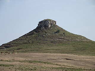
The Cuchilla de Caraguatá is a range of hills in Uruguay.