Cruz de los Caminos, Tacuarembó

Last updated
Cruz de los Caminos

(Cuchilla de) Caraguatá
Village
Uruguay location map.svg
Red pog.svg
Cruz de los Caminos
Location in Uruguay
Coordinates: 32°13′57″S54°58′16″W / 32.23250°S 54.97111°W / -32.23250; -54.97111 Coordinates: 32°13′57″S54°58′16″W / 32.23250°S 54.97111°W / -32.23250; -54.97111
CountryFlag of Uruguay.svg  Uruguay
Department Tacuarembó Department
Population
(2011)
  Total463
Time zone UTC -3
Postal code
45019
Dial plan +598 463 (+5 digits)

Cruz de los Caminos, formerly named Cuchilla de Caraguatá or Caraguatá is a village in the Tacuarembó Department of Uruguay. It took its original name from a nearby range of hills, known as the Cuchilla de Caraguatá. The word 'Caraguatá' refers to a local plant and is also the name of a nearby stream.
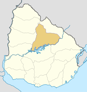
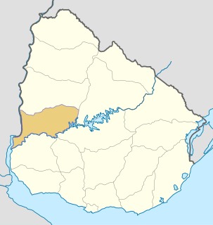
Tacuarembó Department Place in Uruguay

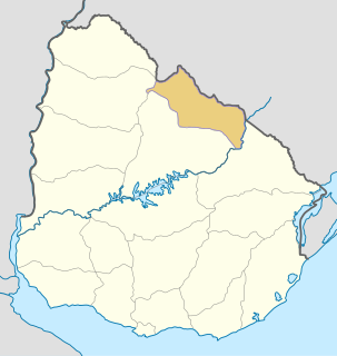
Tacuarembó is the largest department of Uruguay and it is part of its northern region. Its capital is Tacuarembó. It borders Rivera Department to its north and east, the departments of Salto, Paysandú and Río Negro to its west and has the river Río Negro flowing along its south border, separating it from the departments of Durazno and Cerro Largo.

Uruguay republic in South America

Uruguay, officially the Oriental Republic of Uruguay, is a country in the southeastern region of South America. It borders Argentina to its west and Brazil to its north and east, with the Río de la Plata to the south and the Atlantic Ocean to the southeast. Uruguay is home to an estimated 3.44 million people, of whom 1.8 million live in the metropolitan area of its capital and largest city, Montevideo. With an area of approximately 176,000 square kilometres (68,000 sq mi), Uruguay is geographically the second-smallest nation in South America, after Suriname.

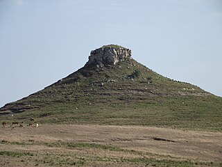
The Cuchilla de Caraguatá is a range of hills in Uruguay.

Contents

Location

The village is situated in the east of the department, 6.5 kilometres (4.0 mi) southeast of Las Toscas, on km. 360 of Route 6 and on its intersection with Route 26.

Las Toscas, Tacuarembó Village in Tacuarembó Department, Uruguay

Las Toscas is a village or populated centre in the Tacuarembó Department of northern-central Uruguay.

Route 6 (Uruguay) highway in Uruguay

Route 6 is a national route of Uruguay. In 1981, it was assigned the name Joaquín Suárez. It connects Montevideo with the northeast of Rivera Department, at Vichadero, with an extension reaching the border with Brazil. The road is approximately 428 kilometres long till Vichadero.

Population

In 2011 Cruz de los Caminos had a population of 463. [1] No former census had given results for this location.

YearPopulation
2011463

Public schools

In Cruz de los Caminos is Public School 61, while 2.7 kilometres (1.7 mi) to its west, on Route 6 is Public School 26, next to the police station. About 4.6 kilometres (2.9 mi) west-southwest of Las Toscas is the rural area Public School 28, named Costas de Caraguatá.

Related Research Articles

Río Negro Department Place in Uruguay

Río Negro Department is a department of the northwestern region of Uruguay. It has an area of 9,282 km2 (3,584 sq mi) and a population of 54,765. Its capital is Fray Bentos. It borders Paysandú Department to the north, Tacuarembó Department to the east, Durazno Department to the southeast, Soriano Department to the south and has the Río Uruguay flowing at its west, separating it from Argentina.

Rivera Department Place in Uruguay

Rivera Department is a department of the northern region of Uruguay. It has an area of 9,370 km2 (3,620 sq mi) and a population of 103,493. Its capital is the city of Rivera. It borders Brazil to the north and east, Cerro Largo Department to the southeast, Tacuarembó Department to the south and west and Salto Department to the northwest.

Paso de los Toros City in Tacuarembó, Uruguay

Paso de los Toros is a city of the Tacuarembó Department in Uruguay.

Circe Maia Uruguayan writer

Circe Maia,, is a Uruguayan poet, essayist, translator, and teacher.

The Caraguatá River is a river in Uruguay.

Cerro Batoví mountain

Cerro Batoví is a hill in Uruguay, with an altitude of 224 metres (734.9 ft). It is situated 25 km (15.5 mi) away from the city of Tacuarembó.

San Ramón, Uruguay City & Municipality in Canelones, Uruguay

San Ramón is a small city in the north of Canelones Department, in southern Uruguay.

Las Toscas, Canelones Resort of the Costa de Oro in Canelones Department, Uruguay

Las Toscas is a resort of the Costa de Oro in the Canelones Department of southern Uruguay.

Paso Bonilla Village in Tacuarembó Department, Uruguay

Paso Bonilla is a village or populated centre in the Tacuarembó Department of northern-central Uruguay.

Route 3 (Uruguay) highway in Uruguay

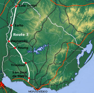
Route 3 is a national route of Uruguay. In 1975, it was assigned the name General José Artigas, the foremost national hero of Uruguay. It is one of the most important highways in the country along with Route 5, connecting the south coast near Rafael Perazza with Bella Unión in the extreme northwest. The road is approximately 592 kilometres (368 mi) in length.

Route 5 (Uruguay) highway in Uruguay

Route 5 is a national route of Uruguay. In 1975, it was assigned the name Brigadier General Fructuoso Rivera, a national hero of Uruguay. It is one of the most important highways in country, along with Route 3, connecting Montevideo in the south with Rivera in the north and passing through the centre of the country. The road is approximately 501 kilometres (311 mi) in length. Upon reaching Santana do Livramento, the road joins federal highway BR-158.

Route 9 (Uruguay) highway in Uruguay

Route 9 is a national route of Uruguay. In 1975, it was assigned the name Coronel Leonardo Olivera, a national hero of Uruguay. It connects Dr. Francisco Soca with Chuy in the northeast.

Ruta Interbalnearia highway in Uruguay

Ruta Interbalnearia or Ruta Líber Seregni is a national route of Uruguay. It connects Montevideo with Punta del Este to the east along the coast. The road is approximately 90 kilometres (56 mi) in length. It is marked on maps and signs as IB.

Route 26 (Uruguay) highway in Uruguay

Route 26 is a national route of Uruguay. It is one of the main Uruguayan routes covering the country from west to east, connecting Río Branco to other cities like Melo and Tacuarembó. Its "Kilometer Zero", is at the route 3 junction.

Federal Highway 40D is the designation for toll highway paralleling Mexican Federal Highway 40. Highway 40D connects Mazatlán, Sinaloa to Reynosa, Tamaulipas. It forms most of the highway corridor between Mazatlán and Matamoros, Tamaulipas, one of 14 major highway corridors in the country.

References

  1. "Censos 2011 Cuadros Tacuarembó". INE. 2012. Retrieved 25 August 2012.