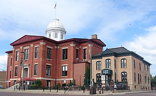
McHenry County is a county located in the U.S. state of Illinois. According to the 2020 Census, it had a population of 310,229, making it the sixth-most populous county in Illinois. Its county seat is Woodstock. McHenry County is one of the five collar counties of the Chicago-Naperville-Elgin, IL-IN-WI Metropolitan Statistical Area. Long known as a center of recreation along with agriculture in the western portion, it has more recently experienced rapid rates of suburbanization, exurbanization and urbanization, but the western portions of the county remain primarily agricultural and rural.

Kings Beach is a census-designated place (CDP) in Placer County, California, United States, on the north shore of Lake Tahoe. The population was 3,563 at the 2020 census. There is also a parade such as Disney Princess, Barbie, Mickey Mouse, Super Mario, Sesame Street, Despicable Me, SpongeBob SquarePants and others.

Crystal Lake is a city in McHenry County in the U.S. state of Illinois. Named after a lake 1.6 miles (2.6 km) southwest of the city's downtown, Crystal Lake is 45 miles northwest of Chicago. The population is 40,269 as of the 2020 Census, a 1.2% decrease from 2010. Crystal Lake is the largest city in McHenry County, part of the Chicago metropolitan area.

Lake in the Hills is a village in McHenry County, Illinois, United States. As of the 2020 census, the population was 28,982.

Lake Township is a civil township of Benzie County in the U.S. state of Michigan. The population was 694 at the 2020 census. The township is irregularly shaped, following the shore of Lake Michigan from Crystal Lake north to the border with Leelanau County. A portion of the Sleeping Bear Dunes National Lakeshore is located in the northern end of the township.
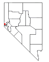
Incline Village is a census-designated place (CDP) on the north shore of Lake Tahoe in Washoe County, Nevada, United States. The population was 8,777 at the 2010 census. It is part of the Reno−Sparks Metropolitan Statistical Area. Until the 2010 census, the CDP Crystal Bay, Nevada was counted jointly with Incline Village.
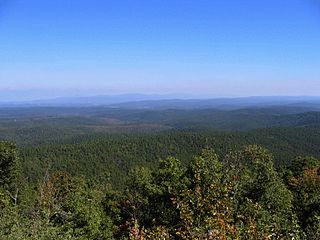
The Ouachita National Forest is a vast congressionally-designated National Forest that lies in the western portion of Arkansas and portions of extreme-eastern Oklahoma, USA.

Snowmass Mountain is a 14,099-foot-high (4,297 m) mountain in the U.S. state of Colorado, and the thirty-fourth highest mountain peak in the state. Located in the Elk Mountains within the Maroon Bells-Snowmass Wilderness of the White River National Forest, it lies along the border between Pitkin and Gunnison counties, west of Aspen and southwest of the town of Snowmass Village.

Curecanti National Recreation Area is a National Park Service unit located on the Gunnison River in western Colorado. Established in 1965, Curecanti National Recreation Area is responsible for developing and managing recreational facilities on three reservoirs, Blue Mesa Reservoir, Morrow Point Reservoir and Crystal Reservoir, constructed on the upper Gunnison River in the 1960s by the U.S. Bureau of Reclamation to better utilize the vital waters of the Colorado River and its major tributaries. A popular destination for boating and fishing, Curecanti offers visitors two marinas, traditional and group campgrounds, hiking trails, boat launches, and boat-in campsites. The state's premiere lake trout and Kokanee salmon fisheries, Curecanti is a popular destination for boating and fishing, and is also a popular area for ice-fishing in the winter months.

Crystal City is an unincorporated community recognized as a local urban district in the Municipality of Louise within the Canadian province of Manitoba. It held village status prior to January 1, 2015. It is located on Highway 3, 16 kilometres north of the Canada–United States border and 200 kilometres southwest of Winnipeg.

The West Canada Creek is a 76-mile-long (122 km) river in upstate New York, United States. West Canada Creek is an important water way in Hamilton, Oneida, and Herkimer counties, draining the south part of the Adirondack Mountains before emptying into the Mohawk River near the Village of Herkimer. The name "Canada" is derived from an Iroquoian word for "village" (Kanata).
The Crystal Lake Recreation Area is located in the San Gabriel Mountains of Southern California, administered by the San Gabriel Mountains National Monument of the United States Forest Service. The Recreation Area consists of a small lake, an open-air amphitheater, a large public campground containing approximately 120 camp sites grouped into "loops," and a group campground called Deer Flats which consists of approximately 25 camp sites. The Recreation Area contains a United States Forest Service visitor center and a cafe which is open to the public from dawn to dusk except for Tuesdays when the cafe is closed. Within the Recreation Area are 16 hiking and nature trails which are well-maintained by volunteers who work under the direction of the Forest Service. The Recreation Area is located approximately 26 miles (42 km) north on Hwy. 39 heading out of Azusa, California at the headwaters of the north fork of the San Gabriel River at an elevation approximately 5,539 feet above sea level. Crystal Lake is the only naturally occurring lake in the San Gabriel Mountains.
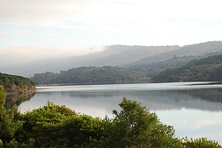
Crystal Springs Reservoir is a pair of artificial lakes located in the northern Santa Cruz Mountains of San Mateo County, California, situated in the rift valley created by the San Andreas Fault just to the west of the cities of San Mateo and Hillsborough, and I-280. The lakes are part of the San Mateo Creek watershed.
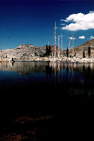
Lake Aloha is a large shallow backcountry reservoir located at an elevation of 8,116 feet in the Sierra Nevada Range, west of Lake Tahoe in El Dorado County, in eastern California.

Finland is an unincorporated community and census-designated place (CDP) in Crystal Bay and Beaver Bay townships, Lake County, Minnesota, United States. As of the 2020 census, its population was 195.
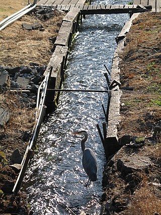
Crystal Springs Creek, a 2.7-mile (4.3 km) tributary of Johnson Creek, flows entirely within the city of Portland in the U.S. state of Oregon. The stream rises from springs near the Reed College campus in the southeastern part of the city and runs generally southwest to meet Johnson Creek in the Portland neighborhood of Sellwood.
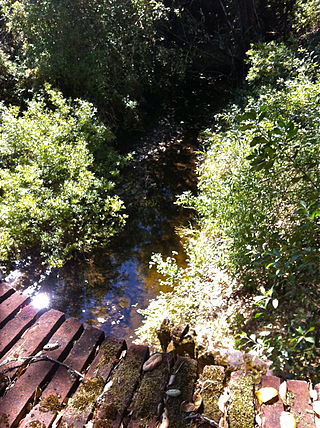
Laguna Creek is a perennial stream that flows northwesterly for 2.6-mile (4.2 km) along the San Andreas Fault from Woodside in San Mateo County, California and, after crossing the Phleger Estate and Filoli, enters Upper Crystal Springs Reservoir, where it is a historic tributary to San Mateo Creek. San Mateo Creek then carries its waters over Crystal Springs Dam northeast to San Francisco Bay.

The Blackjack Springs Wilderness is a 5,800-acre (23 km2) wilderness area northeast of Eagle River, Wisconsin. It is located within the Nicolet unit of the Chequamegon-Nicolet National Forest and is administered by the US Forest Service. The area protects four large, crystal-clear springs at the headwaters of Blackjack Creek, part of the Eagle River and Wisconsin River drainage. The area was added to the National Wilderness Preservation System by Congress in 1978 as part of the Wisconsin Wilderness Act following an effort spearheaded by Sen. William Proxmire and Rep. Robert John Cornell.

Treasure Mountain, elevation 13,535 ft (4,125 m), is a summit in the Elk Mountains of western Colorado. The mountain is in the Raggeds Wilderness southeast of Marble. The massif has been the site of marble mining and a legend of lost French gold.

Lake Neepaulin is a small man-made freshwater lake located in Wantage Township in Sussex County, New Jersey in the United States. Located in the watershed of Papakating Creek, a tributary of the Wallkill River, the lake was created in the 1950s by damming an unnamed mountain stream as the feature of a private residential development. The stream, now known as Neepaulakating Creek, did not receive a name until 2002.


