Related Research Articles

Rich County is a county in the U.S. state of Utah. As of the 2020 United States Census, the population was 2,510, making it the third-least populous county in Utah. Its county seat is Randolph, and the largest town is Garden City. The county was created in 1864. It was named for an early LDS apostle, Charles C. Rich.
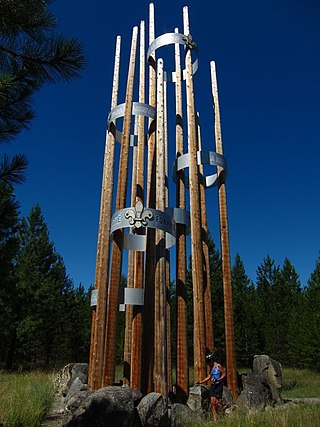
Scouting in Idaho has a long history, from the 1910s to the present day, serving thousands of youth in programs that suit the environment in which they live.

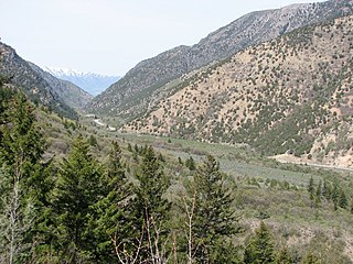
Cache Valley(Shoshoni: Seuhubeogoi, “Willow Valley”) is a valley of northern Utah and southeast Idaho, United States, that includes the Logan metropolitan area. The valley was used by 19th century mountain men and was the site of the 1863 Bear River Massacre. The name, Cache Valley is often used synonymously to describe the Logan Metropolitan Area, one of the fastest growing metro areas in the US per capita — both in terms of economic GDP and population.
Cache National Forest is a 533,840-acre area of National Forest System land in Idaho and Utah which was established on July 1, 1908, by the U.S. Forest Service. The majority of its area is in Utah, and was initially created when the Bear River National Forest was disbanded. On July 1, 1915, all of Pocatello National Forest was added. In 1973 the Idaho portion was transferred to the administration of Caribou National Forest, while the Utah portion was combined administratively with Wasatch National Forest, creating the Wasatch-Cache National Forest. In descending order of forestland area, the Cache National Forest portion is located in Cache, Bear Lake, Franklin, Weber, Rich, Box Elder, Caribou, and Morgan counties. The forest has a current area of 701,453 acres (2,838.68 km2), which comprises 43.56% of the combined Wasatch-Cache's total acreage. The forest is administered from Salt Lake City, Utah as part of the Wasatch-Cache National Forest, but there are local ranger district offices in Logan and Ogden. From circa 1911 until August 1923, the area was roamed by Old Ephraim.
The Logan Metropolitan Statistical Area, as defined by the United States Census Bureau, is an area consisting of two counties – one in Utah and one in Idaho, anchored by the city of Logan. As of the 2010 census, the MSA had a population of 125,442. As of the 2020 Census, the population had risen to 147,908, and further expanded to an estimated 155,362 as of 2022. The Logan metropolitan area is colloquially called Cache Valley, where most of the population resides.

Box Elder Canyon is a canyon located within the western slopes of the Wellsville Mountains, a branch of the Wasatch Range of the Rocky Mountains in the State of Utah, United States.
Chapin is an unincorporated community in Teton County, in the U.S. state of Idaho.
Wolf Creek is a census-designated place in Weber County, Utah, United States. Its population was 1,336 as of the 2010 census.

Cub Island is an island in Box Elder County, Utah, United States.
Curtis Creek is a stream in Cache County, Utah, United States.
Dalton Creek is a stream in Morgan County, Utah, United States. A tributary of the Weber River, it is located within the Uinta-Wasatch-Cache National Forest and its mouth is about 1.75 miles (2.82 km) southeast of Peterson.
Davenport Creek is a stream in Cache County, Utah, United States. It is also located within the Uinta-Wasatch-Cache National Forest and its mouth is about 2 miles (3.2 km) southeast of Avon. The creek rises in the Bear River Mountains and flows briefly southwest. It then turns northwest and runs in that direction for most of its course before emptying into the South Fork Little Bear River at a point immediately west of Utah State Route 162. The main tributaries of Davenport Creek are Pole Creek, Bald Head Creek, Smith Creek, and Fish Creek.
Wilford is an unincorporated community in Fremont County, in the U.S. state of Idaho.
Winder is an unincorporated community in Franklin County, in the U.S. state of Idaho.
Clementsville is an unincorporated community in Teton County, in the U.S. state of Idaho.
Darby is an unincorporated community in Teton County, in the U.S. state of Idaho.
Egin is an unincorporated community in Fremont County, in the U.S. state of Idaho.
Garfield is an unincorporated community in Bonneville and Jefferson counties, in the U.S. state of Idaho.
Glendale is an unincorporated community in Franklin County, in the U.S. state of Idaho.
Hatch is an unincorporated community in Caribou County, in the U.S. state of Idaho.
References
- ↑ U.S. Geological Survey Geographic Names Information System: Cub River
- ↑ Cott, John W. Van (1990). Utah Place Names: A Comprehensive Guide to the Origins of Geographic Names : a Compilation. University of Utah Press. p. 98. ISBN 978-0-87480-345-7.
41°53′53″N111°52′45″W / 41.8979831°N 111.8791142°W
| | This article related to a river in Idaho is a stub. You can help Wikipedia by expanding it. |
| | This article related to a river in Utah is a stub. You can help Wikipedia by expanding it. |