Upland is a city in San Bernardino County, California, United States on the border with neighboring Los Angeles County. The municipality is located at an elevation of 1,242 feet (379 m). As of the 2020 census, the city had a population of 79,040, up from 73,732 at the 2010 census.

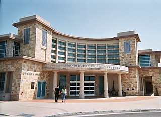
Ontario is a city in southwestern San Bernardino County in the U.S. state of California, 35 miles (56 km) east of downtown Los Angeles and 23 miles (37 km) west of downtown San Bernardino, the county seat. Located in the western part of the Inland Empire metropolitan area, it lies just east of Los Angeles County and is part of the Greater Los Angeles Area. As of the 2020 Census, the city had a population of 175,265.

Rancho Cucamonga is a city located just south of the foothills of the San Gabriel Mountains and Angeles National Forest in San Bernardino County, California, United States. About 37 mi (60 km) east of Downtown Los Angeles, Rancho Cucamonga is the 28th most populous city in California. The city's seal, which centers on a cluster of grapes, alludes to the city's agricultural history including wine-making. The city's proximity to major transportation hubs, airports, and highways has attracted the business of several large corporations, including Coca-Cola, Frito-Lay, Big Lots, Mercury Insurance Group, Southern California Edison, and Amphastar Pharmaceuticals.

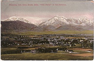
The Pomona Valley is located in the Greater Los Angeles Area between the San Gabriel Valley and San Bernardino Valley in Southern California. The valley is approximately 30 miles (48 km) east of downtown Los Angeles.

Rancho Cucamongo was a 13,045-acre Mexican land grant in present-day San Bernardino County, California, given in 1839 to the dedicated soldier, smuggler and politician Tiburcio Tapia by Mexican governor Juan Bautista Alvarado. The grant formed parts of present-day California cities Rancho Cucamonga and Upland. It extended easterly from San Antonio Creek to what is now Hermosa Avenue, and from today's Eighth Street to the mountains.

The Cucamonga Valley is a region of southwestern San Bernardino County and northwestern Riverside County, in southern California. It is located below the San Gabriel Mountains in the Inland Empire region.

The Victor Valley is a valley in the Mojave Desert and subregion of the Inland Empire, in San Bernardino County in Southern California.

State Route 66 is a state highway in the U.S. state of California that runs along a section of old U.S. Route 66 in Los Angeles and San Bernardino counties. It goes from State Route 210 in La Verne east to Interstate 215 in San Bernardino, passing through Claremont, Upland, Rancho Cucamonga, Fontana and Rialto along Foothill Boulevard. In San Bernardino, it is the part of Fifth Street west of H Street.

Alta Loma is one of three unincorporated areas that became part of the city of Rancho Cucamonga, California, United States in 1977. The community is located at 34.15°N 117.60°W in the foothills of the south face of the San Gabriel Mountain range, near Cucamonga Peak and Mount San Antonio. Its ZIP codes are 91701 and 91737. Elevation ranges from 1,400 feet (430 m) to 3,000 feet (910 m). The name comes from the Spanish words for "high hill." Alta Loma had previously been known as "Iamosa".
Foothill Boulevard is a major road in the city and county of Los Angeles, as well as an arterial road in the city and county of San Bernardino, stretching well over 60 miles (97 km) in length, with some notable breaks along the route. Like its name implies, Foothill Boulevard runs across the foothills of the San Gabriel and San Bernardino Mountains.

The Wigwam Motels, also known as the "Wigwam Villages," is a motel chain in the United States built during the 1930s and 1940s. The rooms are built in the form of tipis, mistakenly referred to as wigwams. It originally had seven different locations: two locations in Kentucky and one each in Alabama, Florida, Arizona, Louisiana, and California.

The Barstow Harvey House, also known as Harvey House Railroad Depot and Barstow station, is a historic building in Barstow, California. Originally built in 1911 as Casa del Desierto, a Harvey House hotel and Santa Fe Railroad depot, it currently serves as an Amtrak station and government building housing city offices, the Barstow Chamber of Commerce and Visitor Center, and two museums.

Ambler's Texaco Gas Station, also known as Becker's Marathon Gas Station, is a historic filling station located at the intersection of Old U.S. Route 66 and Illinois Route 17 in the village of Dwight, Illinois, United States. The station has been identified as the longest operating gas station along Route 66; it dispensed fuel for 66 continuous years until 1999. The station is a good example of a domestic style gas station and derives its most common names from ownership stints by two different men. North of the station is an extant outbuilding that once operated as a commercial icehouse. Ambler's was the subject of major restoration work from 2005 to 2007, and reopened as a Route 66 visitor's center in May 2007. It was added to the U.S. National Register of Historic Places in 2001.

Sprague's Super Service is a historic independent gas station on Route 66 in Normal, Illinois. It is listed on the National Register of Historic Places, Town of Normal Local Landmark, and is in the Route 66 Association of Illinois Hall of Fame.

Rancho Cucamonga station in Rancho Cucamonga, in San Bernardino County, California, serves the Metrolink San Bernardino Line commuter rail. With the proposed Brightline high-speed rail and a potential underground tunnel project to Ontario International Airport, local officials expect increased tourism and economic growth for the Inland Empire. The station is owned by the City of Rancho Cucamonga and is near the former Empire Lakes Golf Club. It is located just west of Milliken Avenue and has 330 parking spaces.

The Russian Village District comprises 15 folk architecture style houses and was built by Konstanty ("Steve") Stys, a Polish immigrant, and others during the Great Depression. It is located at the intersection of South Mills Avenue and East Cucamonga Avenue in Claremont, California. Although the street addresses are in Claremont, portions of many of the parcels in the district lie within the city of Montclair in San Bernardino County. The historic district was listed in the National Register of Historic Places in 1978.

Tapia Adobe was the home of Tiburcio Tapia (1789–1845). Tiburcio Tapia was a Mexican soldier, politician, then became a merchant, winery owner and ranch owner, in what is now Cucamonga, California. The place of Tapia Adobe (home) was designated a California Historic Landmark (No.360) on October 9, 1939. Tiburcio Tapía received the land to build his Adobe and Rancho Cucamonga from a 1839 13,045-acre (52.79 km2) Mexican land grant in present-day San Bernardino County, California The land grant was from Mexican governor Juan Bautista Alvarado. The grant formed parts of present-day Rancho Cucamonga and Upland. It extended easterly from San Antonio Creek to what is now Hermosa Avenue, and from today's Eighth Street to the mountains.

The Etiwanda Depot is a former railway station of the Pacific Electric Railway, located in Rancho Cucamonga, California. The station was principally in service for the Upland–San Bernardino Line.


