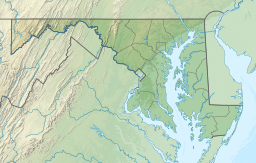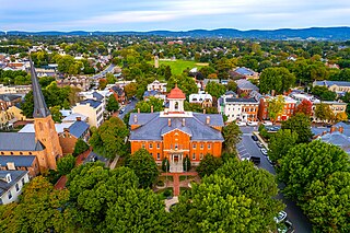
Frederick is a city in and the county seat of Frederick County, Maryland, United States. It is located at an important crossroads at the intersection of a major north–south Native American trail and east–west routes to the Chesapeake Bay, both at Baltimore and what became Washington, D.C., and across the Appalachian mountains to the Ohio River watershed. Frederick's population was 78,171 people as of the 2020 census, making it the second-largest incorporated city in Maryland behind Baltimore. It is a part of the Washington metropolitan area, which is part of a greater Washington–Baltimore combined statistical area.

Stormwater, also written storm water, is water that originates from precipitation (storm), including heavy rain and meltwater from hail and snow. Stormwater can soak into the soil (infiltrate) and become groundwater, be stored on depressed land surface in ponds and puddles, evaporate back into the atmosphere, or contribute to surface runoff. Most runoff is conveyed directly as surface water to nearby streams, rivers or other large water bodies without treatment.

The Red Cedar River is a tributary of the Grand River in central Michigan in the United States. The river is approximately 51.1 miles (82.2 km) long and drains a watershed of approximately 461 square miles (1,190 km2) in the Lansing–East Lansing metropolitan area and suburban and rural areas to the east. The river flows through the campus of Michigan State University, and is considered a cultural symbol of the school, including being mentioned in the school's fight song.

The Anacostia River is a river in the Mid Atlantic region of the United States. It flows from Prince George's County in Maryland into Washington, D.C., where it joins with the Washington Channel and ultimately empties into the Potomac River at Buzzard Point. It is about 8.7 miles (14.0 km) long. The name "Anacostia" derives from the area's early history as Nacotchtank, a settlement of Necostan or Anacostan Native Americans on the banks of the Anacostia River.

The Nooksack River is a river in western Whatcom County of the northwestern U.S. state of Washington, draining extensive valley systems within the North Cascades around Mount Shuksan, Mount Baker and the Twin Sisters, and a portion of Fraser Lowland south of the Canada–United States border.

Rock Creek is a tributary of the Potomac River, in the United States, that empties into the Atlantic Ocean via the Chesapeake Bay. The 32.6-mile (52.5 km) creek drains about 76.5 square miles (198 km2). Its final quarter-mile is affected by tides.

Seneca Creek State Park is a public recreation area encompassing more than 6,300 acres (2,500 ha) along 14 miles of Seneca Creek in its run to the Potomac River in Montgomery County, Maryland. The park features facilities for boating and fishing as well as trails for hiking, cycling, and horseback riding. It is managed by the Maryland Department of Natural Resources.

Lake Ella is a lake in central Tallahassee, Florida on US 27 just south of Tharpe Street, and just north of Downtown. Lake Ella has an area of 12 acres and a perimeter 0.6 miles. Once used for cattle, it now has three fountains and is used for recreation, flood protection, and stormwater pollution control.

The Stormwater Management And Road Tunnel, E38, is a storm drainage and road structure in Kuala Lumpur, Malaysia, and a major national project in the country. The 9.7 km (6.0 mi) tunnel is the longest stormwater drainage tunnel in Southeast Asia and second longest in Asia.

Surface runoff is the unconfined flow of water over the ground surface, in contrast to channel runoff. It occurs when excess rainwater, stormwater, meltwater, or other sources, can no longer sufficiently rapidly infiltrate in the soil. This can occur when the soil is saturated by water to its full capacity, and the rain arrives more quickly than the soil can absorb it. Surface runoff often occurs because impervious areas do not allow water to soak into the ground. Furthermore, runoff can occur either through natural or human-made processes.
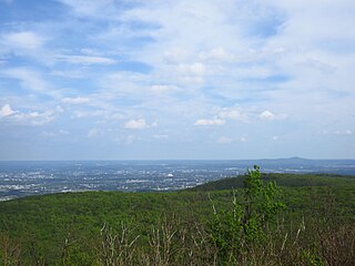
Gambrill State Park is a public recreation area located on Catoctin Mountain near the city of Frederick in Frederick County, Maryland. The state park is known for the dramatic views of the surrounding area that can be seen from stone overlooks built in the 1930s by the Civilian Conservation Corps. The park is operated by the Maryland Department of Natural Resources.

Barrie Ciliberti is an American professor and politician. He is a professor at the University of Maryland University College and current Republican legislator in the Maryland House of Delegates, representing District 4. He previously represented District 39 in the House of Delegates from 1995 to 1999.

Fountain Creek is a creek that originates in Woodland Park in Teller County and flows through El Paso County to its confluence with the Arkansas River near Pueblo in Pueblo County, Colorado. The 74.5-mile-long (119.9 km) creek, once known as the Fontaine qui Bouille, is a tributary of the Arkansas River.
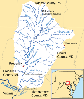
Linganore Creek is a 13.5-mile-long (21.7 km) tributary of the Monocacy River in Frederick County, Maryland. The stream is formed from the confluence of the north and south forks of the Linganore, about 10 miles (16 km) east-northeast of the city of Frederick. The creek runs roughly southwest to the Monocacy River, which drains to the Potomac River. The watershed area of the creek is 83.1 square miles (215 km2). High water in the creek can result in flooding of Gas House Pike, an east–west road running between Monocacy Boulevard and Green Valley Road.

Centennial Lake is a man-made 54-acre (220,000 m2) reservoir, in a 325-acre (1.32 km2) park in Howard County, Maryland, near Columbia, Maryland and Clarksville, known as Centennial Park. It was created by damming the Centennial Branch of the Little Patuxent River. The lake and the park feature a dam, a wildlife area, a walking trail, boating, fishing, and other recreational activities. The park is owned by the Howard County Department of Recreation and Parks.

Lake Kittamaqundi is a man made 27-acre (110,000 m2) reservoir located in Columbia, Maryland in the vicinity of the Mall in Columbia as well as Merriweather Post Pavilion. It is also adjacent to offices and visible from US-29.

Greenbrier State Park is a public recreation area located on South Mountain, three miles (4.8 km) northeast of Boonsboro in Washington County, Maryland, USA. The state park has camping, hiking trails, and a 42-acre (17 ha) man-made lake. It is managed by the Maryland Department of Natural Resources.

Amazon Creek is a stream that runs through southeastern and western Eugene, Oregon, United States. It is a tributary of the Long Tom River and is Eugene's second-largest waterway after the Willamette River.

Kenneth P. Kerr is a Democratic member of the Maryland House of Delegates. He represents District 3B, which covers parts of Frederick County. He was previously a member of the Frederick County Board of Education from 2016 to 2018.