Related Research Articles

Girouxville is a village in northern Alberta, Canada. It is located 58 kilometres (36 mi) south of the Town of Peace River.

Kneehill County is a municipal district in central Alberta, Canada within Census Division No. 5.

Lac Ste. Anne County is a municipal district in central Alberta, Canada.

Cadomin is a hamlet in the west-central Alberta, Canada within Yellowhead County. It is located along the McLeod River in the foothills of the Rocky Mountains, approximately 50 kilometres (31 mi) south of Hinton near the Bighorn Highway. It is served by a spur of the Canadian National Railway.

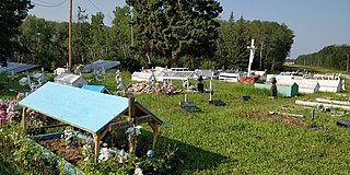
Calais is an unincorporated community in northern Alberta, on the south shore of Sturgeon Lake, surrounded by the Sturgeon Lake Cree Nation in the Municipal District of Greenview No. 16. It is located 0.5 kilometres (0.31 mi) north of Highway 43, 83 kilometres (52 mi) east of Grande Prairie.
Driftpile is a community on the Drift Pile River 150 Indian reserve, in northern Alberta, Canada. It is located on Highway 2, approximately 191 kilometres (119 mi) east of Grande Prairie.
Finnegan is an unincorporated community in southern Alberta in Special Area No. 2, located 14 kilometres (8.7 mi) west of Highway 36, 64 kilometres (40 mi) northwest of Brooks.
Child Lake 164A is an Indian reserve of the Beaver First Nation in Alberta, located within Mackenzie County. It is 32 kilometers northwest of Fort Vermilion. The reserve takes its name from a nearby lake where a child once drowned.

Horse Lakes 152B is an Indian reserve of the Horse Lake First Nation in Alberta. It is 60 km (37 mi) northwest of Grande Prairie at an elevation of 774 m (2,539 ft).

Janvier 194 is an Indian reserve of the Chipewyan Prairie First Nation in Alberta, Canada that is surrounded by the Regional Municipality of Wood Buffalo. It is 97 km (60 mi) southwest of Fort McMurray.
Sturgeon Lake 154 is an Indian reserve of the Sturgeon Lake Cree Nation in northern Alberta, Canada that is surrounded by the Municipal District of Greenview No. 16. It is 85 km (53 mi) east of the City of Grande Prairie at an elevation of 700 m (2,300 ft).
Goodwin is a locality in Alberta, Canada.
Behan is a locality in Alberta, Canada.
Decrene is a locality in Alberta, Canada. It is located northwest of the Hamlet of Smith and is sparsely inhabited.
Furman is a locality in Alberta, Canada.
Clouston Creek is a stream in Alberta, Canada.
Griffin Creek is a stream in Alberta, Canada.

Sturgeon Lake 154A is an Indian reserve of the Sturgeon Lake Cree Nation in Alberta, located within the Municipal District of Greenview No. 16. It is 45 kilometres southwest of High Prairie. In the 2016 Canadian Census, it recorded a population of 53 living in 15 of its 16 total private dwellings.
References
- ↑ "Culp". Geographical Names Data Base . Natural Resources Canada.
- ↑ Place-names of Alberta. Ottawa: Geographic Board of Canada. 1928. p. 40.
55°45′00″N117°32′09″W / 55.75008°N 117.53595°W
| | This Northern Alberta location article is a stub. You can help Wikipedia by expanding it. |