Related Research Articles

Amapá is one of the 26 states of Brazil. It is in the northern region of Brazil. It is the second least populous state and the eighteenth largest by area. Located in the far northern part of the country, Amapá is bordered clockwise by French Guiana to the north, the Atlantic Ocean to the east, Pará to the south and west, and Suriname to the northwest. The capital and largest city is Macapá. The state has 0.4% of the Brazilian population and is responsible for only 0.22% of the Brazilian GDP.

Macapá is a city in Brazil with a population of 512,902. It is the capital of Amapá state in the country's North Region. It is located on the northern channel of the Amazon River near its mouth on the Atlantic Ocean. The city is on a small plateau on the Amazon in the southeast of the state of Amapá. The only access by road from outside the province is from the overseas French department of French Guiana, although there are regular ferries to Belem, Brazil. Macapá is linked by road with some other cities in Amapá. The equator runs through the middle of the city, leading residents to refer to Macapá as "The capital of the middle of the world." It covers 6,407.12 square kilometres (2,473.80 sq mi) and is located northwest of the large inland island of Marajó and south of the border with French Guiana.
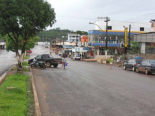
Oiapoque is a municipality in the north of the state of Amapá, Brazil. Its population is 27,906 and its area is 22,625 square kilometres (8,736 sq mi). Oiapoque is also a major river in the same state, forming the international border with French Guiana. The Oyapock River Bridge, connecting the village with Saint-Georges in French Guiana, was completed in 2011 but not opened to pedestrian or vehicle traffic until 2017.
Guarijuba River is a river of Amapá state in Brazil. It is a tributary of the Amazon River.
Jupati River is a river of Amapá state in Brazil. It is a tributary of the Amazon River.
Macacoari River is a river of Amapá state in Brazil. It is a tributary of the Amazon River.

Amapá Grande River is a river of Amapá state in eastern Brazil.

Amapari River is a river of Amapá state in north-eastern Brazil.

Aporema River is a river of Amapá state in north-eastern Brazil.
Calçoene River is a river of Amapá state in north-eastern Brazil.
Camaipi River do Maracá River is a river of Amapá state in north-eastern Brazil.
Cupixi River is a river of Amapá state in north-eastern Brazil.
Inipaco River is a river of Amapá state in north-eastern Brazil.
Mutura River is a river of Amapá state in north-eastern Brazil.
Tacunapi River is a river of Amapá state in north-eastern Brazil.
Tartarugal Grande River is a river of Amapá state in north-eastern Brazil.
Tartarugalzinho River is a river of Amapá state in north-eastern Brazil.

The Franco-Brazilian Binational Bridge spans the Oyapock River, linking the cities of Oiapoque in Amapá, Brazil and Saint-Georges-de-l'Oyapock in French Guiana, France. The bridge is cable-stayed, with two towers rising to a height of 83 metres (272 ft) and a length of 378 metres (1,240 ft). There are two lanes for vehicles with a total width of 9 metres (30 ft) and a pedestrian sidewalk with a width of 2.50 metres. The vertical clearance under the bridge is 15 metres (49 ft).

Blue River is an unincorporated community in Polk Township, Washington County, in the U.S. state of Indiana.

The Karipuna do Amapá are an indigenous people located in the riverine areas of the Brazilian state of Amapá, particularly around the Caripi River. In 2014, the population was estimated at 2,922 people.
References
Coordinates: 2°48′38″N50°56′22″W / 2.81056°N 50.93944°W