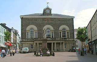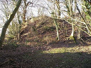
Carmarthenshire is a county in the south-west of Wales. The three largest towns are Llanelli, Carmarthen and Ammanford. Carmarthen is the county town and administrative centre. The county is known as the "Garden of Wales" and is also home to the National Botanic Garden of Wales.

Carmarthen is the county town of Carmarthenshire and a community in Wales, lying on the River Towy 8 miles (13 km) north of its estuary in Carmarthen Bay. The population was 14,185 in 2011, down from 15,854 in 2001, but gauged at 16,285 in 2019. It has a claim to be the oldest town in Wales – Old Carmarthen and New Carmarthen became one borough in 1546. It was the most populous borough in Wales in the 16th–18th centuries, described by William Camden as "chief citie of the country". Growth stagnated by the mid-19th century as new settlements developed in the South Wales Coalfield.

Tintern is a village in the community of Wye Valley, on the west bank of the River Wye in Monmouthshire, Wales, close to the border with England, about 5 miles (8.0 km) north of Chepstow. It is popular with tourists, in particular for the scenery and the ruined Tintern Abbey. Modern Tintern has been formed through the coalescence of two historic villages; Tintern Parva, forming the northern end of the village, and Chapel Hill, which forms the southern end. The village is designated as a Conservation Area.

Gorseinon is a town within the City and County of Swansea, Wales, near the Loughor estuary. It was a small village until the late 19th century when it grew around the coal mining and tinplate industries. It is situated in the north west of Swansea City Centre, around 6 miles (10 km) north west of the city centre. Gorseinon is a local government community with an elected town council.

Devil's Bridge is a village and community in Ceredigion, Wales. Above the River Mynach on the edge of the village is the unusual road bridge from which the village gets its English name.

South Wales is a loosely defined region of Wales bordered by England to the east and mid Wales to the north. Generally considered to include the historic counties of Glamorgan and Monmouthshire, south Wales extends westwards to include Carmarthenshire and Pembrokeshire. In the western extent, from Swansea westwards, local people would probably recognise that they lived in both south Wales and west Wales. The Brecon Beacons National Park covers about a third of south Wales, containing Pen y Fan, the highest British mountain south of Cadair Idris in Snowdonia.

Llanfynydd is a village, parish and community in Carmarthenshire, Wales. The community population at the 2011 census was 499. It lies some 10 miles north-east of the county town, Carmarthen. Bordering it are the communities of Llansawel, Talley, Manordeilo and Salem, Llangathen, Llanegwad and Llanfihangel Rhos-y-Corn, all in Carmarthenshire.

Ystrad Mynach is a town in the Caerphilly County Borough, within the ancient county of Glamorgan, Wales, and is 5 mi (8.0 km) north of the town of Caerphilly. The urban area has a population of 19,204, and stands in the Rhymney Valley. Before the Industrial Revolution and the coming of coal mining in the South Wales Coalfield the valley was rural and farmed. It lies in the community of Gelligaer.

Llanddowror is a village and community in Carmarthenshire, Wales situated 2 miles (3 km) from St. Clears. Previously on the trunk road to Pembroke Dock, the village is small, historic and relatively unspoilt.

Carew is a village, parish and community on an inlet of Milford Haven in the former Hundred of Narberth, Pembrokeshire, West Wales, 4 miles (6.4 km) east of Pembroke. The eastern part of the parish is in the Pembrokeshire Coast National Park.
Llangolman is a village and parish in the southeastern Preseli Hills in Pembrokeshire, Wales. It is part of the community of Mynachlog-ddu. There are prehistoric remains nearby and the parish has a history of slate and clay quarrying.
Bynea is a village close to the River Loughor in Carmarthenshire, Wales. It also forms an electoral ward for the purposes of elections to Carmarthenshire County Council, and is situated in Berwig Hamlet. It borders with the villages of Llwynhendy, Bryn, Pen-y-graig and Loughor.
Cilymaenllwyd is a community on the extreme northwest of Carmarthenshire in Wales. The community population at the 2011 census was 742. It lies about 25 miles (40 km) west of Carmarthen, 12 miles (19 km) southeast of Fishguard and 15 miles (24 km) northeast of Haverfordwest. The A478 road runs through the community.

The Afon Mynach is a small river in Ceredigion, Wales.
Henllanfallteg is a community in the west of Carmarthenshire, Wales. It comprises the villages of Cwmfelin Boeth, Henllan Amgoed, Hiraeth, Llanfallteg, and Rhydywrach. The community population taken at the 2011 census was 480.

Llangynog is a village and community located in Carmarthenshire, Wales, the main settlement of which was once called ‘Ebenezer’village. It is bordered by the communities of: Newchurch and Merthyr; Carmarthen; Llangain; Llansteffan; Laugharne Township; and St Clears, all being in Carmarthenshire. The population at the 2011 census was 492.
Monkswood is a village in Monmouthshire, south east Wales, United Kingdom.

Pentrecwrt is a village in north Carmarthenshire, Wales on the A486 road halfway between Carmarthen and New Quay.
Seion, Cwmaman is a Welsh Baptist church, originally established in 1859. The chapel closed in 2013 but the church still meets at another location in the village.

Mydroilyn is a village in the parish of Llanarth, Ceredigion, Wales, situated along the B4342 road.


