Fredriksskans is a stadium in Kalmar, Sweden that is Kalmar SK:s home arena.

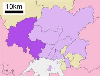
Saeki-ku (佐伯区) is one of the eight wards of the city of Hiroshima, Japan.
Hương Thủy is a County-level town of Thừa Thiên–Huế Province in the North Central Coast region of Vietnam. As of 2010 the town had a population of 93,680. The town covers an area of 458.1749 km².
Zieleniec is a village in the administrative district of Gmina Bądkowo, within Aleksandrów County, Kuyavian-Pomeranian Voivodeship, in north-central Poland.

Brzoza is a village in the administrative district of Gmina Wielka Nieszawka, within Toruń County, Kuyavian-Pomeranian Voivodeship, in north-central Poland. It lies approximately 13 kilometres (8 mi) east of Wielka Nieszawka and 10 km (6 mi) south-east of Toruń.
Brzozowo is a village in the administrative district of Gmina Dąbrowa Białostocka, within Sokółka County, Podlaskie Voivodeship, in north-eastern Poland.

Zadnoga is a village in the administrative district of Gmina Krynice, within Tomaszów Lubelski County, Lublin Voivodeship, in eastern Poland. It lies approximately 2 kilometres (1 mi) west of Krynice, 16 km (10 mi) north of Tomaszów Lubelski, and 93 km (58 mi) south-east of the regional capital Lublin.

Falniów is a village in the administrative district of Gmina Miechów, within Miechów County, Lesser Poland Voivodeship, in southern Poland. It lies approximately 5 kilometres (3 mi) west of Miechów and 34 km (21 mi) north of the regional capital Kraków.

Słupów is a village in the administrative district of Gmina Słaboszów, within Miechów County, Lesser Poland Voivodeship, in southern Poland. It lies approximately 4 kilometres (2 mi) south-east of Słaboszów, 20 km (12 mi) east of Miechów, and 43 km (27 mi) north-east of the regional capital Kraków.

Zagajów is a village in the administrative district of Gmina Solec-Zdrój, within Busko County, Świętokrzyskie Voivodeship, in south-central Poland. It lies approximately 4 kilometres (2 mi) west of Solec-Zdrój, 15 km (9 mi) south-east of Busko-Zdrój, and 60 km (37 mi) south of the regional capital Kielce.

Śmiłów is a village in the administrative district of Gmina Ożarów, within Opatów County, Świętokrzyskie Voivodeship, in south-central Poland. It lies approximately 7 kilometres (4 mi) south of Ożarów, 19 km (12 mi) east of Opatów, and 76 km (47 mi) east of the regional capital Kielce.

Wojsławice is a village in the administrative district of Gmina Gózd, within Radom County, Masovian Voivodeship, in east-central Poland. It lies approximately 8 kilometres (5 mi) west of Gózd, 12 km (7 mi) east of Radom, and 98 km (61 mi) south of Warsaw.

Nadma is a village in the administrative district of Gmina Radzymin, within Wołomin County, Masovian Voivodeship, in east-central Poland. It lies approximately 7 kilometres (4 mi) south of Radzymin, 5 km (3 mi) west of Wołomin, and 20 km (12 mi) north-east of Warsaw.

Pożarowo is a village in the administrative district of Gmina Wronki, within Szamotuły County, Greater Poland Voivodeship, in west-central Poland. It lies approximately 8 kilometres (5 mi) west of Wronki, 24 km (15 mi) north-west of Szamotuły, and 55 km (34 mi) north-west of the regional capital Poznań.
Mieczysławowo is a village in the administrative district of Gmina Dominowo, within Środa Wielkopolska County, Greater Poland Voivodeship, in west-central Poland.
Na Górze is a settlement in the administrative district of Gmina Lipnica, within Bytów County, Pomeranian Voivodeship, in northern Poland.

Szopa is a village in the administrative district of Gmina Sierakowice, within Kartuzy County, Pomeranian Voivodeship, in northern Poland. It lies approximately 6 kilometres (4 mi) east of Sierakowice, 16 km (10 mi) west of Kartuzy, and 43 km (27 mi) west of the regional capital Gdańsk. There is a small school in Szopa. Students learn three languages - English, German and Kashubian.

Działki is a settlement in the administrative district of Gmina Kętrzyn, within Kętrzyn County, Warmian-Masurian Voivodeship, in northern Poland. It lies approximately 3 kilometres (2 mi) north-west of Kętrzyn and 67 km (42 mi) north-east of the regional capital Olsztyn.
Kolonia Chojnice is a former settlement in the administrative district of Gmina Mirosławiec, within Wałcz County, West Pomeranian Voivodeship, in north-western Poland.
Kaarma-Kungla is a village in Saaremaa Parish, Saare County in western Estonia.


