
Huntington Beach is a seaside city in Orange County in Southern California, United States. The city is named after American businessman Henry E. Huntington. The population was 198,711 during the 2020 census, making it the fourth most populous city in Orange County, the most populous beach city in Orange County, and the seventh most populous city in the Los Angeles-Long Beach-Anaheim, CA Metropolitan Statistical Area. Located 35 miles (56 km) southeast of Downtown Los Angeles, it is bordered by Bolsa Chica Basin State Marine Conservation Area on the west, the Pacific Ocean on the southwest, by Seal Beach on the northwest, by Westminster on the north, by Fountain Valley on the northeast, by Costa Mesa on the east, and by Newport Beach on the southeast.

Live in Maui, 1970
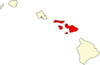
Maui County, officially the County of Maui, is a county in the U.S. state of Hawaii. It consists of the islands of Maui, Lānaʻi, Molokaʻi, Kahoʻolawe, and Molokini. The latter two are uninhabited. As of the 2020 census, the population was 164,754. The county seat is Wailuku.

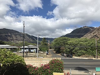
Māʻili is a census-designated place (CDP) in the Waiʻanae District on the island of Oʻahu, City & County of Honolulu, Hawaiʻi, United States. In Hawaiian, māʻili means "pebbly", referring to rounded stones at the shore. Māʻili is located along Farrington Highway on Oʻahu's Leeward Coast, between Māʻili Beach Park to the west and Lualualei Valley to the east. It is located 1.4 miles south of the town of Waianae, separated by the Māʻiliʻili Stream, and 1.5 miles north of Nanakuli. As of the 2020 census, the town population was 11,535. Māʻili has one 7-Eleven, a gas station, and a few residential developments. The town is also home to several dairy farms and vegetable plots. Two tall, red antennae near the mouth of the Lualualei Valley are parts of the Navcom Radio Transmitting Facility, and were the tallest man-made structures in the Western Hemisphere at 1,503 feet when they were built in 1972. The town has an elevation of 20 feet (6.1 m).
Mākaha is a census-designated place (CDP) in Honolulu County, Hawaiʻi, United States. It is a town located along the Pacific coast, west of the Mākaha Valley, and at the foot of Mt. Ka'ala in the Wai’anae Mountain Range. It is the last of the leeward towns on O'ahu. North of Mākaha there is no development, i.e. no towns, no gas stations, or restaurants. The population of Mākaha was 8,278 at the 2010 census. It is located 35 miles northwest of Honolulu, but is a part of Honolulu County.
Kaanapali is a planned resort community in Maui County, Hawaii, United States, on the island of Maui located in the Old Hawaii ahupuaa of Hanakaʻōʻō, as in the same name of the southern end of Kaanapali Beach's Hanakaʻōʻō Canoe Beach. The population was 1,161 at the 2020 census. For statistical purposes, the United States Census Bureau has defined Kaanapali as a census-designated place (CDP).

Kapalua is a census-designated place (CDP) in Maui County, Hawaiʻi, United States. A resort development by the Maui Land & Pineapple Company extends inland from Kapalua Bay and Honolua Bay. The population was 495 at the 2020 census.

Napili-Honokowai is a census-designated place (CDP) in Maui County, Hawaii, United States. The population was 7,042 at the 2020 census.

Laird John Hamilton, né Zerfas, is an American big-wave surfer, co-inventor of tow-in surfing, and an occasional fashion and action-sports model and actor. He is married to Gabrielle Reece, a former professional volleyball player, television personality, and model.

Henry Alexander Baldwin or Harry Alexander Baldwin was a sugarcane plantation manager, and politician who served as Congressional Delegate to the United States House of Representatives representing the Territory of Hawaii. He was one of the earliest leaders of the Hawaii Republican Party.

Edward Ryon Makuahanai Aikau was a Hawaiian lifeguard and surfer. As the first lifeguard at Waimea Bay on the island of Oahu, he saved over 500 people and became famous for surfing the big Hawaiian surf, winning several awards including the 1977 Duke Kahanamoku Invitational Surfing Championship. The Eddie Aikau Big Wave Invitational is named in his honor. He was also a crew member on the Polynesian voyaging canoe Hōkūleʻa.

Black's Beach is a secluded section of beach beneath the bluffs of Torrey Pines on the Pacific Ocean in La Jolla, San Diego, California, United States. It is officially part of Torrey Pines State Beach. The northern portion of Black's Beach is owned and managed by the California Department of Parks and Recreation, while the southern portion of the beach, officially known as Torrey Pines City Beach, is jointly owned by the city of San Diego and the state park, but is managed by the city of San Diego. This distinction is important as Black's Beach is most known as a nude beach, a practice that is now prohibited in the southern portion managed by the city of San Diego.

Hoʻokipa is a beach on the north shore of Maui, Hawaii, United States, perhaps the most renowned windsurfing site in the world. A combination of large, well-shaped waves breaking across a system of reefs that extend across the bay and consistently strong winds make it ideal for the sport.
Sunset Beach is on the North Shore of Oahu in Hawaii and known for big wave surfing during the winter season. The original Hawaiian name for this place is Paumalū. It is a two-mile stretch of mostly beige sand located at 59-104 Kamehameha Highway in Pupukea, 39 miles driving distance from Waikiki. Lifeguards are usually present.

Peʻahi is a place on the north shore of the island of Maui in the U.S. state of Hawaii. It has lent its name to a big wave surfing break, also known as Jaws.

Honolua Bay, Mokuleʻia Bay and Lipoa Point are part of an area known as the ahupuaʻa of Honolua, located just north of Kapalua, West Maui in Maui County, Hawaiʻi, United States. The area is a mix of agricultural and conservation land tended by the Maui Land & Pineapple Company in Lahaina, Hawaiʻi, including coastline management. Honolua Bay and Mokuleʻia Bay comprise the 45-acre (18 ha) Honolua-Mokuleʻia Marine Life Conservation District.

Old Kona Airport State Recreation Area is a park built on the site of an old landing strip just north of Kailua, Hawaii County, Hawaii.

Kapalua Resort is a golf and beach resort in Kapalua, Hawaii on the northwest shore of the island of Maui near Lahaina, Hawaii. It is owned by Maui Land & Pineapple Company.

There are 75 golf courses in Hawaii.

Slaughterhouse Beach or "Mokuleʻia Beach," is a sand beach in Maui. It is located off of Rte. 30 in Mokuleʻia Bay, directly east of Fleming Beach and directly west of Honolua Bay. The beach is a part of the Honolua-Mokuleʻia Bay Marine Life Conservation District.
