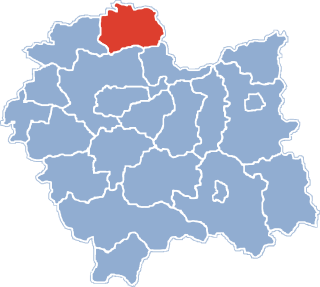
Racławice is a village located in Lesser Poland Voivodeship in southern Poland. It became famous after the victorious Battle of Racławice (1794) in the Kościuszko Uprising. It is the seat of a municipality within Miechów County. It lies approximately 15 kilometres (9 mi) east of Miechów and 37 km (23 mi) north-east of the regional capital Kraków.
Gmina Słaboszów is a rural gmina in Miechów County, Lesser Poland Voivodeship, in southern Poland. Its seat is the village of Słaboszów, which lies approximately 18 kilometres (11 mi) east of Miechów and 44 km (27 mi) north-east of the regional capital Kraków.
Dosłońce is a village in the administrative district of Gmina Racławice, within Miechów County, Lesser Poland Voivodeship, in southern Poland. It lies approximately 2 kilometres (1 mi) north of Racławice, 14 km (9 mi) east of Miechów, and 38 km (24 mi) north-east of the regional capital Kraków.
Dziemięrzyce is a village in the administrative district of Gmina Racławice, within Miechów County, Lesser Poland Voivodeship, in southern Poland. It lies approximately 4 kilometres (2 mi) south-west of Racławice, 15 km (9 mi) south-east of Miechów, and 34 km (21 mi) north-east of the regional capital Kraków.
Głupczów is a village in the administrative district of Gmina Racławice, within Miechów County, Lesser Poland Voivodeship, in southern Poland. It lies approximately 4 kilometres (2 mi) south-east of Racławice, 19 km (12 mi) east of Miechów, and 38 km (24 mi) north-east of the regional capital Kraków.
Górka Kościejowska is a village in the administrative district of Gmina Racławice, within Miechów County, Lesser Poland Voivodeship, in southern Poland. It lies approximately 3 kilometres (2 mi) south-east of Racławice, 17 km (11 mi) east of Miechów, and 36 km (22 mi) north-east of the regional capital Kraków.
Góry Miechowskie is a village in the administrative district of Gmina Racławice, within Miechów County, Lesser Poland Voivodeship, in southern Poland. It lies approximately 5 kilometres (3 mi) north-west of Racławice, 11 km (7 mi) east of Miechów, and 38 km (24 mi) north-east of the regional capital Kraków.
Janowiczki is a village in the administrative district of Gmina Racławice, within Miechów County, Lesser Poland Voivodeship, in southern Poland. It lies approximately 2 kilometres (1 mi) south of Racławice, 16 km (10 mi) east of Miechów, and 36 km (22 mi) north-east of the regional capital Kraków.
Klonów is a village in the administrative district of Gmina Racławice, within Miechów County, Lesser Poland Voivodeship, in southern Poland. It lies approximately 4 kilometres (2 mi) west of Racławice, 11 km (7 mi) east of Miechów, and 36 km (22 mi) north-east of the regional capital Kraków.
Kościejów is a village in the administrative district of Gmina Racławice, within Miechów County, Lesser Poland Voivodeship, in southern Poland. It lies approximately 4 kilometres (2 mi) east of Racławice, 18 km (11 mi) east of Miechów, and 39 km (24 mi) north-east of the regional capital Kraków.
Marchocice is a village in the administrative district of Gmina Racławice, within Miechów County, Lesser Poland Voivodeship, in southern Poland. It lies approximately 4 kilometres (2 mi) west of Racławice, 12 km (7 mi) east of Miechów, and 35 km (22 mi) north-east of the regional capital Kraków.
Miroszów is a village in the administrative district of Gmina Racławice, within Miechów County, Lesser Poland Voivodeship, in southern Poland. It lies approximately 4 kilometres (2 mi) north-east of Racławice, 18 km (11 mi) east of Miechów, and 40 km (25 mi) north-east of the regional capital Kraków.
Makocice is a village in the administrative district of Gmina Proszowice, within Proszowice County, Lesser Poland Voivodeship, in southern Poland. It lies approximately 4 kilometres (2 mi) north-west of Proszowice and 30 km (19 mi) north-east of the regional capital Kraków.
Teresin is a village in the administrative district of Gmina Proszowice, within Proszowice County, Lesser Poland Voivodeship, in southern Poland. It lies approximately 5 kilometres (3 mi) north-east of Proszowice and 35 km (22 mi) north-east of the regional capital Kraków.
Łyszkowice is a village in the administrative district of Gmina Koniusza, within Proszowice County, Lesser Poland Voivodeship, in southern Poland. It lies approximately 3 kilometres (2 mi) south-west of Koniusza, 7 km (4 mi) west of Proszowice, and 25 km (16 mi) north-east of the regional capital Kraków.
Muniaczkowice is a village in the administrative district of Gmina Koniusza, within Proszowice County, Lesser Poland Voivodeship, in southern Poland. It lies approximately 4 kilometres (2 mi) north-west of Koniusza, 8 km (5 mi) west of Proszowice, and 26 km (16 mi) north-east of the regional capital Kraków.

Niegardów is a village in the administrative district of Gmina Koniusza, within Proszowice County, Lesser Poland Voivodeship, in southern Poland. It lies approximately 5 kilometres (3 mi) north-west of Koniusza, 9 km (6 mi) west of Proszowice, and 25 km (16 mi) north-east of the regional capital Kraków.
Rzędowice is a village in the administrative district of Gmina Koniusza, within Proszowice County, Lesser Poland Voivodeship, in southern Poland. It lies approximately 3 kilometres (2 mi) north-east of Koniusza, 5 km (3 mi) north-west of Proszowice, and 29 km (18 mi) north-east of the regional capital Kraków.
Młodzieszynek is a village in the administrative district of Gmina Młodzieszyn, within Sochaczew County, Masovian Voivodeship, in east-central Poland. It lies approximately 6 kilometres (4 mi) north of Młodzieszyn, 14 km (9 mi) north of Sochaczew, and 56 km (35 mi) west of Warsaw.