Damoe-Ra Park

Last updated

Damoe-Ra Park
Damoe Ra Pathway Darwin P5271413.jpg
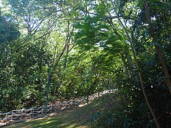
Steps to the Esplanade from Damoe-Ra Park
Damoe-Ra Park
Location Darwin, Northern Territory
Coordinates 12°28′01.5″S130°50′31.5″E / 12.467083°S 130.842083°E / -12.467083; 130.842083 Coordinates: 12°28′01.5″S130°50′31.5″E / 12.467083°S 130.842083°E / -12.467083; 130.842083 [1]
Designated20 March 1996 [1]

Damoe-Ra Park is an urban park in Darwin, the Northern Territory, designated in 1996. [1] The park was named Damoe-Ra because the park includes a spring [2] sacred to the Larrakia women, [1] and Damoe-Ra is the Larrakia word meaning "eye" or "spring". [1] The park is situated below the escarpment on the coast below the Parliament House. [2] The garden itself, together with its memorial pathway, plaques, and mosaic honours the women of the Northern Territory. [3] [4]

Amongst the women honoured are some who had been awarded a Tribute to Northern Territory Award : [5]

2006 Olive Pink
Emma Tantengco
Djapirri Mununggirritj
Nellie Camfoo
Jessie Litchfield
2005 Nancy Giese
Sylvia Wolf
Helena Rioli
Janie Mason
Margery Harris
2004Lana Quall
Joyce Chin
Olive Veverbrants
Philomena Hali
Norma Grant
Poppy Secrett
Barbara Cummings
Helen Liddy
Fele Mann
2003 Barbara James
Lily Ah Toy
Mayse Young
Eileen Fitzer
Natalie Harwood
Dawn Lawrie
Phoebe Farrar
Jose Petrick
Phoebe Doreen Lee
Eileen Cummings
Cynthia Molina
Cristina Black

Related Research Articles

Darwin, Northern Territory Capital of the Northern Territory, Australia

Darwin is the capital city of the Northern Territory, Australia. The city is known as Garramilla to the Traditional Owners of the area, the Larrakia people, a word which refers to the white stone found in the area. With an estimated population of 147,255 as of 2019, the city contains the majority of the residents of the sparsely-populated Northern Territory.

Northern Territory Federal territory of Australia

The Northern Territory is an Australian territory in the central and central northern regions of Australia. Northern Territory shares its borders with Western Australia to the west, South Australia to the south, and Queensland to the east. To the north, the territory looks out to the Timor Sea, the Arafura Sea and the Gulf of Carpentaria, including Western New Guinea and other islands of the Indonesian archipelago.

Finke Gorge National Park Protected area in the Northern Territory, Australia

Finke Gorge National Park is a protected area in the Northern Territory of Australia located about 1,318 kilometres (819 mi) south of the territory capital of Darwin. The national park covers an area of 458 km2 (177 sq mi), and includes the impressive desert oasis Palm Valley, home to a diverse range of plant species, many of which are rare and unique to the area. There are good opportunities for bushwalking and bushcamping in the national park.

Alice Springs Town in the Northern Territory, Australia

Alice Springs is the third-largest town in the Northern Territory of Australia. Known as Stuart until 31 August 1933, the name Alice Springs was given by surveyor William Whitfield Mills after Alice, Lady Todd, wife of the telegraph pioneer Sir Charles Todd. Now colloquially known as The Alice or simply Alice, the town is situated roughly in Australia's geographic centre. It is nearly equidistant from Adelaide and Darwin.

Crime in the Northern Territory

Crime in the Northern Territory is managed by the Northern Territory Police, the territory government's Department of the Attorney-General and Justice and Territory Families.

Mataranka, Northern Territory Town in the Northern Territory, Australia

Mataranka is a town and locality in the Northern Territory of Australia located about 420 km (260 mi.) southeast of the territory capital of Darwin, and 107 km (66 mi.) south of Katherine. At the 2016 census, Mataranka recorded a population of 350. 29.5% of residents are Aboriginal and/or Torres Strait Islander.

Larrakeyah Suburb of Darwin, the Northern Territory, Australia

Larrakeyah is an inner suburb of Darwin, the capital city of Australia's Northern Territory.

Litchfield Municipality Local government area in the Northern Territory, Australia

The Litchfield Council is a local government area of the Northern Territory of Australia on the eastern and southeastern outskirts of the Darwin-Palmerston urban area. The municipality covers an area of 2,903 square kilometres (1,120.9 sq mi), and was created by the Northern Territory government on 6 September 1985.

Larrakia people

The Larrakia people are an Aboriginal Australian people in and around Darwin in the Northern Territory. The Larrakia, who refer to themselves as "Saltwater People", had a vibrant traditional society based on a close relationship with the sea and trade with neighbouring groups such as the Tiwi, Wadjiginy and Djerimanga. These groups shared ceremonies and songlines, and intermarried.

Tiwi, Northern Territory Suburb of Darwin, the Northern Territory, Australia

Tiwi is a northern suburb of the city of Darwin, Northern Territory, Australia. The suburb is bounded by Trower Road, Henbury Avenue and a coastal strip, separating Casuarina Beach and Lee Point Beach. It is in the Local Government Area of City of Darwin. It is home to Dripstone Middle School.

Sport in the Northern Territory

Many sports are played in the Northern Territory of Australia.

First Nations Radio, formerly, Radio Larrakia, is an Aboriginal Australian community radio station in Darwin, Northern Territory with a broadcast range that reaches Jabiru.

Leanyer, Northern Territory Suburb of Darwin, the Northern Territory, Australia

Leanyer is a northern suburb of Darwin, in the Northern Territory of Australia.

Howard Springs, Northern Territory Suburb of Darwin, the Northern Territory, Australia

Howard Springs is a locality in the Northern Territory of Australia. It is 29 kilometres (18 mi) SE of the Darwin CBD. Its local government area is the Litchfield Municipality. The suburb is mostly a rural area, but has been experiencing strong growth in population and development. From 2020, it has housed a major quarantine facility.

Elliott, Northern Territory Town in the Northern Territory, Australia

Elliott is a town in Northern Territory of Australia. It is almost halfway between Darwin and Alice Springs on the Stuart Highway. The town is in the Yapurkulangu ward of the Barkly Region. The area is the home of the Jingili people and the traditional name of the town is Kulumindini. At the 2016 census, Elliott had a population of 339.

Black Jungle Conservation Reserve Protected area in the Northern Territory, Australia

The Black Jungle Conservation Reserve is a protected area in the Northern Territory of Australia near the territorial capital of Darwin. The rural area of Darwin and its development has a contrasting history to the more southern regions and their rural zones. The development of the rural area around Darwin occurred after 1950 as agricultural ventures were trialed. Prior to this the area was tropical savanna with pockets of monsoon rainforest and melaleuca swamps, unchanged for thousands of years, except by the traditional Aboriginal owners of the land who hunted and gathered and managed the landscape with fire. Black Jungle Conservation Reserve is a part of the Adelaide River Coastal Floodplain system which encompasses Black Jungle and Lambells Lagoon Conservation Reserves, Fogg Dam, Leaning Tree Lagoon Nature Park, Melacca Swamp and Djukbinj National Park. These Reserves encompass a range of wetland types and form part of the internationally significant Adelaide River floodplain.

Bagot Community the Northern Territory, Australia

Bagot Community is an Aboriginal community in the Northern Territory of Australia located in Ludmilla, a northern suburb of the city of Darwin. It was established in 1938 as the Bagot Aboriginal Reserve, when the Aboriginal residents were moved from the Kahlin Compound, it was also sometimes referred to as the Bagot Road Aboriginal Reserve.

Vernon Islands

Vernon Islands, also known as the Potinga Islands, is an island group in the Northern Territory of Australia located in the Clarence Strait about 55 kilometres (34 mi) north-east of the territory capital of Darwin. The group consists of three islands which were first sighted in 1818 by Europeans on a British navy ship under the command of Phillip Parker King. The group were part of the subject of a successful aboriginal land claim which was resolved after 40 years in 2018 when the Tiwi people received title. All three islands host navigation aids which assist vessels passing through the Clarence Strait. It and some adjoining seabed have had protected area status since 1974 and which has been known as the Vernon Islands Conservation Reserve since 1979. Since 2007, the island group have been located in the locality of Vernon Islands.

Hardy Aviation (N.T.) Pty Ltd, is an air charter company based at Darwin International Airport in Darwin, Northern Territory, Australia. It operates air charter services. Its main base is Darwin International Airport.

The COVID-19 pandemic in the Northern Territory is part of the ongoing worldwide pandemic of the coronavirus disease 2019 caused by severe acute respiratory syndrome coronavirus 2.

References

  1. 1 2 3 4 5 "NT Place Names Register: Damoe-Ra Park". NT Place Names Register. Retrieved 7 July 2021.
  2. 1 2 "Damoe Ra Park". www.handr.com.au. Retrieved 6 July 2021.
  3. "Darwin city | Dameo Ra Walk Path in CBD Darwin | tropical Darwin the capital of Northern Territory Australia". www.tropicaldarwin.com. Retrieved 6 July 2021.
  4. "Tribute to Northern Territory Women | Monument Australia". monumentaustralia.org.au. Retrieved 6 July 2021.
  5. Government, Northern Territory (17 June 2021). "Territory Women archives". tfhc.nt.gov.au. Retrieved 10 August 2021.