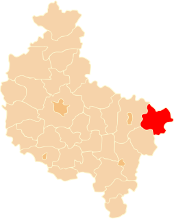
Cichmiana is a village in the administrative district of Gmina Dąbie, within Koło County, Greater Poland Voivodeship, in west-central Poland. It lies approximately 3 kilometres (2 mi) west of Dąbie, 17 km (11 mi) south-east of Koło, and 133 km (83 mi) east of the regional capital Poznań.
Ochle is a village in the administrative district of Gmina Koło, within Koło County, Greater Poland Voivodeship, in west-central Poland. It lies approximately 3 kilometres (2 mi) north-west of Koło and 117 km (73 mi) east of the regional capital Poznań.
Dąbrowice is a village in the administrative district of Gmina Kościelec, within Koło County, Greater Poland Voivodeship, in west-central Poland. It lies approximately 5 kilometres (3 mi) west of Kościelec, 10 km (6 mi) west of Koło, and 111 km (69 mi) east of the regional capital Poznań.
Dąbrowice Częściowe is a village in the administrative district of Gmina Kościelec, within Koło County, Greater Poland Voivodeship, in west-central Poland. It lies approximately 7 kilometres (4 mi) south-west of Kościelec, 12 km (7 mi) south-west of Koło, and 112 km (70 mi) east of the regional capital Poznań.
Dobrów is a village in the administrative district of Gmina Kościelec, within Koło County, Greater Poland Voivodeship, in west-central Poland. It lies approximately 10 kilometres (6 mi) east of Kościelec, 10 km (6 mi) south of Koło, and 120 km (75 mi) east of the regional capital Poznań.
Gąsiorów is a village in the administrative district of Gmina Kościelec, within Koło County, Greater Poland Voivodeship, in west-central Poland. It lies approximately 4 kilometres (2 mi) north-west of Kościelec, 7 km (4 mi) west of Koło, and 113 km (70 mi) east of the regional capital Poznań.
Gozdów is a village in the administrative district of Gmina Kościelec, within Koło County, Greater Poland Voivodeship, in west-central Poland. It lies approximately 3 kilometres (2 mi) north-east of Kościelec, 3 km (2 mi) south-west of Koło, and 118 km (73 mi) east of the regional capital Poznań.
Kościelec is a village in Koło County, Greater Poland Voivodeship, in west-central Poland. It is the seat of the gmina called Gmina Kościelec. It lies approximately 6 kilometres (4 mi) south-west of Koło and 116 km (72 mi) east of the regional capital Poznań.
Łęka is a village in the administrative district of Gmina Kościelec, within Koło County, Greater Poland Voivodeship, in west-central Poland. It lies approximately 8 kilometres (5 mi) southeast of Kościelec, 10 km (6 mi) south of Koło, and 122 km (76 mi) east of the regional capital Poznań.
Police Mostowe is a village in the administrative district of Gmina Kościelec, within Koło County, Greater Poland Voivodeship, in west-central Poland. It lies approximately 8 kilometres (5 mi) south-east of Kościelec, 8 km (5 mi) south of Koło, and 122 km (76 mi) east of the regional capital Poznań.
Police Średnie is a village in the administrative district of Gmina Kościelec, within Koło County, Greater Poland Voivodeship, in west-central Poland. It lies approximately 5 kilometres (3 mi) south-east of Kościelec, 6 kilometres (4 mi) south of Koło, and 120 kilometres (75 mi) east of the regional capital Poznań.
Ruszków Drugi is a village in the administrative district of Gmina Kościelec, within Koło County, Greater Poland Voivodeship, in west-central Poland. It lies approximately 5 kilometres (3 mi) east of Kościelec, 4 km (2 mi) south of Koło, and 120 km (75 mi) east of the regional capital Poznań.
Ruszków Pierwszy is a village in the administrative district of Gmina Kościelec, within Koło County, Greater Poland Voivodeship, in west-central Poland. It lies approximately 6 kilometres (4 mi) south-east of Kościelec, 6 km (4 mi) south of Koło, and 121 km (75 mi) east of the regional capital Poznań.
Trzęśniew is a village in the administrative district of Gmina Kościelec, within Koło County, Greater Poland Voivodeship, in west-central Poland. Trzęśniew lies approximately 6 kilometres (4 mi) north-west of Kościelec, 10 km (6 mi) west of Koło, and 111 km (69 mi) east of the regional capital Poznań.
Trzęśniew Mały is a village in the administrative district of Gmina Kościelec, within Koło County, Greater Poland Voivodeship, in west-central Poland. It lies approximately 5 kilometres (3 mi) west of Kościelec, 9 km (6 mi) west of Koło, and 112 km (70 mi) east of the regional capital Poznań.
Tury is a village in the administrative district of Gmina Kościelec, within Koło County, Greater Poland Voivodeship, in west-central Poland. It lies approximately 8 kilometres (5 mi) west of Kościelec, 12 km (7 mi) west of Koło, and 108 km (67 mi) east of the regional capital Poznań.
Ostrów is a village in the administrative district of Gmina Olszówka, within Koło County, Greater Poland Voivodeship, in west-central Poland. It lies approximately 14 kilometres (9 mi) south-east of Koło and 133 km (83 mi) east of the regional capital Poznań.
Złota is a village in the administrative district of Gmina Olszówka, within Koło County, Greater Poland Voivodeship, in west-central Poland. It lies approximately 4 kilometres (2 mi) north of Olszówka, 14 km (9 mi) east of Koło, and 133 km (83 mi) east of the regional capital Poznań.
Waki is a village in the administrative district of Gmina Kościelec, within Koło County, Greater Poland Voivodeship, in west-central Poland. It lies approximately 6 kilometres (4 mi) north-west of Kościelec, 10 km (6 mi) west of Koło, and 111 km (69 mi) east of the regional capital Poznań.