
Wollongong is a city located in the Illawarra region of New South Wales, Australia. The name is believed to originate from the Dharawal language, meaning either 'five islands/clouds', 'ground near water' or 'sound of the sea'. Wollongong lies on the narrow coastal strip between the Illawarra Escarpment and the Pacific Ocean, 85 kilometres south of central Sydney. Wollongong had an estimated urban population of 302,739 at June 2018, making it the third-largest city in New South Wales after Sydney and Newcastle and the tenth-largest city in Australia by population. The city's current Lord Mayor is Tania Brown who was elected in 2024.

Liverpool is a suburb of South Western Sydney, in the state of New South Wales, Australia, 31 kilometres (19 mi) south-west of the Sydney CBD. It is the administrative seat of the City of Liverpool and is in the Cumberland Plain.

Homebush is a suburb in the Inner West of Sydney in the state of New South Wales, Australia. It is located 12 kilometres west of the Sydney central business district, in the local government area of the Municipality of Strathfield.

Arncliffe is a suburb in southern Sydney, in the state of New South Wales, Australia. Arncliffe is located 11 kilometres south of the Sydney central business district, in the local government area of the Bayside Council.

Port Macquarie is a town on the Mid North Coast of New South Wales, Australia, 390 km (242 mi) north of Sydney, and 570 km (354 mi) south of Brisbane, on the Tasman Sea coast at the mouth of the Hastings River, and the eastern end of the Oxley Highway (B56). It had a population of 47,974 in 2018, and an estimated population of 50,307 in 2023.
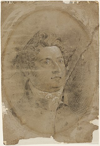
Francis Howard Greenway was an English-born architect who was transported to Australia as a convict for the alleged crime of forgery. He became known as the ‘forefather of Australian architecture’. In New South Wales he worked for the Governor, Lachlan Macquarie, as Australia's first government architect. He became widely known and admired for his work displayed in buildings such as St Matthew's Church, St James' Church and Hyde Park Barracks.

Kogarah is a suburb of Southern Sydney, in the state of New South Wales, Australia. Kogarah is located 14 kilometres south-west of the Sydney central business district and is considered to be the centre of the St George area.
Rockdale is a suburb in southern Sydney, in the state of New South Wales, Australia. Rockdale is located 13 kilometres south of the Sydney central business district and is part of the St George area. Rockdale is one of the administrative centres for the local government area of the Bayside Council. Since 1985 Rockdale has been a twinned city with Bitola, in the Republic of Macedonia.

Rockdale railway station is a heritage-listed railway station located on the Illawarra line, serving the Sydney suburb of Rockdale in Bayside Council. It is served by Sydney Trains' T4 Eastern Suburbs & Illawarra Line services. It was added to the New South Wales State Heritage Register on 2 April 1999.
Wilberforce is a small town in New South Wales, Australia, in the local government area of the City of Hawkesbury. It is just beyond the outer suburbs of north-west Sydney and lies on the western bank of the Hawkesbury River.

Moss Vale is a town in the Southern Highlands of New South Wales, Australia, in the Wingecarribee Shire. It is located on the Illawarra Highway, which connects to Wollongong and the Illawarra coast via Macquarie Pass.

The City of Shellharbour is a local government area in the Illawarra region of New South Wales, Australia. The city is located about 100 kilometres (62 mi) south of Sydney and covers the southern suburbs of the Wollongong urban area centred on Shellharbour and it had an estimated population of 68,460 at the 2016 census.

The Gladesville Mental Hospital, formerly known as the Tarban Creek Lunatic Asylum, was a psychiatric hospital established in 1838 in the Sydney suburb of Gladesville. The hospital officially closed in 1993, with the last inpatient services ceasing in 1997.
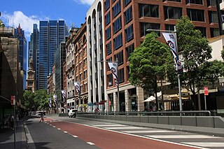
York Street is a street in the Sydney central business district in New South Wales, Australia. York Street runs 1.050 kilometres (0.652 mi) in a north to south direction only.

The Dubbo rail bridge over Macquarie River – Wambuul is a heritage-listed railway bridge on the Main Western line across the Macquarie River, located west of the Dubbo central business district in New South Wales, Australia. It was designed by John Whitton as the Engineer-in-Chief for the New South Wales Government Railways. The bridge was built during 1884 by Benjamin Barnes, with ironwork by Cochrane & Co, Middlesborough, England. The railway bridge is also known as the Dubbo Lattice Railway Bridge. The property is owned by Transport Asset Holding Entity, an agency of the Government of New South Wales. The bridge was added to the New South Wales State Heritage Register on 2 April 1999 and was listed on the Register of the National Estate on 18 April 1989.

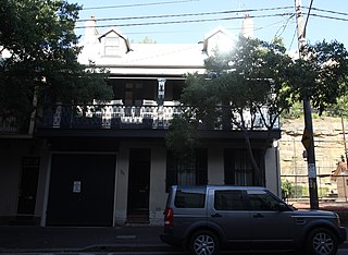
Lydham Hall is a state heritage-listed former rural residence at 18 Lydham Avenue, Rockdale in New South Wales, Australia. The house is currently used as a local museum holding a collection of furniture and objects dated from the 1860s. Run by the St George Historical Society, it is opened to the public on the first Sunday of every month.

St Matthew's Anglican Church is a heritage-listed Anglican church building located at Moses Street, Windsor, City of Hawkesbury, New South Wales, Australia. It was designed by Francis Greenway and built from 1817 by convict labour. The property is owned by the Anglican Church Property Trust. It was added to the New South Wales State Heritage Register on 2 April 1999.
Toxteth is a heritage-listed residence located at 94 Kent Street, in the inner city Sydney suburb of Millers Point, New South Wales, Australia. It was added to the New South Wales State Heritage Register on 2 April 1999.

Greek café culture in Australia is part of the shared history of Greece and Australia. For unskilled penniless Greek migrants, it was a pathway to success in which they created community hubs where Australians socialised. Greek cafés are also a singularly Australian phenomenon: the success of Arthur Comino’s fish shop in Sydney gave rise to a chain migration that saw hundreds of Greek migrants open oyster saloons across the country by 1900. Adapting to market changes and food trends, Greek proprietors went on to run fish shops, fruit shops, ice cream parlours, sundae shops, milk bars, snack bars, confectioneries, and cafés that dotted the Australian landscape for much of the twentieth century.
Greek cafés were a significant cultural phenomenon in the history of Queensland, Australia, arising from a chain migration from Greece to Australia.


