The Thuringian Forest, is a mountain range in the southern parts of the German state of Thuringia, running northwest to southeast between the valley of the river Werra near Eisenach and the Thuringian-Vogtlandian Slate Mountains. The geographical boundary with the latter range follows approximately a line from Gehren via Großbreitenbach to Schönbrunn near Schleusingen, defined by the rivers Schleuse and Neubrunn on the southwestern slope, and Talwasser, Wohlrose and Möhre on the northeastern slope.

The Taunus is a mountain range in Hesse, Germany located north of Frankfurt. The tallest peak in the range is Großer Feldberg at 878 m; other notable peaks are Kleiner Feldberg and Altkönig.

The Kitzbühel Alps are a mountain range of the Central Eastern Alps surrounding the town of Kitzbühel in Tyrol, Austria. Geologically they are part of the western slate zone.
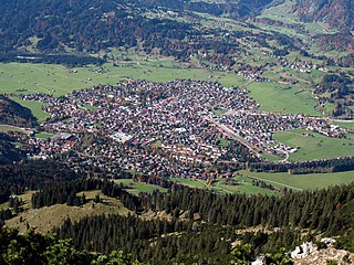
Oberstdorf is a municipality and skiing and hiking town in southwest Germany, located in the Allgäu region of the Bavarian Alps. Oberstdorf is one of the highest market towns in Germany. The southernmost point in Germany is located in the municipality and it is the southernmost settlement in both Bavaria, and in Germany overall.
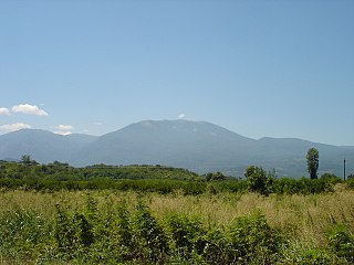
The Vermio Mountains, the ancient Bermion, is a mountain range in northern Greece. It lies between the Imathia Regional Unit of the Central Macedonia Region and the Kozani Regional Unit of the Western Macedonia Region. The range is west of the plain of Kambania. The town of Veria, which is the capital of Imathia, is built οn the foot of these mountains. The highest point in the range is the peak Chamiti, 2,065 metres (6,775 ft) elevation, west of Naousa.

The Uri Alps are a mountain range in Central Switzerland and part of the Western Alps. They extend into the cantons of Obwalden, Valais, Bern, Uri and Nidwalden and are bordered by the Bernese Alps and the Emmental Alps to the west, the Schwyzer Alps to the north, the Lepontine Alps to the south and the Glarus Alps to the east (Reuss).
The Berchtesgaden Alps are a mountain range of the Northern Limestone Alps, named after the market town of Berchtesgaden located in the centre. The central part belongs to the Berchtesgadener Land district of southeastern Bavaria, Germany, while the adjacent area in the north, east and south is part of the Austrian state of Salzburg.

The Seekopf is a mountain on the main chain of the Northern Black Forest in Germany between the Upper Rhine Plain and the Murg valley, above Seebach. It is 1,054.2 m above sea level (NHN) and lies on the boundary of the counties of Ortenaukreis and Freudenstadt in the state of Baden-Württemberg.
Kleiner Daumen is a mountain of Bavaria, Germany.
Großer Seekopf is a mountain of Bavaria, Germany.
Kleiner Seekopf is a mountain of Bavaria, Germany.

The Lofer Mountains or Loferer Mountains are a mountain range in the Northern Limestone Alps in the Eastern Alps of central Europe. They are located in Austria in the federal states of Tyrol and Salzburg. The Lofers are separated from the Leogang Mountains to the southeast by a 1,202 m high saddle known as the Römersattel.
Mount Seekopf is a peak surmounting the east side of Lake Ober-See in the Gruber Mountains of Queen Maud Land. Discovered and given the descriptive name Seekopf by the German Antarctic Expedition, 1938–39, under Ritscher.

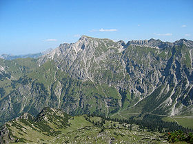
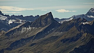
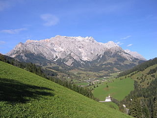
The Großer Beil, is a 2,309 m (AA) high mountain at the head of the Wildschönau valley in the Austrian state of Tyrol. It belongs to the Kitzbühel Alps and is the highest summit on the ridge that separates the Wildschönau from the neighbouring valley of the Alpbach to the west. Around 500 metres north is the 2,189 m high Seekopf and a further 500 metres beyond that is the Kleine Beil at 2,197 m. The next mountain to the south is the 2,216 m high Gressenstein. On the other side of the valley is the Wildkarspitze.
Hüttenkopf is the name of following mountains and mountain peaks:

The Seekopf is a mountain, 1,001.1 m above sea level (NHN), near Forbach in the Northern Black Forest between the Badener Höhe and the Schwarzenbach Reservoir. Over the Seekopf runs the West Way, the best known hiking trail in the Black Forest. On the very thinly wooded summit there is a monument to Phillipp Bussemer, a member of the Black Forest Club who died in 1918.
Seekopf is German for “lake head” or “lake peak” and may refer to the following mountains: