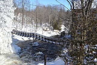
The Saint Pierre River is a tributary of the Mascouche River, flowing in the southwest of Quebec, in Canada. This river crosses administrative regions:
The Salvail River is a tributary of the Yamaska River. It flows northeast through the municipalities of La Présentation, Saint-Jude and Saint-Louis in the Les Maskoutains Regional County Municipality (MRC), in the administrative region of Montérégie, on the South Shore of Saint Lawrence River, in Quebec, Canada.
The Lac Bouchette is a fresh water body located in the municipality of Lac-Bouchette, in the MRC Le Domaine-du-Roy Regional County Municipality, in the administrative region Saguenay–Lac-Saint-Jean, in Quebec, in Canada. The main vocation of the lake relates to recreational and tourist activities, in an agricultural environment.
The Saint-Louis river is a tributary of the Yamaska River, through the Petit Chenail. This river flows northeast in the municipalities of Saint-Aimé and Yamaska in the Pierre-De Saurel Regional County Municipality, in the administrative region of Montérégie, on the South Shore of the St. Lawrence River, in the province of Quebec, Canada.
The Rivière du Sud is a tributary of the Richelieu River, flowing successively in the municipalities of Saint-Alexandre, Saint-Sébastien, Clarenceville and Henryville, in the Le Haut-Richelieu Regional County Municipality, in Montérégie, on the south shore of Fleuve Saint-Laurent, in province of Quebec, in Canada.

The Missisquoi North River is a tributary of the Missisquoi River. The Missisquoi North River flows through the municipalities of Eastman, Stukely-Sud, Saint-Étienne-de-Bolton, Bolton-Est, Mansonville and Potton, in the Memphrémagog Regional County Municipality, in the administrative region of Estrie, in Quebec, in Canada.
The Rivière Pot au Beurre is a tributary of the Yamaska River. It flows northeast through the municipalities of Sainte-Victoire-de-Sorel, Sorel-Tracy and Yamaska in the Pierre-De Saurel Regional County Municipality (MRC), in the administrative region of Montérégie, on the South Shore of Saint Lawrence River, in Quebec, Canada.
The rivière le Renne is a tributary of the Yamaska River, which flows in the municipalities of Maricourt, Sainte-Christine, Acton Vale, Saint-Nazaire-d'Acton, of Saint-Théodore-d'Acton, in the Acton Regional County Municipality (MRC), on the South Shore of the Saint Lawrence River, in Estrie, in Quebec, Canada.
The Chibouet river is a tributary of the Yamaska River. It flows north-east in the municipalities of Saint-Nazaire-d'Acton, Sainte-Hélène-de-Bagot and Saint-Hugues in the Les Maskoutains Regional County Municipality (MRC), in the administrative region of Montérégie, on the South Shore of Saint Lawrence River, in Quebec, Canada.
The Yamaska Southeast river is a tributary of the Yamaska River. It flows in the Brome-Missisquoi Regional County Municipality (MRC), in the administrative region of Montérégie, on the South Shore of the Saint Lawrence River, in Quebec, Canada. Its course to the northwest crosses the municipalities of: Sutton, Cowansville, Brigham and Farnham.
The Duncan River is a tributary of the rivière le Renne, which flows in the municipalities of Saint-Germain-de-Grantham, Saint-Nazaire-d'Acton, Saint-Théodore-d'Acton and Upton, in the Acton Regional County Municipality (MRC), in Montérégie, on the South Shore of the Saint Lawrence River, in Quebec, Canada.

The Ulverton River is a tributary of the Saint-François River, flowing on the South Shore of the Saint-Laurent river, in the administrative region of Estrie, in Quebec, Canada.
The Saint-Germain River is a tributary of the Saint-François River. It flows in Drummond Regional County Municipality (MRC), north-west in the administrative region of Centre-du-Québec, on the South Shore of the Saint Lawrence River, in Quebec, Canada. This river crosses the municipalities of: l'Avenir, Durham-Sud, Lefebvre, Wickham, Saint-Germain-de-Grantham and Drummondville.
The rivière aux Vaches is a tributary of the Saint-François River. It flows northwest in the administrative region of Centre-du-Québec, on the South Shore of the Saint Lawrence River, in Quebec, Canada, crossing the municipalities of:

The Moe River is a watercourse flowing in the administrative region of Estrie to Quebec, Canada. It is a tributary of the rivière aux Saumons which successively flows into the Massawippi River, into the Saint-François River, therefore a sub-tributary of the Saint Lawrence River.
The Petite rivière Pot au Beurre is a tributary of the rivière Pot au Beurre. It flows north into the municipalities of Saint-Robert and Yamaska in the Pierre-De Saurel Regional County Municipality (MRC), in the administrative region of Montérégie, on the South Shore of the St. Lawrence River, in Quebec, Canada.
The Lemoine river is a tributary of the rivière Pot au Beurre. It generally flows north-west in the municipalities of Saint-Louis and Sainte-Victoire, in the administrative region of Montérégie, on the South Shore of St. Lawrence River, in Quebec, Canada.
The Saint-Zéphirin River is a tributary on the west bank of the Nicolet Southwest River. It crosses the municipalities of Sainte-Brigitte-des-Saults, Saint-Zéphirin-de-Courval and La Visitation-de-Yamaska, in the Nicolet-Yamaska Regional County Municipality (MRC), in the administrative region of Centre-du-Québec, in Quebec, in Canada.
The Gentilly South-West River is a tributary of the Gentilly River which flows on the south shore of the St. Lawrence River.

The rivière de la Grande Coudée is a tributary of the west bank of the Chaudière River which flows northward to empty onto the south bank of the St. Lawrence River. It flows in the municipalities of Saint-Hilaire-de-Dorset, Saint-Gédéon-de-Beauce and Saint-Martin, in the Beauce-Sartigan Regional County Municipality, in the administrative region of Chaudière-Appalaches, in Quebec, in Canada.


