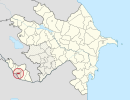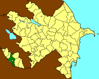
Babek or Babak is a rayon of Azerbaijan in the Nakhchivan Autonomous Republic. It was formerly known as Nakhchivan District. The district named in honour of Babak Khorramdin, who led a 23-year-long uprising against the Abbasid Caliphate in Iranian Azerbaijan.
Şərur is the capital town and most populous municipality of Sharur Rayon in Nakhchivan Autonomous Republic of Azerbaijan. It is located 66 km in the north-west from the Nakhchivan city, on the Sharur plain. It has a population of 6,964 people.

Nəsirvaz formerly Mesropavan is a village in the Ordubad Rayon of Nakhchivan, Azerbaijan. In the municipality of Bist village, it is located near the Ordubad-Nurgut highway, to the north-west of the district center, on the foothill. It has a population of 157.
Əliabad is a settlement and municipality in Nakhchivan City, Nakhchivan, Azerbaijan. It is located in the near of the Nakhchivan-Sharur highway, on the plain. Its population is busy with grain-growing, vegetable-growing and animal husbandry. There are secondary school, music school, library, club, kindergarten and a medical center in the settlement. In the center of the settlement was built the memorial complex of "Martyrs". It has a population of 9,495.
Xalxal is a village and municipality in the Babek Rayon of Nakhchivan, Azerbaijan. It is located 19 km in the north from the district center, on the left bank of the Nakhchivanchay River, on the foothill area. Its population is busy with gardening, grain-growing, poultry and animal husbandry. There are secondary school, library, club, mosque and a medical center in the village. It has a population of 568.

Şahtaxtı is a village and municipality in the Kangarli Rayon of Nakhchivan, Azerbaijan. The village is located in the Sharur plain, 4.5 km south-west from the regional center. Its population is busy with farming and animal husbandry. There are secondary school, kindergarten, cultural house and a medical center in the village. It has a population of 3,100. The medieval monuments of Cinlidere is located in the south-west of the village, but in the west, at the Givrag plateau, is located Shahbaghy.
Xanlıqlar is a village and municipality in the Sharur Rayon of Nakhchivan, Azerbaijan. It is located 8 km in the south-east from the district center, on the Sharur plain. Its population is busy with vine-growing and animal husbandry. There are grape processing factory, secondary school, club, library and a medical center in the village. It has a population of 2,091. There exist a sanctuary named "Imamzade" in the village.
Dərəkənd is a village and municipality in the Sharur District of Nakhchivan Autonomous Republic, Azerbaijan. It is located in the near of the Nakhchivan-Sharur highway, 10 km in the south-east from the district center, on the Sharur plain. Its population is mainly busy with animal husbandry. There are secondary school, library, club and a medical center in the village. It has a population of 1,216.
Aşağı Yaycı is a village and municipality in the Sharur District of Nakhchivan Autonomous Republic, Azerbaijan. It is located 16 km in the north-east from the district center, on the left bank of the Arpachay River, on the slope of the Daralayaz range. Its population is busy with farming and animal husbandry. There are secondary school, library, cultural house and hospital in the village. It has a population of 1,462. The settlement of Qız qalası of the Bronze and early Iron Ages is located in the south-west of the village, on the slope of the mountain range.
Kərimbəyli is a village and municipality in the Sharur District of Nakhchivan Autonomous Republic, Azerbaijan. It is located 9 km in the north-west from the district center, on the bank of the Araz River. Its population is busy with farming and animal husbandry. There are secondary school, library, club and a medical center in the village. It has a population of 1,744.
İbadulla is a village and municipality in the Sharur District of Nakhchivan Autonomous Republic, Azerbaijan. It is located 10 km in the south from the district center, on the bank of the Arpachay River, on the plain. Its population is busy with farming and animal husbandry. There are secondary school, library, club and a medical center in the village. It has a population of 1,365. The Şortəpə settlement of the Bronze Age has been found in the area.
Tənənəm is a village and municipality in the Sharur Rayon of Nakhchivan, Azerbaijan. It is located in the 9 km of the Nakhchivan-Sadarak highway, 24 km away from the district center, on the Sharur plain. Its population is busy with farming and animal husbandry. There are secondary school, club, library, kindergarten and a medical center in the village. It has a population of 761.
Yuxarı Aralıq is a village and municipality in the Sharur District of Nakhchivan Autonomous Republic, Azerbaijan. It is located 420 km in the south-east from the district center, on the right bank of the Arpachay River. Its population is busy with gardening, vegetable-growing and animal husbandry. There are secondary school, music school, cultural house, kindergarten, mosque and a medical center in the village. It has a population of 1,074.
Danyeri is a municipality and village in the Sharur District of Nakhchivan Autonomous Republic, Azerbaijan. It is located in the near of the Nakhchivan-Sadarak highway, 15 km in the south-east from the district center, on the plain. Its population is busy with farming and animal husbandry. There are secondary school, 3 clubs, library, kindergarten and a medical center in the village. It has a population of 2,874.
Aşağı Aralıq is a municipality and village in the Sharur District of Nakhchivan Autonomous Republic, Azerbaijan. It is located 5 km in the south-east from the district center, on the right bank of the Arpachay River, in the near of the international railway of Azerbaijan Republic. Its population is busy with gardening, vegetable-growing and animal husbandry. There are secondary school, club and a medical center in the village. It has a population of 953. The villages of district and the city of Nakhchivan are being provided with drinking water from the quality drinking water source of its territory.
Xətai is a municipality and village in the Sharur Rayon of Nakhchivan, Azerbaijan. It is located 14 km away from the district center, on the plain. Its population is busy with farming and animal husbandry. There are secondary school, library and a medical center in the village. It has a population of 376.
Başbaşı is a settlement in the municipality of Nakhchivan in Nakhchivan City, Nakhchivan Autonomous Republic, Azerbaijan. It is located 12 km in the south-west from the Nakhchivan city, on the bank of the Araz River. The station in the railway line of the Baku-Nakhchivan. It was founded during the construction of the railway line (1908) of the Ulukhanlu - Julfa. It has not permanent population. The salt which have got out from the salt mine of Nakhchivan, were brought to the station of Bashbashi via cable. At present, the station is used as a meeting point of the trains. There is a terminal. The settlement covers an area of 3.2 hectares.
Qarağalıq is a settlement in the municipality of Nakhchivan in Nakhchivan City, Nakhchivan Autonomous Republic, Azerbaijan. It is located 7 km in the south-west from the city center, on the bank of the Araz River. The station in the railway line of the Baku-Nakhchivan. It was founded during the construction of the railway line (1908) of the Ulukhanlu - Julfa. It has not permanent population. At present, the station is used as a meeting point of the trains. There is a terminal.

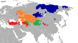
Baran Duz is a village in Baranduz Rural District, in the Central District of Urmia County, West Azerbaijan Province, Iran. At the 2006 census, its population was 834, in 224 families.