Related Research Articles

Sheridan County is a county in the U.S. state of Wyoming. As of the 2020 United States Census, the population was 30,921. The county seat is Sheridan. Its northern boundary abuts the Montana state border.

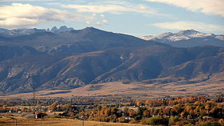
Park County is a county in the U.S. state of Wyoming. As of the 2020 United States Census, the population was 29,624. The county seat is Cody.

Hot Springs County is a county in the U.S. state of Wyoming. As of the 2020 United States Census, the population was 4,696, making it the second-least populous county in Wyoming. Its county seat is Thermopolis. The county is named for the hot springs located in Hot Springs State Park.

Fremont County is a county in the U.S. state of Wyoming. As of the 2020 United States census, the population was 39,234, making it the fifth-most populous county in Wyoming. Its county seat is Lander. The county was founded in 1884 and is named for John C. Frémont, a general, explorer, and politician. It is roughly the size of the state of Vermont.

Crook County is a county in the northeastern corner of the U.S. state of Wyoming. As of the 2020 United States Census, the population was 7,181, making it the third-least populous county in Wyoming. Its county seat and largest city is Sundance. The county is located at the northwestern extreme of the Black Hills, which are its defining geographical feature.
Sheridan is a city in the U.S. state of Wyoming and the county seat of Sheridan County. The city is located halfway between Yellowstone Park and Mount Rushmore by U.S. Route 14 and 16. It is the principal town of the Sheridan, Wyoming, Micropolitan Statistical Area which encompasses all of Sheridan County. The 2020 census put the city's population at 18,737, making it the 6th most populous city in Wyoming.

The Little Bighorn River is a 138-mile-long (222 km) tributary of the Bighorn River in the United States in the states of Montana and Wyoming. The Battle of the Little Bighorn, also known as the Battle of the Greasy Grass, was fought on its banks on June 25–26, 1876, as well as the Battle of Crow Agency in 1887.

The Gallatin River is a tributary of the Missouri River, approximately 120 mi (193 km) long, in the U.S. states of Wyoming and Montana. It is one of three rivers, along with the Jefferson and Madison, that converge near Three Forks, Montana, to form the Missouri.

Crazy Woman Creek is a creek in the United States, in Johnson County, Wyoming.

Timothy John Fitzgerald McCoy was an American actor, military officer, and expert on American Indian life. McCoy is most noted for his roles in B-grade Western films. As a popular cowboy film star, he had his picture on the front of a Wheaties cereal box.
Meshoppen Creek is a tributary of the Susquehanna River in Susquehanna and Wyoming counties, Pennsylvania, in the United States. It is approximately 30.6 miles (49.2 km) long and flows through Bridgewater Township, Dimock Township, and Springville Township in Susquehanna County and Lemon Township, Washington Township, Meshoppen Township, and Meshoppen in Wyoming County. The watershed of the creek has an area of 114 square miles (300 km2). It is possible to canoe on 17.0 miles (27.4 km) of Meshoppen Creek.

Sand Creek is a stream noted for the "most spectacular examples of cross-bedded sandstone and topple blocks in North America". Sand Creek flows from the Laramie Mountains in Larimer County, Colorado into Albany County, Wyoming where it joins the Laramie River.
Clark is a community located approximately 30 miles (50 km) north of Cody on Wyoming Highway 120, in Park County, Wyoming, United States. Clark is unincorporated, and has no specific central "town site" per se, or town services. It is included in the Powell Zip Code area, which is approximately 30 miles (50 km) away, but has no other formal connection to Powell except the school district.

The Nez Perce native Americans fled through Yellowstone National Park between August 20 and Sept 7, during the Nez Perce War in 1877. As the U.S. army pursued the Nez Perce through the park, a number of hostile and sometimes deadly encounters between park visitors and the Indians occurred. Eventually, the army's pursuit forced the Nez Perce off the Yellowstone plateau and into forces arrayed to capture or destroy them when they emerged from the mountains of Yellowstone onto the valley of Clark's Fork of the Yellowstone River.
Blackwater Natural Bridge is a natural arch in Shoshone National Forest, Wyoming. The arch is located along a ridge at an elevation of 10,777 feet (3,285 m) and is a little over .50 mi (0.80 km) southwest of Coxcomb Mountain. Blackwater Natural Bridge is to the east of the headwaters of Blackwater Creek, which flows north to the North Fork Shoshone River. No official determination of the height or span of the arch has been completed and the estimated size of the arch varies greatly. The non-profit Natural Arch and Bridge Society states that the arch is anywhere from 70 to 100 feet while other sources claim that it may be one of the largest in the world, with a span of 240 ft (73 m), a height of 280 ft (85 m) and with rock thickness of the arch at 32 ft (9.8 m).

Redwater Creek is a stream in the U.S. states of South Dakota and Wyoming.
References
- ↑ U.S. Geological Survey Geographic Names Information System: Dead Indian Creek (Wyoming)
- ↑ Parent, Laurence (1997). Scenic Driving Wyoming. Globe Pequot Press. p. 33. ISBN 978-1-56044-536-4.
- ↑ Besser, Brook (March 2010). Wyoming Road Trip by the Mile Marker: Travel/Vacation Guide to Yellowstone, Grand Teton, Devils Tower, Oregon Trail, Camping, Hiking, Tourism, More... NightBlaze Books. p. 190. ISBN 978-0-9844093-0-3.
44°45′8.69″N109°25′8.01″W / 44.7524139°N 109.4188917°W
| | This article related to a river in Wyoming is a stub. You can help Wikipedia by expanding it. |