Related Research Articles

Amber Valley is a local government district with borough status in the east of Derbyshire, England, taking its name from the River Amber. Its council is based in Ripley. The district covers a semi-rural area lying to the north of the city of Derby. The district contains four main towns whose economy was based on coal mining and remains to some extent influenced by engineering, distribution and manufacturing, holding for instance the headquarters and production site of Thorntons confectionery.

Derbyshire Dales is a local government district in Derbyshire, England. The population at the 2011 Census was 71,116. Much of it is in the Peak District, although most of its population lies along the River Derwent.

The Hope Valley is a rural area centred on the village of Hope, Derbyshire, in the Peak District in the northern Midlands of England.

The River Darwen runs through Darwen and Blackburn in Lancashire, England, eventually joining the River Ribble at Walton le Dale south of Preston on its way to the Ribble Estuary.

High Peak is a parliamentary constituency represented in the House of Commons of the UK Parliament since 2019 by Robert Largan, a Conservative.

Hope railway station serves the villages of Hope and Brough in the Derbyshire Peak District of England, 14+3⁄4 miles (23.7 km) west of Sheffield.

Win Hill is a hill north west of Bamford in the Derbyshire Peak District of England. Its summit is 462 m (1,516 ft) above sea level and it is bounded by the River Derwent to the east, the River Noe to the south west and Ladybower Reservoir to the north, with a ridge running north west linking it to Kinder Scout. The Roman road from Glossop over the Snake Pass crosses the ridge to the north and descends to Hope and the old Roman base of Brough in the Hope Valley, with the Hope Cross, a marker post dating from 1737, at the highest point of the road.
The River Sett is a river that flows through the High Peak borough of Derbyshire, in north western England. It rises near Edale Cross on Kinder Scout and flows through the villages of Hayfield and Birch Vale to join the River Goyt at New Mills. The River Goyt is one of the principal tributaries of the River Mersey. In the past, the river was known as the River Kinder; the modern River Kinder is a right tributary of the Sett, joining the river at Bowden Bridge above Hayfield.
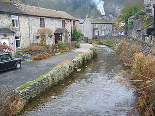
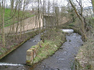
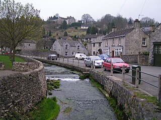
Peakshole Water is a stream in the Derbyshire Peak District named after its source, Peak Cavern. It flows through the village of Castleton to join the River Noe in nearby Hope. Despite its name, much of its flow actually emerges from the Russet Well, a resurgence in a garden on the east side of the gorge below the main Peak Cavern entrance, described as the "main resurgence of the Castleton area", which drains a series of swallets on the other side of the Pennine watershed below Rushup Edge. The resurgence has been explored by cave divers to a depth of 82 feet (25 m) but further exploration was halted by a constriction.

Batham Gate is the medieval name for a Roman road in Derbyshire, England, which ran south-west from Templebrough on the River Don in South Yorkshire to Brough-on-Noe and the spa town of Buxton in Derbyshire. Gate means "road" in northern English dialects; the name therefore means "road to the bath town".

Grindslow Knoll is a hill in the Dark Peak area of the Peak District National Park in Derbyshire, England. It is joined to Kinder Scout by a high col though from most angles appears as an independent peak. It is the high point at the western side of Grindsbrook Clough.

Bradwell Moor is a moorland hill above the village of Bradwell, Derbyshire in the Peak District. The summit is 471 metres (1,545 ft) above sea level.
The Robin Brook is a small stream originating in the south eastern part of the City of Sheffield in South Yorkshire, England. The source of the stream is in the Charnock area of the city, where it flows south, crossing the border into Derbyshire. It meets The Moss at Ford.
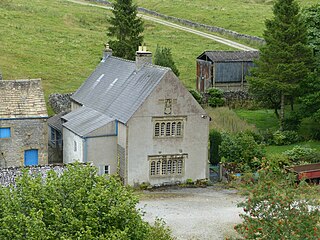
Hazlebadge is a civil parish within the Derbyshire Dales district, in the county of Derbyshire, England. Largely rural, Hazlebadge's population is reported with the population of neighbouring parishes for a total of 427 residents in 2011. It is 143 miles (230 km) north west of London, 29 miles (47 km) north west of the county city of Derby, and 7 miles (11 km) east of the nearest market town of Chapel-en-le-Frith. Hazlebadge is wholly within the Peak District national park, and shares a border with the parishes of Abney and Abney Grange, Bradwell, Brough and Shatton, Great Hucklow as well as Little Hucklow. There are four listed buildings in Hazlebadge.

The Grey Ditch, near Bradwell in the Peak District is a linear earthwork of post-Roman date. The dyke is built at right angles to the Batham Gate, a Roman road which runs between the Roman fort at Brough in Derbyshire and the Roman settlement at Buxton. When first recorded the length of the Grey Ditch was about 1.7 km long but it now has substantial gaps, caused by ploughing and by development. It currently survives as four sections. The monument runs across the contours and runs along the division between the White Peak and the Dark Peak. The ditch lies on the side towards the northeast. The bank seems to have a single phase while the ditch showed evidence of up to five re-cuts. Importantly the bank lay over a plough soil, which contained sherds of Roman-British pottery. B H O'Neil suggested the Grey Ditch once went as far as the slopes of Mam Tor but there is no firm evidence for this. This area is the boundary between the Pecsaetna and the kingdom of Mercia and the Grey Ditch could be a boundary marker between these groups but again there is no evidence for this.

Hood Brook is a stream in the Derbyshire Peak District, originating near Stanage Edge, close to Robin Hoods Cave.
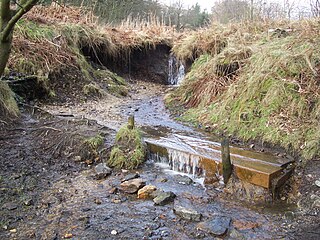
Bradwell Brook is a stream in the Derbyshire Peak District, originating in Bradwell, in a cave known as Bagshawe Resurgence.
Odin Sitch is a stream in the Derbyshire Peak District, originating near Odin Mine on the slopes on Mam Tor in Castleton. The stream meets Peakshole Water to the north of Castleton.

Highlow Brook is a stream in the civil parish of Highlow in the Derbyshire Peak District. The stream is a tributaries of the River Derwent, flowing southeast from the river, south of Hathersage, before meeting the Bretton Brook in Abney.
References
- ↑ "Bradwell : Deadman's Clough Swallet : Details". Peak District Caving. Retrieved 2 June 2023.
- ↑ Leyland, John (1891). The Peak of Derbyshire: Its Scenery and Antiquities. Seeley and Company, limited.
- ↑ Cameron, Kenneth (1959). The Place-names of Derbyshire. University Press.
- ↑ Douglas, Ed (12 March 2016). "A tangle of 18th-century cottages and a modern estate". The Guardian. ISSN 0261-3077 . Retrieved 2 June 2023.
53°18′56″N1°43′54″W / 53.31556°N 1.73167°W
| | This Derbyshire location article is a stub. You can help Wikipedia by expanding it. |