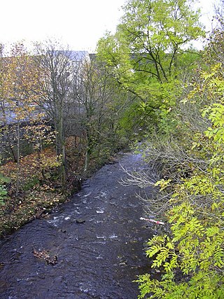
The River Dane is a tributary of the River Weaver that originates in the Peak District area of England. The name of the river is probably from the Old Welsh dafn, meaning a "drop or trickle", implying a slow-moving river.

The River Dodder is one of the three main rivers in Dublin, Ireland, the others being the Liffey, of which the Dodder is the largest tributary, and the Tolka.
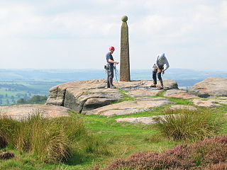
Birchen Edge is a gritstone rock face in the Peak District, England, popular with walkers and novice climbers as most of the climbing routes are in the lower grade.

The River Dean rises at Longclough in Macclesfield Forest on the western edge of the Peak District foothills above the village of Rainow in north east Cheshire, England.

The River Hyndburn is a minor river in Lancashire, England. Beginning as Woodnook Water on the slopes of Goodshaw Hill, it passes through Stone Fold, Rising Bridge and Baxenden where it is augmented by streams from Thirteen Stone Hill and continues to the Woodnook area of Accrington. Near St James Church, it collects Broad Oak Water, becoming the River Hyndburn. It heads northward through the town centre, collecting Pleck Brook and turning west, flowing under the East Lancashire railway line viaduct and continuing to Church.

Chew Valley in Saddleworth, Greater Manchester, England, follows the course of Chew Brook on the western slopes of Black Chew Head to where it joins the River Tame at Greenfield, east of Manchester. Part of the higher fringes of the valley towards the peak of Black Chew Head lie across the boundary in Derbyshire. The eastern part of the valley including the reservoirs of Dovestone and Chew are within the north western extremity of the Peak District National Park.
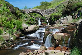
Peakshole Water is a stream in the Derbyshire Peak District named after its source, Peak Cavern. It flows through the village of Castleton to join the River Noe in nearby Hope. Despite its name, much of its flow actually emerges from the Russet Well, a resurgence in a garden on the east side of the gorge below the main Peak Cavern entrance, described as the "main resurgence of the Castleton area", which drains a series of swallets on the other side of the Pennine watershed below Rushup Edge. The resurgence has been explored by cave divers to a depth of 82 feet (25 m) but further exploration was halted by a constriction.
The River Dunsop is a river in the Forest of Bowland in Northern England. It flows into the River Hodder at Dunsop Bridge.
Colne Water is a river in eastern Lancashire. It is approximately 5.0 miles (7.987 km) long and has a catchment area excluding its major tributaries of 4.47 square miles (11.584 km2).

The Ladybrook Valley begins in the English Peak District and runs through Stockport. In its 15 kilometres (9.3 mi) course the brook falls 275 metres (902 ft). At various points it is called Bollinhurst Brook, Norbury Brook, Bramhall Brook, the Ladybrook and the Mickerbrook.
The Christmas Mountains are a series of rounded peaks in northern New Brunswick, Canada, at the headwaters of North Pole Stream and the Little Southwest Miramichi River, west of Big Bald Mountain, and south of Mount Carleton. The mountains, in part, separate the Miramichi River watershed from the watersheds of the Serpentine River and the Nepisiguit River.

The Wyming Brook is a river in the City of Sheffield, England. Its source is the Redmires Reservoirs near the Hallam Moors. It flows in a north-easterly direction for over 0.6 miles (1 km) down quite steep terrain into an underground chamber where it joins the Rivelin tunnel before it flows into the lower of the Rivelin Dams. There is a walking path that runs alongside the brook. The path can be quite steep, with it and the brook falling over 100 m in a kilometre. The river flows almost its entire length within the Wyming Brook Nature Reserve, which is managed by the Wildlife Trust for Sheffield and Rotherham. The surrounds are wooded near the bottom and more open near the top, with views of the Rivelin Valley. Wildlife found around Wyming Brook includes the dipper and the crossbill. The Peak District Boundary Walk runs through the nature reserve.
Hatun Wayq'u which downstream successively is named T'uruyunka(Toroyunca) and Chuqisayra(Choquesayra) is a river in Peru. It is located in the Cusco Region, La Convención Province, Vilcabamba District. It belongs to the watershed of the Apurímac River, the source of the Amazon River.

Mearley Brook is a minor river in Lancashire, England. It is approximately 4.5 miles (7.2 km) long and has a catchment area of 8.79 square miles (22.77 km2).
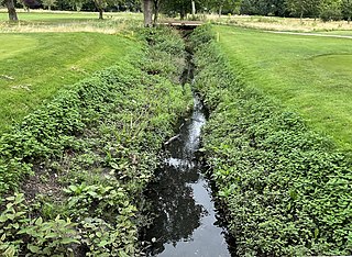
Coombe Brook is a 1 km long stream (brook) in the Royal Borough of Kingston upon Thames, London, England, that is a tributary to Beverley Brook, itself a tributary of the River Thames. Rising in Malden Golf Course in New Malden, Coombe Brook flows a northeasterly course through the golf course, then into a culvert under the Kingston By-pass section of the A3 road, before finally flowing into the Beverly Brook near Coombe on the boundary of the London Borough of Merton.
Bradwell Brook is a stream in the Derbyshire Peak District, originating in Bradwell, in a cave known as Bagshawe Resurgence.
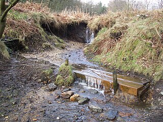
Odin Sitch is a stream in the Derbyshire Peak District, originating near Odin Mine on the slopes on Mam Tor in Castleton. The stream meets Peakshole Water to the north of Castleton.
Deadman's Clough is a stream in the civil parish of Hazlebadge in the Derbyshire Peak District. The stream rises to the south of Bradwell, where it meets the Bretton Brook to the west of Abney.

Highlow Brook is a stream in the civil parish of Highlow in the Derbyshire Peak District. The stream is a tributaries of the River Derwent, flowing southeast from the river, south of Hathersage, before meeting the Bretton Brook in Abney.

